Cape sandstone wilderness

Cederberg

Sandstone arches, dry mountain valleys and rock art create a rugged landscape north of Cape Town.

Sandstone archesRock artFynbos

Location
Western Cape, South Africa
Best window
Mar-May, Aug-Oct
Suggested stay
3-5 days
Go for
Rock formations and mountain trails
The reason to go

Maltese Cross and arches

Erosion has produced large freestanding forms and natural windows.

Start early and make this the first exposed stop of the day. Keep a lower route ready if cloud, heat, wind or trail conditions change during Mar-May, Aug-Oct.

Look a little closer

Worth discovering

The details that make Cederberg different.

Destination view
01

Maltese Cross and arches

Erosion has produced large freestanding forms and natural windows.

Destination view
02

Rock art shelters

Paintings record long human presence across the mountain landscape.

Destination view
03

Fynbos and rooibos country

Distinct vegetation and agriculture reflect the region’s climate.

Photo journal

A closer look at Cederberg

8 photographs
The full story

The landscape memory of Cederberg

Sandstone arches, dry mountain valleys and rock art create a rugged landscape north of Cape Town. The view is only the surface of a longer story of formation, use and change.

Cederberg occupies a mountain range between the West Coast and the Tankwa interior. Sandstone arches, dry mountain valleys and rock art create a rugged landscape north of Cape Town. The Cederberg links the Cape Floristic Region with the arid interior and west-coast valleys, creating a marked ecological transition.

Many visits to Cederberg begin with the experience described as “Maltese Cross and arches”. The more revealing question is why it exists here, how people used the surrounding ground and what remains visible from earlier phases. Erosion has produced large freestanding forms and natural windows.

Continue to practical planning
Stack of split sandstone below Cedarberg sandstone cliffSee the complete photo journal
Landform

The physical foundations of the place

Understanding Cederberg starts below the visible surface. Orange and red sandstone forms cliffs, pillars and arches above fynbos, cedar remnants and seasonal streams.

Relief controls far more than the view. At Cederberg, “Maltese Cross and arches” reveals how elevation divides vegetation, weather, water and the routes available to people. Erosion has produced large freestanding forms and natural windows.

Human history

Routes, livelihoods and belonging

The cultural layer of Cederberg is easiest to read in homes, fields, paths and local institutions. San rock art, rooibos farming and scattered mountain communities add cultural layers to what can otherwise appear empty.

At Cederberg, the feature described as “Rock art shelters” offers a second line of evidence. Paintings record long human presence across the mountain landscape. Within Cederberg, it shows how local knowledge and practical use became embedded in the landscape.

Reorganisation

The transition visible today

The modern identity of Cederberg emerged as livelihoods, transport and outside attention changed their balance. At Cederberg, the present destination was assembled from places that previously served practical, seasonal or community purposes. At Cederberg, the consequences are clearest where traditional use, protection and tourism occupy the same ground.

Details to read

The evidence still visible on the ground

At Cederberg, the feature “Maltese Cross and arches” provides a precise clue to how the landscape works. Erosion has produced large freestanding forms and natural windows. Its position and condition at Cederberg connect physical history with the way people use the place now.

Look closely at the feature “Rock art shelters” in Cederberg; it carries information that a panoramic view can miss. Paintings record long human presence across the mountain landscape. Its position and condition at Cederberg connect physical history with the way people use the place now.

At Cederberg, the feature “Fynbos and rooibos country” is one of the most useful pieces of visible evidence. Distinct vegetation and agriculture reflect the region’s climate. Within Cederberg, it is both an attraction and a record of the processes described above.

Present day

Why the landscape still feels dynamic

Cederberg changes through the year because weather and biological cycles rearrange what can be seen and used. Spring and autumn offer cooler walking conditions; summer is hot and fire-prone, while winter can bring cold fronts and snow on high ground.

For Cederberg, the main seasonal constraint is: the strongest planning window is Mar-May, Aug-Oct. For Cederberg, outside it, check weather, daylight, road or ferry schedules and seasonal closures before committing to a fixed route.

For Cederberg, one practical detail matters: distances, fuel, food and mobile coverage can be less predictable than the map suggests. For Cederberg, carry offline maps and keep a margin in the schedule.

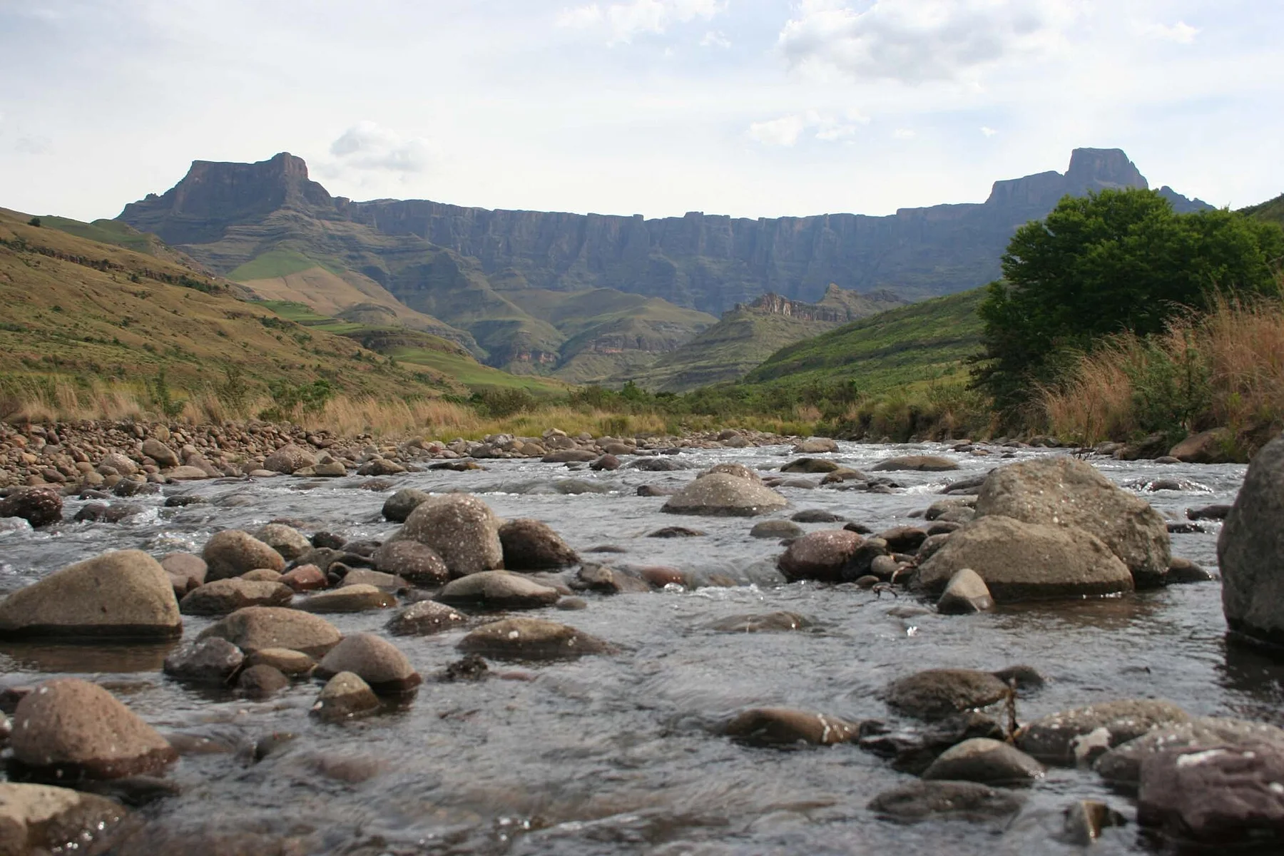
Placed within its wider geography, Cederberg is not an isolated exception. The Cederberg links the Cape Floristic Region with the arid interior and west-coast valleys, creating a marked ecological transition.
Travel notes

Plan your visit

Time needed
3-5 days
Getting around
4x4 or local driver, with short walks at the main sites
Effort
Moderate to demanding
Plan first
Main transport and accommodation
Time of day
Start early for clearer conditions and more time
Best window
Mar-May, Aug-Oct
Traveller stories

Stories from people who have been here.

First-hand moments, practical notes and overlooked details from Cederberg.

Loading traveller stories…

Browse all traveller stories ↗

Keep exploring

Where next?

All place stories