Sea caves
Wave-cut caves and arches make the volcanic and sedimentary coast legible from the water.
Plan the least frequent boat, ferry or exposed coastal section first. Use early or late light and keep a weather alternative during Apr-Oct.
Sea cliffs, endemic wildlife, kelp forests and deep Indigenous history define an island chain just beyond the urban coast of Southern California.
Wave-cut caves and arches make the volcanic and sedimentary coast legible from the water.
Plan the least frequent boat, ferry or exposed coastal section first. Use early or late light and keep a weather alternative during Apr-Oct.
The details that make Channel Islands different.
Wave-cut caves and arches make the volcanic and sedimentary coast legible from the water.
An endemic species symbolises both island evolution and successful restoration.
Archaeological sites and cultural continuity place the islands within a very long human history.
Sea cliffs, endemic wildlife, kelp forests and deep Indigenous history define an island chain just beyond the urban coast of Southern California. The view is only the surface of a longer story of formation, use and change.
The Channel Islands lie within sight of one of North America's most populated coasts yet form a separate ecological and cultural world. Five islands are protected within the national park, each with different terrain, vegetation and access. Sea cliffs, grassland, canyons and small beaches continue below the water into rich kelp forests.
Many visits to Channel Islands begin with the experience described as “Sea caves”. The more revealing question is why it exists here, how people used the surrounding ground and what remains visible from earlier phases. Wave-cut caves and arches make the volcanic and sedimentary coast legible from the water.
Continue to practical planningBefore roads, settlements or protected-area boundaries, the terrain of Channel Islands set the basic terms. Isolation has produced endemic species, including the island fox, while currents and upwelling support marine mammals, seabirds and diverse underwater life. Santa Cruz contains extensive sea caves; Anacapa is narrow and cliff-bound; Santa Rosa and San Miguel feel broader and more exposed.
The map understates the role of the sea. At Channel Islands, “Sea caves” makes clear that water is both a boundary and the route through which settlements, wildlife and outside connections developed. Wave-cut caves and arches make the volcanic and sedimentary coast legible from the water.
At Channel Islands, daily life gives the terrain a historical meaning that a viewpoint alone cannot provide. The islands are central to Chumash history and include some of the oldest evidence of human coastal life in the Americas. Ranching, military use and conservation later transformed habitats. Restoration work has removed invasive species and supported the recovery of native wildlife.
At Channel Islands, the feature described as “Island fox” offers a second line of evidence. An endemic species symbolises both island evolution and successful restoration. Within Channel Islands, it shows how local knowledge and practical use became embedded in the landscape.
Formal protection changed how Channel Islands was described and managed. At Channel Islands, new boundaries, visitor rules and conservation priorities created a public identity that still has to coexist with settlements, customary use and economic pressures. At Channel Islands, that transition remains visible in the contrast between older working features and visitor infrastructure.
Look closely at the feature “Sea caves” in Channel Islands; it carries information that a panoramic view can miss. Wave-cut caves and arches make the volcanic and sedimentary coast legible from the water. Its position and condition at Channel Islands connect physical history with the way people use the place now.
At Channel Islands, the feature “Island fox” provides a precise clue to how the landscape works. An endemic species symbolises both island evolution and successful restoration. At Channel Islands, it gives a concrete reference point for reading change rather than merely collecting viewpoints.
Start with the feature “Chumash landscape”, because it condenses a much larger part of the story of Channel Islands. Archaeological sites and cultural continuity place the islands within a very long human history. Its position and condition at Channel Islands connect physical history with the way people use the place now.
A single visit to Channel Islands captures only one phase of its annual cycle. Spring brings wildflowers and nesting activity, while summer and early autumn often provide calmer seas and longer days. Fog, wind and swell can alter crossings at any time. Winter storms create powerful coastal conditions and a more remote atmosphere.
For Channel Islands, the main seasonal constraint is: the strongest planning window is Apr-Oct. For Channel Islands, outside it, check weather, daylight, road or ferry schedules and seasonal closures before committing to a fixed route.
For Channel Islands, one practical detail matters: ferries, tunnels and weather can change the order of the day. For Channel Islands, build the route around the least frequent connection, not the closest viewpoint.
Placed within its wider geography, Channel Islands is not an isolated exception. For Channel Islands, the wider context shows that, the archipelago extends beyond the national park to include islands closer to Los Angeles and San Diego. For Channel Islands, its marine ecosystems connect with the Santa Barbara Channel and the broader California Current, making the islands inseparable from the mainland coast they face.
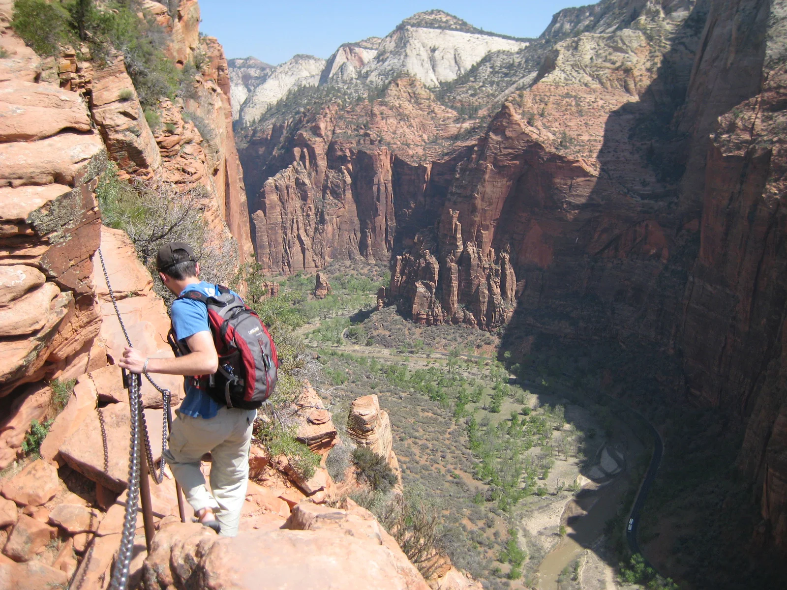
A steep trail climbs Walter’s Wiggles and an exposed chain-protected fin above Zion Canyon.
Explore this place
Sharp eroded spires and mixed-grass prairie meet in a dense fossil landscape.
Explore this place
Desert basins, volcanic mountains and the Rio Grande form a remote border landscape in far western Texas.
Explore this place