Echo Canyon
Dense clusters of rock columns create a maze-like trail landscape.
Plan the least frequent boat, ferry or exposed coastal section first. Use early or late light and keep a weather alternative during Mar-May, Sep-Nov.
Rhyolite pinnacles and oak-pine sky islands rise above the desert grasslands of southeastern Arizona.
Dense clusters of rock columns create a maze-like trail landscape.
Plan the least frequent boat, ferry or exposed coastal section first. Use early or late light and keep a weather alternative during Mar-May, Sep-Nov.
The details that make Chiricahua different.
Dense clusters of rock columns create a maze-like trail landscape.
The road climbs from grassland through multiple vegetation zones.
The mountains formed part of a wider homeland and resistance landscape.
Rhyolite pinnacles and oak-pine sky islands rise above the desert grasslands of southeastern Arizona. The deeper story links its visible features with the people and changes behind them.
Chiricahua occupies a mountain range near the Mexico border. Rhyolite pinnacles and oak-pine sky islands rise above the desert grasslands of southeastern Arizona. Chiricahua belongs to the Madrean sky-island chain extending between Arizona, New Mexico and northern Mexico.
Visitors often encounter Chiricahua through the idea of “Echo Canyon”, but the destination is more than that single scene. Its landscape carries evidence of work, movement, adaptation and environmental change. Dense clusters of rock columns create a maze-like trail landscape.
Continue to practical planningBefore roads, settlements or protected-area boundaries, the terrain of Chiricahua set the basic terms. Eroded volcanic tuff forms columns, balanced rocks and narrow canyons, while elevation supports woodland above surrounding desert.
The landscape of Chiricahua can look static, yet wind, runoff and temperature continue to reshape it. “Echo Canyon” is a concise example of that ongoing change. Dense clusters of rock columns create a maze-like trail landscape.
At Chiricahua, people learned to work with the landscape limits rather than arriving after its story was complete. Apache history, ranching, military routes and conservation history all intersect in the mountain landscape.
A close look at “Bonita Canyon drive” makes the cultural layer of Chiricahua more concrete. The road climbs from grassland through multiple vegetation zones. At Chiricahua, the surviving form links present-day identity with earlier work and settlement.
Formal protection changed how Chiricahua was described and managed. At Chiricahua, new boundaries, visitor rules and conservation priorities created a public identity that still has to coexist with settlements, customary use and economic pressures. At Chiricahua, the current visitor experience is the newest layer rather than the whole history.
At Chiricahua, the feature “Echo Canyon” provides a precise clue to how the landscape works. Dense clusters of rock columns create a maze-like trail landscape. Its position and condition at Chiricahua connect physical history with the way people use the place now.
Start with the feature “Bonita Canyon drive”, because it condenses a much larger part of the story of Chiricahua. The road climbs from grassland through multiple vegetation zones. Its position and condition at Chiricahua connect physical history with the way people use the place now.
At Chiricahua, the feature “Apache cultural history” is best understood as part of the surrounding system rather than an isolated stop. The mountains formed part of a wider homeland and resistance landscape. At Chiricahua, the detail links local scale with the wider regional pattern.
A single visit to Chiricahua captures only one phase of its annual cycle. Spring and autumn are comfortable; summer monsoon storms can be dramatic, and winter snow occasionally affects the higher road.
For Chiricahua, the main seasonal constraint is: the strongest planning window is Mar-May, Sep-Nov. For Chiricahua, outside it, check weather, daylight, road or ferry schedules and seasonal closures before committing to a fixed route.
For Chiricahua, one practical detail matters: distances, fuel, food and mobile coverage can be less predictable than the map suggests. For Chiricahua, carry offline maps and keep a margin in the schedule.
Placed within its wider geography, Chiricahua is not an isolated exception. Chiricahua belongs to the Madrean sky-island chain extending between Arizona, New Mexico and northern Mexico.
At Chiricahua, “Echo Canyon, Bonita Canyon drive and Apache cultural history” forms a practical cross-section when connected with surrounding routes and settlements, rather than treated as a set of unrelated attractions. At Chiricahua, movement organised by 4x4 or local driver, with short walks at the main sites reveals which parts of the landscape have remained difficult to reach or costly to maintain. At Chiricahua, the usual effort level, moderate to demanding, is not just a visitor rating; it reflects gradients, exposure or transport gaps that shaped local use before leisure travel. Within Arizona, these relationships distinguish Chiricahua from superficially similar destinations and explain why a slower, connected reading produces more understanding than a rapid series of stops.
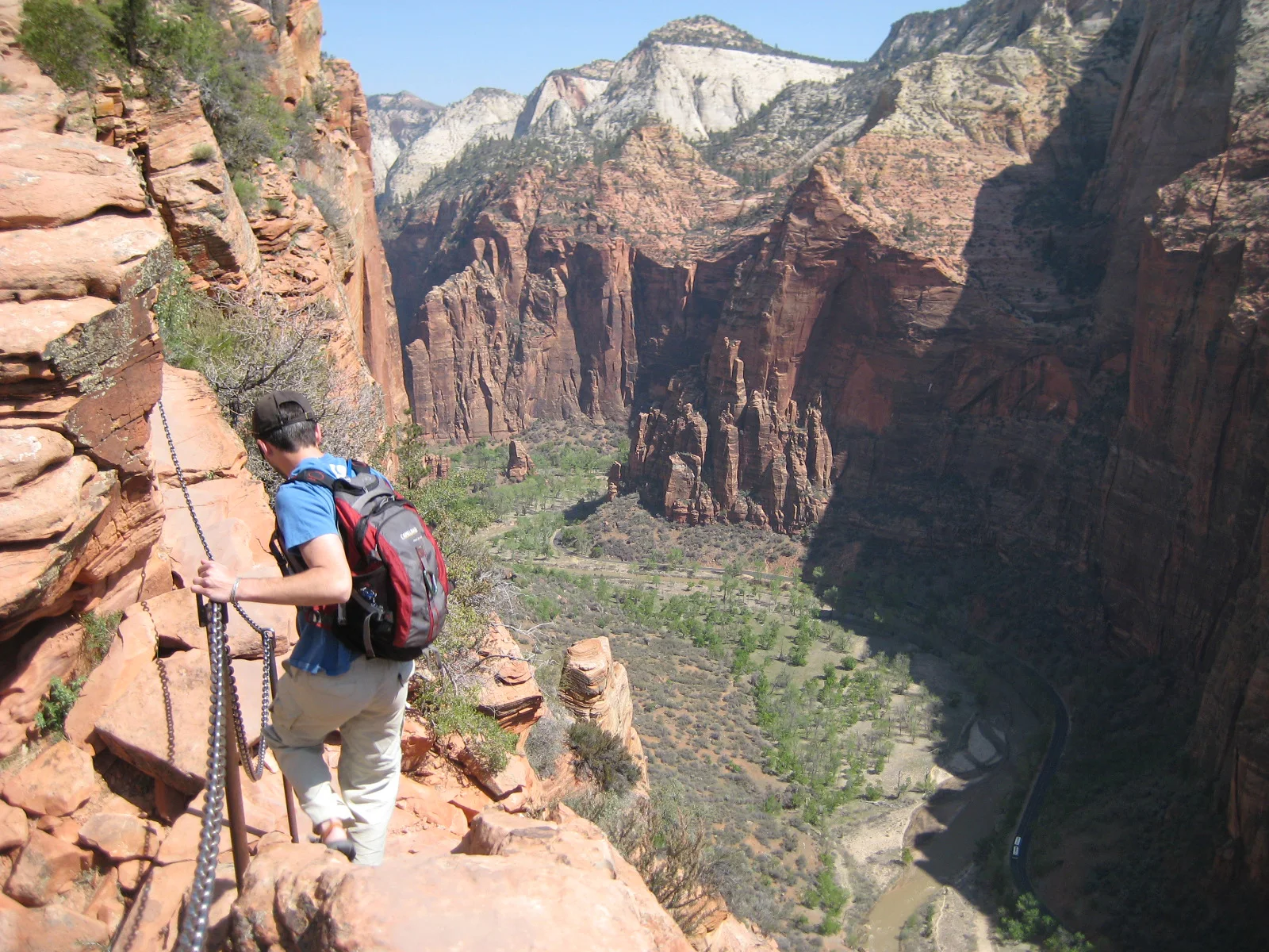
A steep trail climbs Walter’s Wiggles and an exposed chain-protected fin above Zion Canyon.
Explore this place
Sharp eroded spires and mixed-grass prairie meet in a dense fossil landscape.
Explore this place
Desert basins, volcanic mountains and the Rio Grande form a remote border landscape in far western Texas.
Explore this place