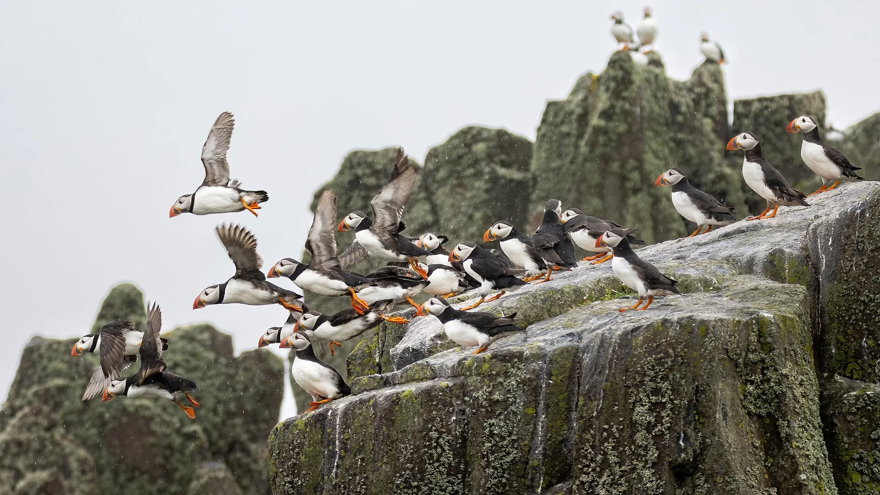
Walk the western cliffs while seabirds fill the updraft
The cliffs rise directly from the Atlantic and the absence of crowd infrastructure keeps the experience raw and immediate.
Plan the least frequent boat or flight first, then use the remaining time for the signature route rather than trying to collect every viewpoint.
Look a little closer
Worth discovering
The details that make Foula different.
Destination view
01
Da Kame cliffs
Some of Britain's highest sea cliffs dominate the west.
Photo journal
02
Gaada Stack
A natural arch and sea stack shape the north coast.
Destination view
03
Traditional island culture
Local music and the old calendar preserve distinctive customs.
Photo journal
A closer look at Foula
9 photographs
01Below Da Nort Bank - geograph.org.uk - 371701802Blackbird (Turdus merula), Ham, Foula - geograph.org.uk - 632268003Foula — view 304Brambling (Fringilla montifringilla), Ham Yard, Foula - geograph.org.uk - 729932705Aurora borealis over Ham, Foula - geograph.org.uk - 730039506Aurora borealis over Ham, Foula - geograph.org.uk - 730298207Sunset beyond Gaada Stack, Foula - geograph.org.uk - 581541008Allseed (Radiola linoides), Foula - geograph.org.uk - 789318309Aurora borealis over Foula - geograph.org.uk - 7897016
Deep background
Foula beyond the first view
One of Britain's most remote inhabited islands has towering sea cliffs, open moor and a small community preserving Norse traditions. This account follows the forces, communities and decisions that made the present landscape.
4 min readShetland, United Kingdom
Foula is centred on Shetland, where one of Britain's most remote inhabited islands has towering sea cliffs, open moor and a small community preserving Norse traditions. The strongest reason to make the journey is to walk the western cliffs while seabirds fill the updraft.
Many visits to Foula begin with the experience described as “Walk the western cliffs while seabirds fill the updraft”. The more revealing question is why it exists here, how people used the surrounding ground and what remains visible from earlier phases. The cliffs rise directly from the Atlantic and the absence of crowd infrastructure keeps the experience raw and immediate.
On an island, coast, altitude and exposure work together. At Foula, the feature described as “Da Kame cliffs” shows how a short distance can separate sheltered ground from a very different ocean-facing environment. Some of Britain's highest sea cliffs dominate the west.
Foula is not a uniform area. Changes in elevation, exposure, water and substrate produce distinct environments over short distances, which is why a route through the place often reveals more than a fixed viewpoint.
02
Human history
Settlement, movement and local knowledge
Foula's name and many of its place names reflect centuries of Norse settlement within Shetland. Crofting, sheep, fishing and seabird harvesting supported a small population separated from larger markets by one of Britain's most exposed sea crossings. The Norn language survived here later than in many other parts of Shetland.
Estate ownership and agricultural change affected the island, but Foula avoided complete clearance and retained several dispersed crofting districts. The cliffs also entered modern history through shipwrecks, wartime navigation and the long work of lighthouse and coastguard services around the western approaches.
03
Turning point
A landscape reorganised
Air service and a small ferry reduced isolation without removing it; weather still controls travel and supplies. Stone dykes, crofts, Norse names and the calendar traditions associated with old Shetland practice give the island a cultural depth that is easy to miss when attention stays only on the cliffs.
04
On the ground
The evidence still visible on the ground
At Foula, the significance of the feature “Da Kame cliffs” goes beyond its visual impact. Some of Britain's highest sea cliffs dominate the west. Within Foula, the feature explains why this destination differs from nearby landscapes.
Start with the feature “Gaada Stack”, because it condenses a much larger part of the story of Foula. A natural arch and sea stack shape the north coast. Its position and condition at Foula connect physical history with the way people use the place now.
At Foula, the feature “Traditional island culture” provides a precise clue to how the landscape works. Local music and the old calendar preserve distinctive customs. At Foula, it gives a concrete reference point for reading change rather than merely collecting viewpoints.
05
Continuity
A living landscape, not a frozen scene
At Foula, light, water and temperature reveal different structures at different times of year. For Foula, the most reliable visiting window is May-Aug.
For Foula, the stated visiting window is May-Aug, but its practical meaning depends on local weather, water and transport rather than the calendar alone.
Placed within its wider geography, Foula is not an isolated exception. Beyond the best-known image of Foula feature, Foula matters because gaada stack and traditional island culture place the destination inside a broader regional story.
Chronology
Key dates
Island integrated into Norse Shetland
Language, place names and maritime farming linked Foula to the North Atlantic Norse world.
Crofting under estate ownership
Fishing and livestock sustained households while outside landlords shaped land use and rents.
Modern transport arrives
Air and ferry links improved access, although storms continue to isolate the island regularly.
Travel notes
Plan your visit
Time needed
3-5 days
Getting around
Local transport, walking and boat or ferry connections
Effort
Easy to moderate
Plan first
Main flight or ferry, accommodation and weather backup
Time of day
Morning movement; late light for coast
Best window
May-Aug
Traveller stories
Stories from people who have been here.
First-hand moments, practical notes and overlooked details from Foula.