Gila River canyons
A free-flowing river supports forest and wildlife corridors.
Start early and make this the first exposed stop of the day. Keep a lower route ready if cloud, heat, wind or trail conditions change during Apr-Jun, Sep-Oct.
Forested mountains, hot springs and deep canyons form the first designated wilderness area in the United States.
A free-flowing river supports forest and wildlife corridors.
Start early and make this the first exposed stop of the day. Keep a lower route ready if cloud, heat, wind or trail conditions change during Apr-Jun, Sep-Oct.
The details that make Gila Wilderness different.
A free-flowing river supports forest and wildlife corridors.
Mogollon structures place human history directly within the canyon landscape.
Geothermal water appears along remote river routes.
Forested mountains, hot springs and deep canyons form the first designated wilderness area in the United States. The deeper story links its visible features with the people and changes behind them.
Gila Wilderness occupies a large mountain and canyon system in southwestern New Mexico. Forested mountains, hot springs and deep canyons form the first designated wilderness area in the United States. The Gila links the Rocky Mountain and Sonoran ecological regions and forms part of a wider landscape extending toward Arizona and northern Mexico.
The strongest visual shorthand for Gila Wilderness is the experience described as “Gila River canyons”. Behind it lies a more complex relationship between physical processes, settlement and the modern idea of the place as a destination. A free-flowing river supports forest and wildlife corridors.
Continue to practical planningBefore roads, settlements or protected-area boundaries, the terrain of Gila Wilderness set the basic terms. Pine-covered plateaus are cut by the Gila River and tributary canyons, creating water-rich corridors within a dry regional climate.
Relief controls far more than the view. At Gila Wilderness, “Gila River canyons” reveals how elevation divides vegetation, weather, water and the routes available to people. A free-flowing river supports forest and wildlife corridors.
At Gila Wilderness, daily life gives the terrain a historical meaning that a viewpoint alone cannot provide. Mogollon archaeological sites, ranching history and the development of the wilderness idea add cultural layers to the backcountry.
At Gila Wilderness, the feature described as “Cliff dwellings” offers a second line of evidence. Mogollon structures place human history directly within the canyon landscape. Within Gila Wilderness, it shows how local knowledge and practical use became embedded in the landscape.
Economic use reorganised the landscape of Gila Wilderness. At Gila Wilderness, extraction, farming or engineered infrastructure created routes and clearings that still influence settlement and the scenery interpreted as natural today. At Gila Wilderness, the consequences are clearest where traditional use, protection and tourism occupy the same ground.
At Gila Wilderness, the feature “Gila River canyons” provides a precise clue to how the landscape works. A free-flowing river supports forest and wildlife corridors. Its position and condition at Gila Wilderness connect physical history with the way people use the place now.
Start with the feature “Cliff dwellings”, because it condenses a much larger part of the story of Gila Wilderness. Mogollon structures place human history directly within the canyon landscape. Within Gila Wilderness, the feature explains why this destination differs from nearby landscapes.
At Gila Wilderness, the feature “Hot springs” is best understood as part of the surrounding system rather than an isolated stop. Geothermal water appears along remote river routes. Its position and condition at Gila Wilderness connect physical history with the way people use the place now.
At Gila Wilderness, season is part of the landscape history, not merely a planning detail. Spring and autumn are mildest; summer brings heat, monsoon storms and flash-flood risk, while winter affects higher routes.
For Gila Wilderness, the main seasonal constraint is: the strongest planning window is Apr-Jun, Sep-Oct. For Gila Wilderness, outside it, check weather, daylight, road or ferry schedules and seasonal closures before committing to a fixed route.
For Gila Wilderness, one practical detail matters: distances, fuel, food and mobile coverage can be less predictable than the map suggests. For Gila Wilderness, carry offline maps and keep a margin in the schedule.
Placed within its wider geography, Gila Wilderness is not an isolated exception. For Gila Wilderness, the wider context shows that, the Gila links the Rocky Mountain and Sonoran ecological regions and forms part of a wider landscape extending toward Arizona and northern Mexico.
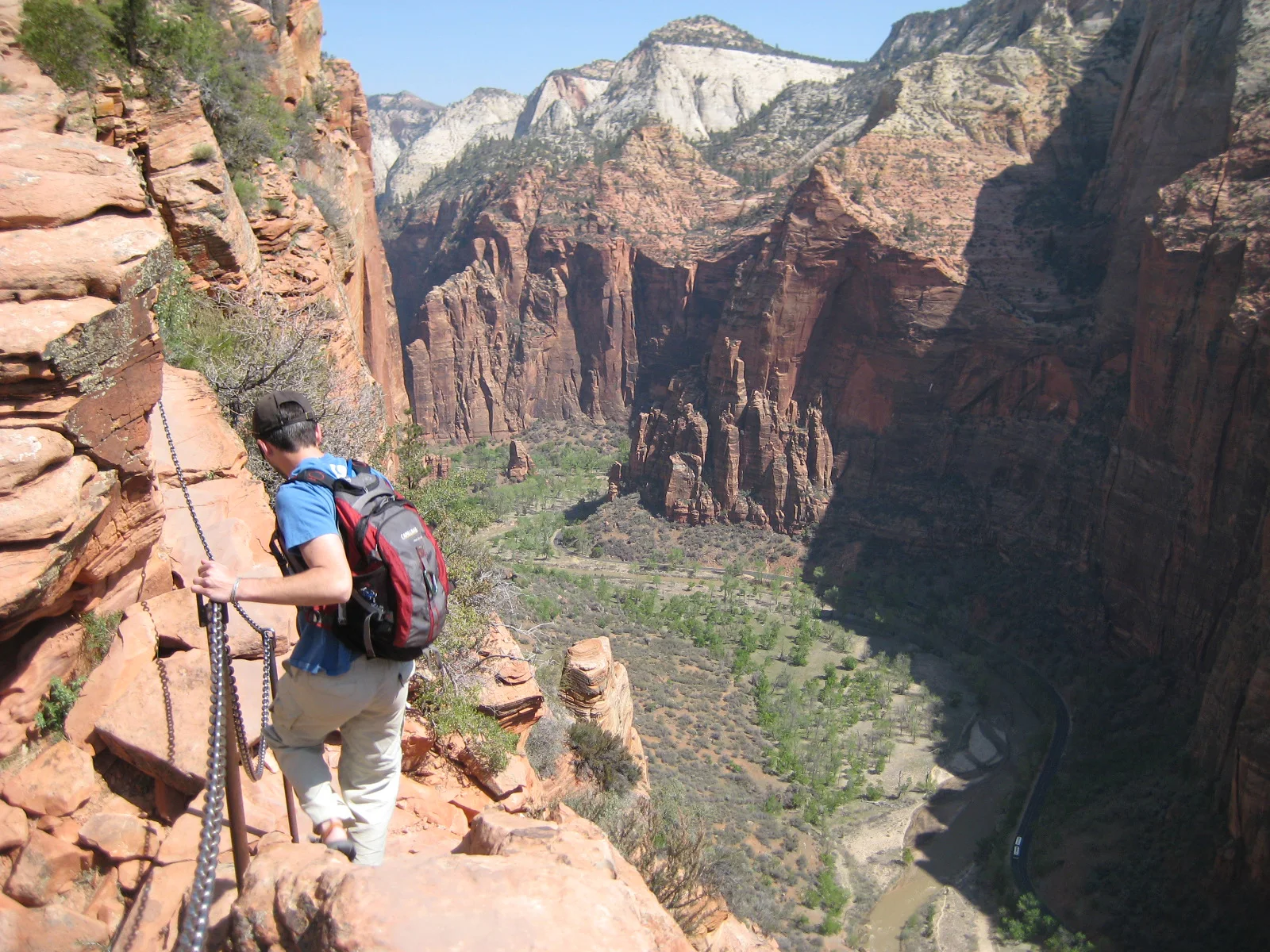
A steep trail climbs Walter’s Wiggles and an exposed chain-protected fin above Zion Canyon.
Explore this place
Sharp eroded spires and mixed-grass prairie meet in a dense fossil landscape.
Explore this place
Desert basins, volcanic mountains and the Rio Grande form a remote border landscape in far western Texas.
Explore this place