Hisaka and Naru islands
Small ports and churches preserve a dispersed cultural landscape.
Plan the least frequent boat, ferry or exposed coastal section first. Use early or late light and keep a weather alternative during Apr-Jun, Sep-Nov.
A chain of wooded islands, fishing ports and hidden-Christian heritage extends west of Kyushu into the East China Sea.
Small ports and churches preserve a dispersed cultural landscape.
Plan the least frequent boat, ferry or exposed coastal section first. Use early or late light and keep a weather alternative during Apr-Jun, Sep-Nov.
The details that make Goto Islands different.
Small ports and churches preserve a dispersed cultural landscape.
The largest island combines volcanic terrain, beaches and working towns.
Churches and villages record communities that maintained faith through long periods of prohibition.
A chain of wooded islands, fishing ports and hidden-Christian heritage extends west of Kyushu into the East China Sea. This account follows the forces, communities and decisions that made the present landscape.
Goto Islands occupies an island group off the western coast of Kyushu. A chain of wooded islands, fishing ports and hidden-Christian heritage extends west of Kyushu into the East China Sea. The islands connect Nagasaki’s trading history with the wider East China Sea and nearby Korean and Chinese maritime routes.
Visitors often encounter Goto Islands through the idea of “Hisaka and Naru islands”, but the destination is more than that single scene. Its landscape carries evidence of work, movement, adaptation and environmental change. Small ports and churches preserve a dispersed cultural landscape.
Continue to practical planningAt Goto Islands, the form of the landscape explains many of the choices that came later. Ria coastlines, small beaches and forested hills produce a broken maritime landscape connected by ferries rather than one continuous road.
Because land is limited, every ridge, bay and passage acquires practical importance. At Goto Islands, “Hisaka and Naru islands” is where that compressed geography becomes easiest to read. Small ports and churches preserve a dispersed cultural landscape.
At Goto Islands, human history is written into settlement and land use rather than separated from the scenery. Fishing communities, stone walls, churches and pilgrimage history reflect centuries of movement, isolation and religious adaptation.
At Goto Islands, “Fukue coastline” should not be treated as a decorative detail. The largest island combines volcanic terrain, beaches and working towns. The feature records how construction, movement or livelihood adapted to local conditions at Goto Islands.
The modern identity of Goto Islands emerged as livelihoods, transport and outside attention changed their balance. At Goto Islands, the present destination was assembled from places that previously served practical, seasonal or community purposes. At Goto Islands, the result is not a clean break with the past because earlier routes and habits continue to organise the present landscape.
At Goto Islands, the significance of the feature “Hisaka and Naru islands” goes beyond its visual impact. Small ports and churches preserve a dispersed cultural landscape. At Goto Islands, it gives a concrete reference point for reading change rather than merely collecting viewpoints.
At Goto Islands, the feature “Fukue coastline” is one of the most useful pieces of visible evidence. The largest island combines volcanic terrain, beaches and working towns. At Goto Islands, it gives a concrete reference point for reading change rather than merely collecting viewpoints.
At Goto Islands, the significance of the feature “Hidden-Christian sites” goes beyond its visual impact. Churches and villages record communities that maintained faith through long periods of prohibition. Within Goto Islands, the feature explains why this destination differs from nearby landscapes.
At Goto Islands, light, water and temperature reveal different structures at different times of year. Spring and autumn provide mild conditions; summer can be hot and humid, while winter ferries may be affected by strong weather.
For Goto Islands, the main seasonal constraint is: the strongest planning window is Apr-Jun, Sep-Nov. For Goto Islands, outside it, check weather, daylight, road or ferry schedules and seasonal closures before committing to a fixed route.
For Goto Islands, one practical detail matters: ferries, tunnels and weather can change the order of the day. For Goto Islands, build the route around the least frequent connection, not the closest viewpoint.
Placed within its wider geography, Goto Islands is not an isolated exception. For Goto Islands, the wider context shows that, the islands connect Nagasaki’s trading history with the wider East China Sea and nearby Korean and Chinese maritime routes.
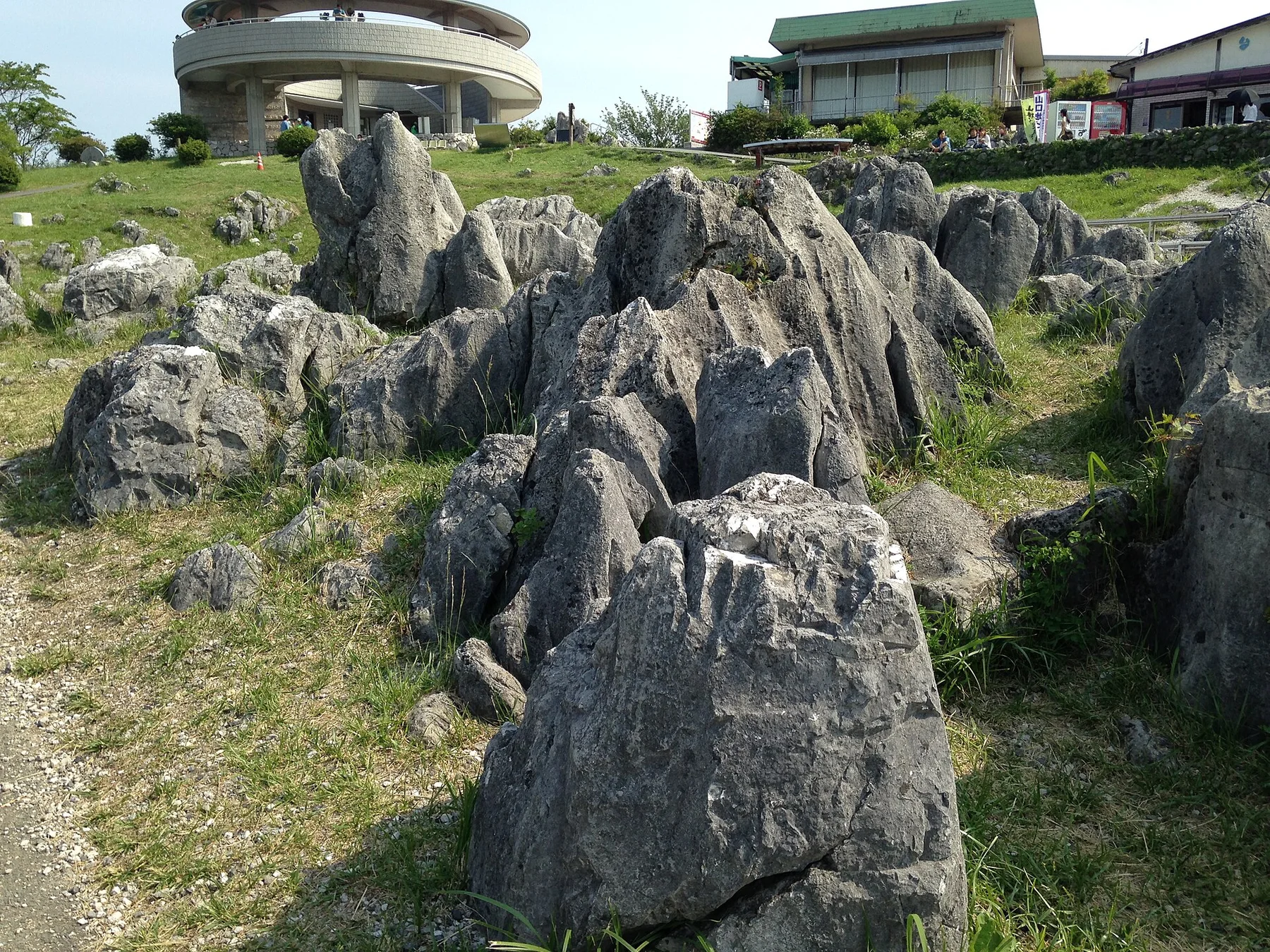
Japan's largest karst plateau combines pale limestone pinnacles, grassland, caves and a long record of human land management.
Explore this place
A high volcanic massif of alpine plateaus, hot springs and vast autumn colour rises at the centre of Hokkaido.
Explore this place
A steep interior valley of forested mountains, scattered hamlets, vine bridges and roads cut into the slopes of central Shikoku.
Explore this place