Cable-assisted summit

Half Dome Cables

A long Yosemite hike ends with a steep cable route up the exposed granite shoulder of Half Dome.

Cable-assisted summitDramatic routeViewpointsMist Trail waterfallsSub Dome steps

Location
Yosemite National Park, California, United States
Best window
Jun-Oct
Suggested stay
Full day
Go for
Long summit hike with cable finish
The reason to go

Climb the cable route to Half Dome summit

After waterfalls, forest and subalpine slabs, the final ascent uses twin cables on steep granite before the broad summit opens over Yosemite Valley.

Treat the cables as the final part of a very long day; turn around early if storms, wet granite or fatigue develop.

Look a little closer

Worth discovering

The details that make Half Dome Cables different.

Photo journal
01

Mist Trail waterfalls

Vernal and Nevada Falls form the dramatic lower approach.

Destination view
02

Sub Dome steps

Stone and granite switchbacks rise above the forest before the cables.

Destination view
03

Cable route

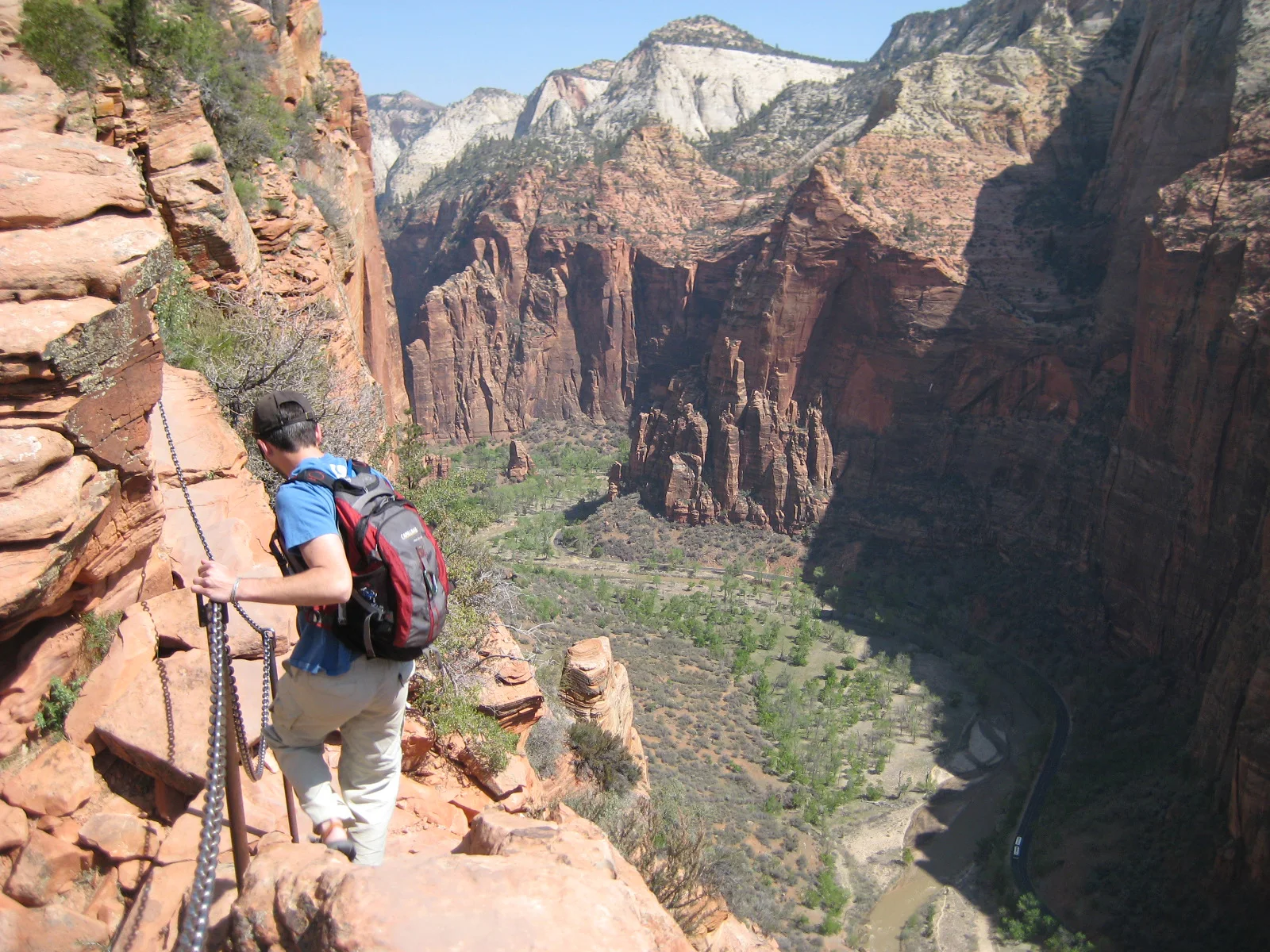
Two fixed cables assist the final steep slab to the summit.

Photo journal

A closer look at Half Dome Cables

11 photographs
Landscape and history

The landscape memory of Half Dome Cables

A long Yosemite hike ends with a steep cable route up the exposed granite shoulder of Half Dome. This account follows the forces, communities and decisions that made the present landscape.

Half Dome Cables is centred on Yosemite National Park, California, where a long Yosemite hike ends with a steep cable route up the exposed granite shoulder of Half Dome. The strongest reason to make the journey is to climb the cable route to Half Dome summit.

The strongest visual shorthand for Half Dome Cables is the experience described as “Climb the cable route to Half Dome summit”. Behind it lies a more complex relationship between physical processes, settlement and the modern idea of the place as a destination. After waterfalls, forest and subalpine slabs, the final ascent uses twin cables on steep granite before the broad summit opens over Yosemite Valley.

Continue to practical planning
Scenery near Nevada Falls on the Mist Trail, Yosemite National Park 10 July 2006See the complete photo journal
Origins

How the landscape was assembled

Before roads, settlements or protected-area boundaries, the terrain of Half Dome Cables set the basic terms. Changes in height, rock, water and exposure make the sequence important: the approach, the most engineered or natural passage and the final overlook each reveal a different part of Yosemite National Park, California.

A route records decisions about gradient, exposure and access. At Half Dome Cables, “Mist Trail waterfalls” shows why this line was chosen and what kind of movement it was designed to permit. Vernal and Nevada Falls form the dramatic lower approach.

Cultural landscape

Routes, livelihoods and belonging

Half Dome was long considered inaccessible, but George Anderson reached the summit in 1875 after drilling and fixing an early rope system into the granite. His line established the basis for later cable access.

The Sierra Club installed a more permanent cable route in 1919, allowing hikers to ascend the final slab without technical climbing. Posts and cables are removed or lowered seasonally and repeatedly replaced, so the system is historic in alignment rather than original in material.

Change

A landscape reorganised

The cables transformed a mountaineering objective into a mass hiking route. A permit system introduced in the twenty-first century now limits numbers on a section where congestion itself can create danger.

Visible evidence

What to read in the landscape

At Half Dome Cables, the feature “Mist Trail waterfalls” provides a precise clue to how the landscape works. Vernal and Nevada Falls form the dramatic lower approach. Its position and condition at Half Dome Cables connect physical history with the way people use the place now.

At Half Dome Cables, the feature “Sub Dome steps” is best understood as part of the surrounding system rather than an isolated stop. Stone and granite switchbacks rise above the forest before the cables. Within Half Dome Cables, it is both an attraction and a record of the processes described above.

At Half Dome Cables, the feature “Cable route” provides a precise clue to how the landscape works. Two fixed cables assist the final steep slab to the summit. Within Half Dome Cables, it is both an attraction and a record of the processes described above.

Present day

What continues to change

At Half Dome Cables, season is part of the landscape history, not merely a planning detail. For Half Dome Cables, the most reliable visiting window is Jun-Oct.

For Half Dome Cables, one practical detail matters: a permit is required when cables are up. For Half Dome Cables, never enter the cable section during thunderstorms or on wet rock.

For Half Dome Cables, the most useful visiting period is: pre-dawn start.

Placed within its wider geography, Half Dome Cables is not an isolated exception. Beyond the best-known image of Half Dome Cables crossing, Half Dome Cables is useful because sub dome steps and cable route place the route inside a broader landscape story.
Chronology

Key dates

  1. First recorded ascent

    George Anderson used drilled eyebolts and rope to overcome the final granite slab.

  2. Permanent cables installed

    The Sierra Club created the basis of the route used by hikers today.

  3. Permits limit use

    Daily access controls responded to severe crowding on the narrow cable section.

Travel notes

Plan your visit

Time needed
Full day
Getting around
Permit-controlled hike from Yosemite Valley
Effort
Very demanding; extreme exposure
Plan first
Permit, weather, water and daylight
Time of day
Pre-dawn start
Best window
Jun-Oct
Traveller stories

Stories from people who have been here.

First-hand moments, practical notes and overlooked details from Half Dome Cables.

Loading traveller stories…

Browse all traveller stories ↗

Keep exploring

Where next?

All place stories