Himalayan cultural corridor

Kinnaur

Deep Himalayan valleys, orchards, Buddhist and Hindu traditions and high desert passes meet along the upper Sutlej corridor.

Sutlej gorgesOrchard villagesHigh passes

Location
Himachal Pradesh, India
Best window
May-Oct
Suggested stay
3-5 days
Go for
High-valley road journey
The reason to go

Sangla and Baspa valley

Orchards, wooden villages and high peaks create one of the most inhabited and visually balanced parts of Kinnaur.

Start early and make this the first exposed stop of the day. Keep a lower route ready if cloud, heat, wind or trail conditions change during May-Oct.

Look a little closer

Worth discovering

The details that make Kinnaur different.

Photo journal
01

Sangla and Baspa valley

Orchards, wooden villages and high peaks create one of the most inhabited and visually balanced parts of Kinnaur.

Photo journal
02

Kalpa and Kinner Kailash views

Terraced settlement looks across the Sutlej valley toward a powerful wall of high mountains.

Photo journal
03

Upper Sutlej corridor

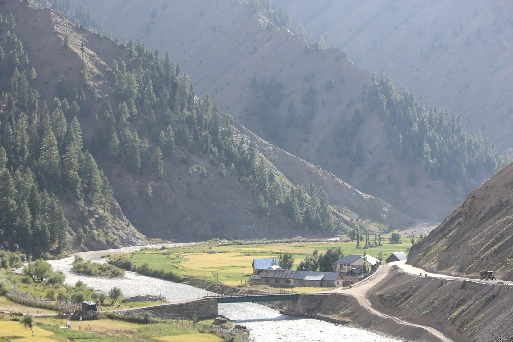
Dry slopes, monasteries and cliff roads show the transition toward the trans-Himalayan landscape.

Photo journal

A closer look at Kinnaur

10 photographs
Landscape and history

The landscape memory of Kinnaur

Deep Himalayan valleys, orchards, Buddhist and Hindu traditions and high desert passes meet along the upper Sutlej corridor. This account follows the forces, communities and decisions that made the present landscape.

Kinnaur occupies a dramatic transition between the greener western Himalaya and the dry highlands toward Tibet. The Sutlej and its tributaries cut deep valleys beneath steep rock, forest and snow peaks. Villages sit on terraces and side valleys where water and cultivable land are available.

The familiar invitation at Kinnaur is “Sangla and Baspa valley”, yet that image makes more sense when it is connected to the landform, the local economy and the changes that determined access. Orchards, wooden villages and high peaks create one of the most inhabited and visually balanced parts of Kinnaur.

Continue to practical planning
Apple and walnut orchards after a night of snowfall in Sangla in the Kinnaur district of the northern Indian state of Himachal PradeshSee the complete photo journal
Natural history

From underlying structure to visible landscape

At Kinnaur, the form of the landscape explains many of the choices that came later. Lower areas contain pine and deodar forest, while upper valleys become increasingly arid and mineral in colour. Roads cling to gorge walls, and side routes climb toward orchards, monasteries and high viewpoints. The vertical difference between river and settlement is often extreme.

The landscape of Kinnaur can look static, yet wind, runoff and temperature continue to reshape it. “Sangla and Baspa valley” is a concise example of that ongoing change. Orchards, wooden villages and high peaks create one of the most inhabited and visually balanced parts of Kinnaur.

Lives and livelihoods

Routes, livelihoods and belonging

At Kinnaur, daily life gives the terrain a historical meaning that a viewpoint alone cannot provide. Apple cultivation, trans-Himalayan trade history and a mix of Hindu and Buddhist practices shape the region. Timber-and-stone architecture and village temples reflect local building traditions adapted to cold winters and seismic terrain. Modern roads have increased access but remain vulnerable to landslides.

A close look at “Kalpa and Kinner Kailash views” makes the cultural layer of Kinnaur more concrete. Terraced settlement looks across the Sutlej valley toward a powerful wall of high mountains. At Kinnaur, the surviving form links present-day identity with earlier work and settlement.

Turning point

What altered the old balance

The decisive modern change at Kinnaur was access. At Kinnaur, transport and visitor infrastructure made the landscape easier to reach while concentrating pressure at the few points where roads, boats or trails enter it. At Kinnaur, the current visitor experience is the newest layer rather than the whole history.

Details to read

Three details that explain the whole place

At Kinnaur, the feature “Sangla and Baspa valley” is one of the most useful pieces of visible evidence. Orchards, wooden villages and high peaks create one of the most inhabited and visually balanced parts of Kinnaur. At Kinnaur, the detail links local scale with the wider regional pattern.

Look closely at the feature “Kalpa and Kinner Kailash views” in Kinnaur; it carries information that a panoramic view can miss. Terraced settlement looks across the Sutlej valley toward a powerful wall of high mountains. Within Kinnaur, it is both an attraction and a record of the processes described above.

At Kinnaur, the feature “Upper Sutlej corridor” provides a precise clue to how the landscape works. Dry slopes, monasteries and cliff roads show the transition toward the trans-Himalayan landscape. Within Kinnaur, the feature explains why this destination differs from nearby landscapes.

Season and scale

Season, scale and the present day

At Kinnaur, light, water and temperature reveal different structures at different times of year. Late spring and summer open most main roads and bring orchard activity. The monsoon affects lower and western sections, while upper valleys can remain drier. Autumn often offers clearer skies, but early snow and road closures become more likely later in the season.

For Kinnaur, the main seasonal constraint is: the strongest planning window is May-Oct. For Kinnaur, outside it, check weather, daylight, road or ferry schedules and seasonal closures before committing to a fixed route.

For Kinnaur, one practical detail matters: distances, fuel, food and mobile coverage can be less predictable than the map suggests. For Kinnaur, carry offline maps and keep a margin in the schedule.

Placed within its wider geography, Kinnaur is not an isolated exception. Kinnaur links Shimla district with Spiti and the Tibetan borderlands. For Kinnaur, travelling through several elevation zones reveals a cultural and ecological transition rather than a single mountain destination.
Travel notes

Plan your visit

Time needed
3-5 days
Getting around
4x4 or local driver, with short walks at the main sites
Effort
Moderate to demanding
Plan first
Main transport and accommodation
Time of day
Sunrise and the final hours of light
Best window
May-Oct
Traveller stories

Stories from people who have been here.

First-hand moments, practical notes and overlooked details from Kinnaur.

Loading traveller stories…

Browse all traveller stories ↗

Keep exploring

Where next?

All place stories