Bolivia from Andes to Amazon

Madidi

Andean peaks, cloud forest and Amazonian lowlands descend through one enormous protected landscape in western Bolivia.

Cloud forestAmazon riversExtreme elevation range

Location
La Paz Department, Bolivia
Best window
May-Oct
Suggested stay
3-5 days
Go for
Andes-to-Amazon biodiversity
The reason to go

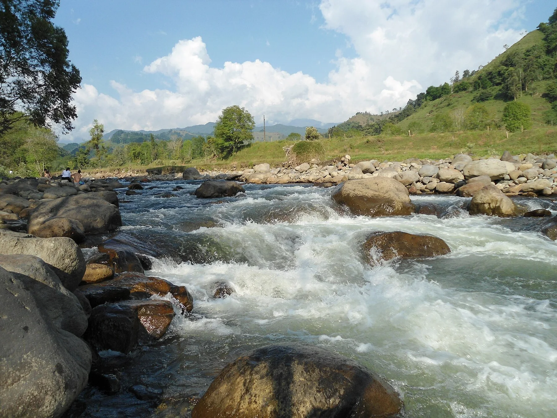
Amazon river corridors

Boat travel provides access to extensive lowland forest.

Use this as the anchor of the visit, then add only one nearby secondary route. Leave enough time to experience the place rather than moving between disconnected photo stops.

Look a little closer

Worth discovering

The details that make Madidi different.

Destination view
01

Amazon river corridors

Boat travel provides access to extensive lowland forest.

Destination view
02

Cloud forest gradient

Middle elevations contain some of the park’s richest biological transitions.

Destination view
03

Andean headwaters

High terrain shows where tropical river systems begin.

Photo journal

A closer look at Madidi

4 photographs
Deep background

What made Madidi distinctive

Andean peaks, cloud forest and Amazonian lowlands descend through one enormous protected landscape in western Bolivia. The deeper story links its visible features with the people and changes behind them.

Madidi spans an exceptional elevation gradient from high Andean country to lowland Amazon forest. The park’s scale makes it less a single destination than a connected system of rivers, mountain slopes and tropical habitats.

The strongest visual shorthand for Madidi is the experience described as “Amazon river corridors”. Behind it lies a more complex relationship between physical processes, settlement and the modern idea of the place as a destination. Boat travel provides access to extensive lowland forest.

Continue to practical planning
Parque Nacional Madidi - La Paz - Bolivia 9See the complete photo journal
Physical setting

Why the terrain has this form

At Madidi, the form of the landscape explains many of the choices that came later. Cloud forest occupies middle elevations, while broad lowland rivers and dense rainforest dominate the Amazonian side. Higher areas open toward puna grasslands and rugged mountain terrain.

Forest history at Madidi is often visible through openings, old routes and changes in species rather than monuments. “Amazon river corridors” is one such point of evidence. Boat travel provides access to extensive lowland forest.

Cultural landscape

People, work and memory

At Madidi, human history is written into settlement and land use rather than separated from the scenery. Indigenous communities and river settlements have long histories within the wider region. Visitor access often begins in Rurrenabaque or local community projects, with boats remaining essential for many lowland routes.

At Madidi, “Cloud forest gradient” should not be treated as a decorative detail. Middle elevations contain some of the park’s richest biological transitions. The feature records how construction, movement or livelihood adapted to local conditions at Madidi.

Modern history

The change that redefined the place

Formal protection changed how Madidi was described and managed. At Madidi, new boundaries, visitor rules and conservation priorities created a public identity that still has to coexist with settlements, customary use and economic pressures. At Madidi, that transition remains visible in the contrast between older working features and visitor infrastructure.

On the ground

The small features that reveal the larger pattern

Start with the feature “Amazon river corridors”, because it condenses a much larger part of the story of Madidi. Boat travel provides access to extensive lowland forest. Its position and condition at Madidi connect physical history with the way people use the place now.

At Madidi, the feature “Cloud forest gradient” provides a precise clue to how the landscape works. Middle elevations contain some of the park’s richest biological transitions. At Madidi, the detail links local scale with the wider regional pattern.

At Madidi, the significance of the feature “Andean headwaters” goes beyond its visual impact. High terrain shows where tropical river systems begin. At Madidi, the detail links local scale with the wider regional pattern.

Season and scale

What continues to change

At Madidi, season is part of the landscape history, not merely a planning detail. The drier months from May to October generally make river and trail travel more predictable. Rain remains possible and lowland heat persists, while higher elevations can be cool year-round.

For Madidi, the main seasonal constraint is: the strongest planning window is May-Oct. For Madidi, outside it, check weather, daylight, road or ferry schedules and seasonal closures before committing to a fixed route.

For Madidi, one practical detail matters: cloud, wind and trail conditions can change quickly. For Madidi, put the highest or most exposed stop first and keep a lower-level alternative.

Placed within its wider geography, Madidi is not an isolated exception. Madidi connects ecologically with protected areas in Peru and with Bolivia’s broader Amazon-Andes transition. For Madidi, its greatest value lies in the continuity between very different ecosystems over a relatively short horizontal distance.
Travel notes

Plan your visit

Time needed
3-5 days
Getting around
Car to access points, then walking or hiking
Effort
Moderate
Plan first
Accommodation and seasonal transport
Time of day
Start early for clearer conditions and more time
Best window
May-Oct
Traveller stories

Stories from people who have been here.

First-hand moments, practical notes and overlooked details from Madidi.

Loading traveller stories…

Browse all traveller stories ↗

Keep exploring

Where next?

All place stories