Rainforest

Monte Alen

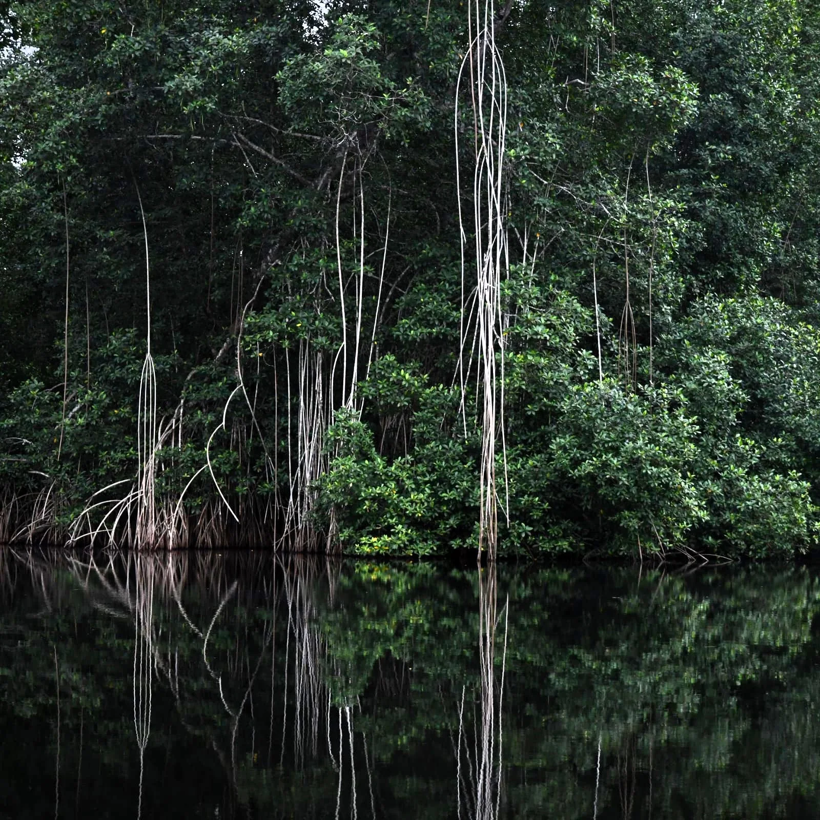
Mountain rainforest, rivers and granite ridges form the largest protected landscape on mainland Equatorial Guinea.

RainforestWildlifeRiver travelMonte Alen trailsUoro River waterfalls

Location
Mainland Rio Muni, Equatorial Guinea
Best window
Dec-Feb, Jun-Aug
Suggested stay
3-5 days
Go for
Rainforest expedition
The reason to go

Hike from dense forest to a granite viewpoint

The shift from enclosed canopy to a broad view over unbroken green is the park's clearest payoff.

Use an experienced local guide and begin early, when wildlife activity, water levels and cooler conditions are most favourable.

Look a little closer

Worth discovering

The details that make Monte Alen different.

Destination view
01

Monte Alen trails

Steep forest paths climb toward rocky high ground.

Destination view
02

Uoro River waterfalls

Cascades and pools break the humid forest journey.

Destination view
03

Lowland wildlife forest

Elephants, primates and birds occupy the wider park.

Photo journal

A closer look at Monte Alen

4 photographs
Beyond the surface

What made Monte Alen distinctive

Mountain rainforest, rivers and granite ridges form the largest protected landscape on mainland Equatorial Guinea. The deeper story links its visible features with the people and changes behind them.

Monte Alen is centred on Mainland Rio Muni, where mountain rainforest, rivers and granite ridges form the largest protected landscape on mainland Equatorial Guinea. The strongest reason to make the journey is to hike from dense forest to a granite viewpoint.

Many visits to Monte Alen begin with the experience described as “Hike from dense forest to a granite viewpoint”. The more revealing question is why it exists here, how people used the surrounding ground and what remains visible from earlier phases. The shift from enclosed canopy to a broad view over unbroken green is the park's clearest payoff.

Continue to practical planning
Nationalpark Monte AlénSee the complete photo journal
Origins

The landform before the landmark

The first layer of Monte Alen is geological and ecological rather than scenic. Dense canopy limits long views, making rivers, clearings, ridges and waterfalls the key points of orientation. Humidity, rain and trail conditions shape the pace more than the distance alone.

The visible shoreline or channel at Monte Alen is only one stage in a larger cycle. “Monte Alen trails” demonstrates how flow, season and terrain interact. Steep forest paths climb toward rocky high ground.

Settlement and memory

The cultural layer of the place

Monte Alen lies within Fang cultural territory on the mainland of Equatorial Guinea. Villages historically depended on forest products, hunting and small farms, while Spanish colonial administration and later road building connected the interior to coastal centres.

The national park was established in 1990, protecting rugged forest, rivers and peaks in a country where oil wealth later transformed urban areas far more rapidly than rural services.

Modern history

The transition visible today

Scientific surveys and limited ecotourism brought attention to gorillas, chimpanzees and forest elephants, but weak infrastructure and hunting pressure have kept the park far less visited and researched than comparable Central African reserves.

Details to read

The small features that reveal the larger pattern

Look closely at the feature “Monte Alen trails” in Monte Alen; it carries information that a panoramic view can miss. Steep forest paths climb toward rocky high ground. At Monte Alen, it gives a concrete reference point for reading change rather than merely collecting viewpoints.

Start with the feature “Uoro River waterfalls”, because it condenses a much larger part of the story of Monte Alen. Cascades and pools break the humid forest journey. Within Monte Alen, it is both an attraction and a record of the processes described above.

At Monte Alen, the feature “Lowland wildlife forest” is best understood as part of the surrounding system rather than an isolated stop. Elephants, primates and birds occupy the wider park. Within Monte Alen, the feature explains why this destination differs from nearby landscapes.

Present day

What continues to change

At Monte Alen, season is part of the landscape history, not merely a planning detail. For Monte Alen, the most reliable visiting window is Dec-Feb, Jun-Aug.

For Monte Alen, the stated visiting window is Dec-Feb, Jun-Aug, but its practical meaning depends on local weather, water and transport rather than the calendar alone.

Placed within its wider geography, Monte Alen is not an isolated exception. Beyond the best-known image of Monte Alen feature, Monte Alen matters because uoro river waterfalls and lowland wildlife forest place the destination inside a broader regional story.
Chronology

Key dates

  1. Forest settlement and exchange

    Communities used rivers, farms and forest territories across Rio Muni.

  2. Spanish administration reaches the interior

    Roads and political control changed trade and settlement patterns.

  3. Monte Alen National Park established

    Formal protection covered one of Equatorial Guinea's largest mainland forest areas.

Travel notes

Plan your visit

Time needed
3-5 days
Getting around
Local guide, river transport and forest walking
Effort
Moderate to demanding
Plan first
Guide, permits, health preparation and transfers
Time of day
Early morning and late afternoon
Best window
Dec-Feb, Jun-Aug
Traveller stories

Stories from people who have been here.

First-hand moments, practical notes and overlooked details from Monte Alen.

Loading traveller stories…

Browse all traveller stories ↗

Keep exploring

Where next?

All place stories