Lesser Antilles, United Kingdom Overseas Territory
Best window
Dec-May
Suggested stay
3-5 days
Go for
Volcanic island exploration
The reason to go
View the buried city of Plymouth from an authorised exclusion-zone tour
The sight of streets and buildings overtaken by ash gives the island a direct, recent geological history unlike almost anywhere else in the Caribbean.
Plan the least frequent boat or flight first, then use the remaining time for the signature route rather than trying to collect every viewpoint.
Look a little closer
Worth discovering
The details that make Montserrat different.
Destination view
01
Plymouth ruins
The former capital lies partly buried below Soufriere Hills.
Photo journal
02
Montserrat Volcano Observatory
Exhibits and viewpoints explain ongoing volcanic monitoring.
Destination view
03
Centre Hills
Forest trails protect endemic birds in the inhabited north.
Photo journal
A closer look at Montserrat
9 photographs
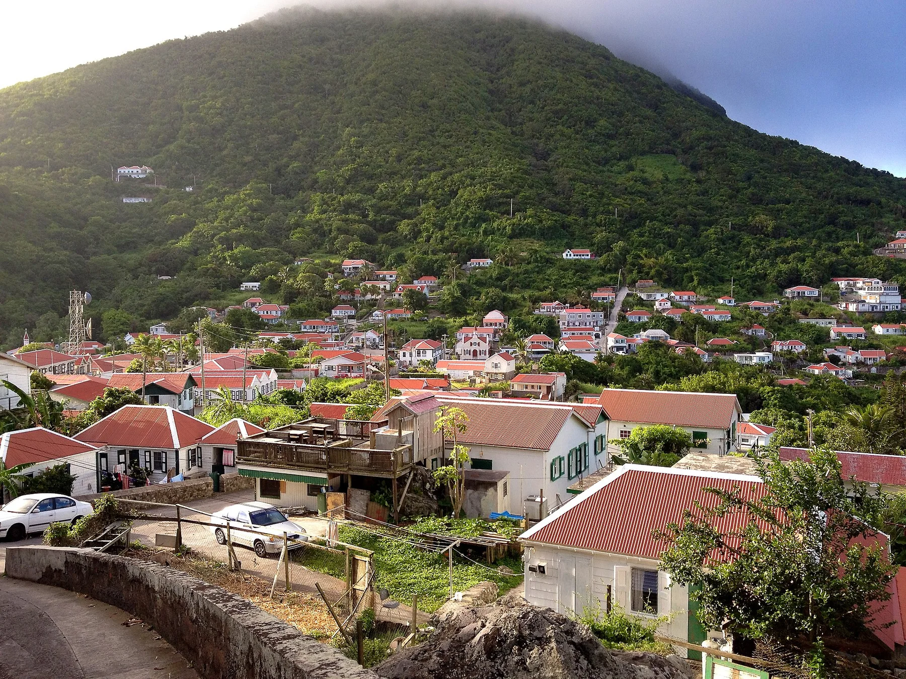
01The inhabited part of Monserrat (12124530744)02From Garibaldi Hill (5809292121) (2)03Montserrat — view 304Montserrat Island Sunset (4568325551)05Montserrat volcano damage06Montserrat, Karibik - 2012-03-04 - Tutties and Bethel - The east Coast after a Volcanic Eruption - panoramio07The inhabited part of Monserrat (12124530744)08Montserrat Golf Course (5809291829)09Belham River Valley (5809291535)
The full story
Montserrat beyond the first view
An active volcano reshaped the island, burying the former capital while the north remained inhabited. The deeper story links its visible features with the people and changes behind them.
4 min readLesser Antilles, United Kingdom Overseas Territory
Montserrat is centred on Lesser Antilles, where an active volcano reshaped the island, burying the former capital while the north remained inhabited. The strongest reason to make the journey is to view the buried city of plymouth from an authorised exclusion-zone tour.
The familiar invitation at Montserrat is “View the buried city of Plymouth from an authorised exclusion-zone tour”, yet that image makes more sense when it is connected to the landform, the local economy and the changes that determined access. The sight of streets and buildings overtaken by ash gives the island a direct, recent geological history unlike almost anywhere else in the Caribbean.
The map understates the role of the sea. At Montserrat, “Plymouth ruins” makes clear that water is both a boundary and the route through which settlements, wildlife and outside connections developed. The former capital lies partly buried below Soufriere Hills.
Montserrat is not a uniform area. Changes in elevation, exposure, water and substrate produce distinct environments over short distances, which is why a route through the place often reveals more than a fixed viewpoint.
02
Human history
The cultural layer of the place
English and Irish settlers established plantations on Montserrat in the seventeenth century, and enslaved Africans produced sugar, cotton and other crops. Irish place names and cultural memory remained visible, but the island's society and land ownership were fundamentally shaped by slavery and the plantation economy.
Soufriere Hills volcano reawakened in 1995 after centuries of quiet. Pyroclastic flows and ash destroyed Plymouth, buried villages and forced most residents to leave the southern half of the island. The capital was abandoned and an exclusion zone created, turning roads, church towers and modern buildings into a rapidly weathering archaeological landscape.
03
Reorganisation
From local landscape to protected destination
The eruption reduced the population and shifted government and settlement northward. Montserrat now lives with a divided geography: an inhabited green north, an actively monitored volcanic centre and a former capital that can only be approached under controlled conditions.
04
Field notes
What to read in the landscape
Look closely at the feature “Plymouth ruins” in Montserrat; it carries information that a panoramic view can miss. The former capital lies partly buried below Soufriere Hills. At Montserrat, the detail links local scale with the wider regional pattern.
Start with the feature “Montserrat Volcano Observatory”, because it condenses a much larger part of the story of Montserrat. Exhibits and viewpoints explain ongoing volcanic monitoring. Within Montserrat, it is both an attraction and a record of the processes described above.
Start with the feature “Centre Hills”, because it condenses a much larger part of the story of Montserrat. Forest trails protect endemic birds in the inhabited north. At Montserrat, it gives a concrete reference point for reading change rather than merely collecting viewpoints.
05
Continuity
The current chapter
Montserrat changes through the year because weather and biological cycles rearrange what can be seen and used. For Montserrat, the most reliable visiting window is Dec-May.
For Montserrat, the stated visiting window is Dec-May, but its practical meaning depends on local weather, water and transport rather than the calendar alone.
Placed within its wider geography, Montserrat is not an isolated exception. Beyond the best-known image of Montserrat feature, Montserrat matters because montserrat volcano observatory and centre hills place the destination inside a broader regional story.
Chronology
Key dates
Plantation colony develops
Irish and English settlement expanded through enslaved African labour and export agriculture.
Soufriere Hills eruption begins
Renewed volcanic activity triggered evacuations and the progressive loss of southern settlements.
Plymouth destroyed
Major pyroclastic flows buried much of the capital and confirmed the long-term exclusion zone.
Travel notes
Plan your visit
Time needed
3-5 days
Getting around
Local transport, walking and boat or ferry connections
Effort
Easy to moderate
Plan first
Main flight or ferry, accommodation and weather backup
Time of day
Morning movement; late light for coast
Best window
Dec-May
Traveller stories
Stories from people who have been here.
First-hand moments, practical notes and overlooked details from Montserrat.