Southern Namib silence

NamibRand

Open desert plains, red dunes, dark mountains and exceptional night skies form a privately protected landscape in the southern Namib.

Red dunesDark-sky reserveDesert mountains

Location
Southern Namib, Namibia
Best window
Mar-Oct
Suggested stay
3-5 days
Go for
Desert horizons and dark skies
The reason to go

Wolwedans plains

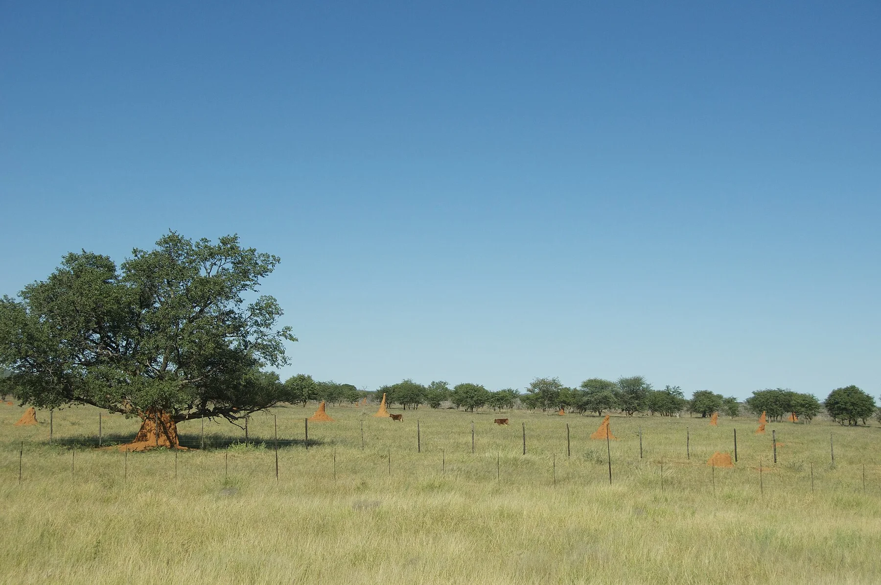
Open grass-desert and distant mountains create the reserve most recognisable sense of scale.

Start early and make this the first exposed stop of the day. Keep a lower route ready if cloud, heat, wind or trail conditions change during Mar-Oct.

Look a little closer

Worth discovering

The details that make NamibRand different.

Destination view
01

Wolwedans plains

Open grass-desert and distant mountains create the reserve most recognisable sense of scale.

Destination view
02

Tok Tokkie trails landscape

Walking routes reveal tracks, plants and small desert processes often missed from a vehicle.

Destination view
03

Dark-sky horizon

The absence of major settlement makes the night landscape as significant as the daytime desert.

Photo journal

A closer look at NamibRand

13 photographs
Origins and change

How time shaped NamibRand

Open desert plains, red dunes, dark mountains and exceptional night skies form a privately protected landscape in the southern Namib. Its character becomes clearer when geology, settlement and modern protection are considered together.

NamibRand occupies a vast transition between the high red dunes of the Namib and darker mountain ranges farther east. Gravel plains, dry river courses and isolated inselbergs create long uninterrupted views. The scale is difficult to judge because there are few buildings, trees or roads to provide familiar reference points.

The strongest visual shorthand for NamibRand is the experience described as “Wolwedans plains”. Behind it lies a more complex relationship between physical processes, settlement and the modern idea of the place as a destination. Open grass-desert and distant mountains create the reserve most recognisable sense of scale.

Continue to practical planning
NamibRand-3540 - Flickr - Ragnhild & Neil CrawfordSee the complete photo journal
Natural history

The forces behind the first impression

The first layer of NamibRand is geological and ecological rather than scenic. The landscape changes gradually rather than through sudden landmarks. Dunes lower into open plains, mountains appear to float in heat haze, and dry channels support narrow lines of vegetation. At night, minimal artificial light reveals another dimension of the desert.

Colour and form at NamibRand are the result of long physical processes. “Wolwedans plains” helps distinguish the underlying structure from the surface image seen in photographs. Open grass-desert and distant mountains create the reserve most recognisable sense of scale.

Lives and livelihoods

How people learned to live here

At NamibRand, daily life gives the terrain a historical meaning that a viewpoint alone cannot provide. The reserve is managed through a small number of low-density tourism concessions and conservation operations. Historic farming infrastructure and neighbouring pastoral land show the shift from livestock production toward landscape-scale protection. Access is controlled, keeping vehicle pressure relatively low.

A close look at “Tok Tokkie trails landscape” makes the cultural layer of NamibRand more concrete. Walking routes reveal tracks, plants and small desert processes often missed from a vehicle. At NamibRand, the surviving form links present-day identity with earlier work and settlement.

Modern history

A landscape reorganised

Formal protection changed how NamibRand was described and managed. At NamibRand, new boundaries, visitor rules and conservation priorities created a public identity that still has to coexist with settlements, customary use and economic pressures. At NamibRand, that transition remains visible in the contrast between older working features and visitor infrastructure.

Details to read

Where the story becomes visible

At NamibRand, the significance of the feature “Wolwedans plains” goes beyond its visual impact. Open grass-desert and distant mountains create the reserve most recognisable sense of scale. Within NamibRand, the feature explains why this destination differs from nearby landscapes.

Start with the feature “Tok Tokkie trails landscape”, because it condenses a much larger part of the story of NamibRand. Walking routes reveal tracks, plants and small desert processes often missed from a vehicle. At NamibRand, the detail links local scale with the wider regional pattern.

At NamibRand, the feature “Dark-sky horizon” is one of the most useful pieces of visible evidence. The absence of major settlement makes the night landscape as significant as the daytime desert. Its position and condition at NamibRand connect physical history with the way people use the place now.

Continuity

Why the landscape still feels dynamic

NamibRand changes through the year because weather and biological cycles rearrange what can be seen and used. Cooler months bring comfortable days and cold nights, while summer can be extremely hot with occasional dramatic storms. Light is strongest at sunrise and late afternoon, when dune and mountain forms become more legible. Clear winter nights are particularly notable.

For NamibRand, the main seasonal constraint is: the strongest planning window is Mar-Oct. For NamibRand, outside it, check weather, daylight, road or ferry schedules and seasonal closures before committing to a fixed route.

For NamibRand, one practical detail matters: distances, fuel, food and mobile coverage can be less predictable than the map suggests. For NamibRand, carry offline maps and keep a margin in the schedule.

Placed within its wider geography, NamibRand is not an isolated exception. NamibRand connects visually and ecologically with Sossusvlei, the Namib-Naukluft landscape and the Great Escarpment. For NamibRand, its distinct value is the continuity of open space between these better-known features.
Travel notes

Plan your visit

Time needed
3-5 days
Getting around
4x4 or local driver, with short walks at the main sites
Effort
Moderate to demanding
Plan first
Main transport and accommodation
Time of day
Sunrise and the final hours of light
Best window
Mar-Oct
Traveller stories

Stories from people who have been here.

First-hand moments, practical notes and overlooked details from NamibRand.

Loading traveller stories…

Browse all traveller stories ↗

Keep exploring

Where next?

All place stories
