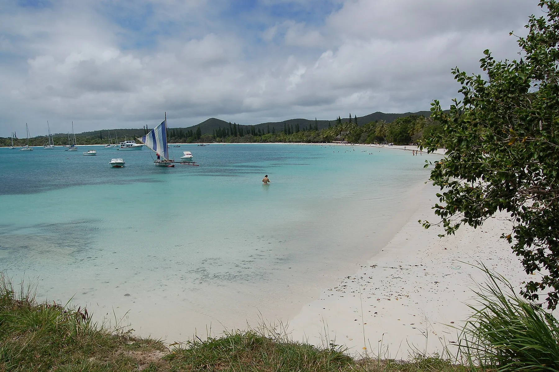
Cycle the lagoon coast and cross the Mouli Bridge at high tide
The bridge reveals clear tidal channels, rays and reef water, while the road continues beside an almost uninterrupted white beach.
Plan the least frequent boat or flight first, then use the remaining time for the signature route rather than trying to collect every viewpoint.
Look a little closer
Worth discovering
The details that make Ouvea different.
Photo journal
01
Mouli Bridge
A narrow crossing gives a direct view into lagoon channels.
Destination view
02
Fayaoue beach
Long pale sand follows the inhabited coast.
Destination view
03
Pleiades reefs
Northern and southern reef groups frame the island lagoon.
Photo journal
A closer look at Ouvea
3 photographs
01Ouvea — view 102Four océanien à Ouvéa03Ouvea Pont de Mouli
Beyond the surface
How Ouvea became the place it is
A narrow raised-coral island separates a brilliant lagoon from the open Pacific along one of the region's longest beaches. The view is only the surface of a longer story of formation, use and change.
4 min readLoyalty Islands, New Caledonia
Ouvea is centred on Loyalty Islands, where a narrow raised-coral island separates a brilliant lagoon from the open Pacific along one of the region's longest beaches. The strongest reason to make the journey is to cycle the lagoon coast and cross the mouli bridge at high tide.
The strongest visual shorthand for Ouvea is the experience described as “Cycle the lagoon coast and cross the Mouli Bridge at high tide”. Behind it lies a more complex relationship between physical processes, settlement and the modern idea of the place as a destination. The bridge reveals clear tidal channels, rays and reef water, while the road continues beside an almost uninterrupted white beach.
The map understates the role of the sea. At Ouvea, “Mouli Bridge” makes clear that water is both a boundary and the route through which settlements, wildlife and outside connections developed. A narrow crossing gives a direct view into lagoon channels.
Ouvea is not a uniform area. Changes in elevation, exposure, water and substrate produce distinct environments over short distances, which is why a route through the place often reveals more than a fixed viewpoint.
02
Cultural landscape
People, work and memory
Ouvea's Kanak communities speak Iaai and Faga Uvea, reflecting both Loyalty Islands roots and older Polynesian migration from Wallis. Chiefdoms organised land and lagoon use long before missionaries, sandalwood traders and French colonial authority arrived in the nineteenth century.
The island became central to New Caledonia's political history in 1988, when a hostage crisis ended with a deadly assault at Gossanah cave. The violence accelerated negotiations that produced the Matignon Accords and a new framework for Kanak participation and provincial government.
03
Turning point
The change that redefined the place
The lagoon's World Heritage recognition strengthened conservation, but access remains grounded in customary permission and community authority. Churches, tribal lands, memorial sites and the long reef island should be understood together rather than treating Ouvea as an empty beach destination.
04
On the ground
Three details that explain the whole place
Start with the feature “Mouli Bridge”, because it condenses a much larger part of the story of Ouvea. A narrow crossing gives a direct view into lagoon channels. At Ouvea, it gives a concrete reference point for reading change rather than merely collecting viewpoints.
Look closely at the feature “Fayaoue beach” in Ouvea; it carries information that a panoramic view can miss. Long pale sand follows the inhabited coast. For Ouvea, that relationship is more informative than treating the feature only as a photograph or checklist item.
At Ouvea, the feature “Pleiades reefs” provides a precise clue to how the landscape works. Northern and southern reef groups frame the island lagoon. Its position and condition at Ouvea connect physical history with the way people use the place now.
05
Living landscape
A living landscape, not a frozen scene
At Ouvea, light, water and temperature reveal different structures at different times of year. For Ouvea, the most reliable visiting window is Apr-Nov.
For Ouvea, the stated visiting window is Apr-Nov, but its practical meaning depends on local weather, water and transport rather than the calendar alone.
Placed within its wider geography, Ouvea is not an isolated exception. Beyond the best-known image of Ouvea feature, Ouvea matters because fayaoue beach and pleiades reefs place the destination inside a broader regional story.
Chronology
Key dates
Kanak and Polynesian cultural exchange
Iaai and Faga Uvea communities organised land, clan and lagoon rights across the atoll.
Mission and French rule
Christian missions and colonial administration altered political and religious institutions.
Ouvea crisis and Matignon process
Violence at Gossanah became a decisive event in negotiations over New Caledonia's future.
Travel notes
Plan your visit
Time needed
3-5 days
Getting around
Local transport, walking and boat or ferry connections
Effort
Easy to moderate
Plan first
Main flight or ferry, accommodation and weather backup
Time of day
Morning movement; late light for coast
Best window
Apr-Nov
Traveller stories
Stories from people who have been here.
First-hand moments, practical notes and overlooked details from Ouvea.