Alpine river corridor

Soca Valley

An intensely coloured alpine river links gorges, mountain towns and First World War landscapes on Slovenia's western edge.

Emerald riverJulian AlpsWar history

Location
Julian Alps, Slovenia
Best window
May-Oct
Suggested stay
2-4 days
Go for
River and mountain route
The reason to go

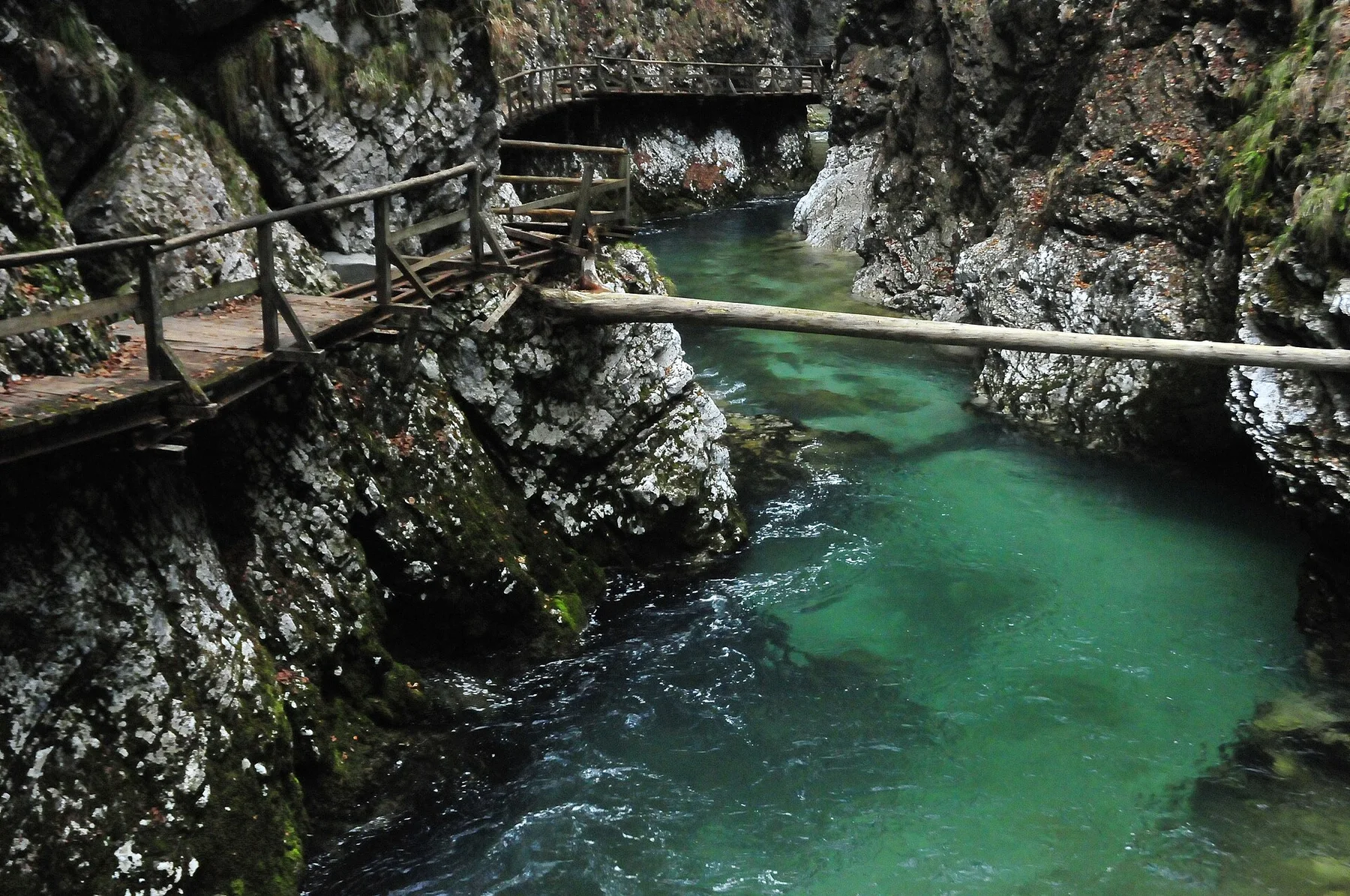
Great Soca gorge

Narrow limestone walls compress the river into a vivid channel in the upper valley.

Start early and make this the first exposed stop of the day. Keep a lower route ready if cloud, heat, wind or trail conditions change during May-Oct.

Look a little closer

Worth discovering

The details that make Soca Valley different.

Destination view
01

Great Soca gorge

Narrow limestone walls compress the river into a vivid channel in the upper valley.

Destination view
02

Kobarid landscape

Museum, memorial routes and mountain villages place the First World War history directly within the valley.

Destination view
03

Tolmin gorges

Water, rock and forest create a concentrated transition between the high Alps and the wider lower valley.

Photo journal

A closer look at Soca Valley

9 photographs
Deep background

Reading the layers of Soca Valley

An intensely coloured alpine river links gorges, mountain towns and First World War landscapes on Slovenia's western edge. Its character becomes clearer when geology, settlement and modern protection are considered together.

The Soca Valley follows one of Europe's most visually distinctive alpine rivers from the high Julian Alps toward the Adriatic lowlands. Clear blue-green water, limestone gorges, forest and steep mountain walls create the natural structure, while Bovec, Kobarid and Tolmin provide inhabited centres with different scales and histories.

The strongest visual shorthand for Soca Valley is the experience described as “Great Soca gorge”. Behind it lies a more complex relationship between physical processes, settlement and the modern idea of the place as a destination. Narrow limestone walls compress the river into a vivid channel in the upper valley.

Continue to practical planning
Soca Valley — view 4See the complete photo journal
Physical setting

Why the terrain has this form

At Soca Valley, the physical story begins with the structure of the ground. The river changes quickly along its course. In the upper valley it runs through narrow gorges and glacially shaped terrain; farther south, the corridor widens and the climate becomes softer. Waterfalls, tributaries and suspended footbridges add close-range detail to the broad mountain setting.

Altitude turns distance into effort and creates abrupt ecological boundaries. At Soca Valley, “Great Soca gorge” provides a useful reference point for understanding that vertical structure. Narrow limestone walls compress the river into a vivid channel in the upper valley.

Cultural landscape

Settlement, movement and local knowledge

At Soca Valley, people learned to work with the landscape limits rather than arriving after its story was complete. The valley also carries the physical memory of the Isonzo Front. Fortifications, cemeteries, museums and routes across the mountains reveal how intensely the landscape was contested during the First World War. Contemporary outdoor tourism and local food traditions now coexist with that difficult history.

A close look at “Kobarid landscape” makes the cultural layer of Soca Valley more concrete. Museum, memorial routes and mountain villages place the First World War history directly within the valley. At Soca Valley, the surviving form links present-day identity with earlier work and settlement.

Change

The change that redefined the place

Formal protection changed how Soca Valley was described and managed. At Soca Valley, new boundaries, visitor rules and conservation priorities created a public identity that still has to coexist with settlements, customary use and economic pressures. At Soca Valley, the consequences are clearest where traditional use, protection and tourism occupy the same ground.

Visible evidence

Landmarks that carry the deeper story

At Soca Valley, the feature “Great Soca gorge” is best understood as part of the surrounding system rather than an isolated stop. Narrow limestone walls compress the river into a vivid channel in the upper valley. Within Soca Valley, the feature explains why this destination differs from nearby landscapes.

At Soca Valley, the feature “Kobarid landscape” provides a precise clue to how the landscape works. Museum, memorial routes and mountain villages place the First World War history directly within the valley. At Soca Valley, it gives a concrete reference point for reading change rather than merely collecting viewpoints.

At Soca Valley, the significance of the feature “Tolmin gorges” goes beyond its visual impact. Water, rock and forest create a concentrated transition between the high Alps and the wider lower valley. For Soca Valley, that relationship is more informative than treating the feature only as a photograph or checklist item.

Living landscape

The place within its wider region

At Soca Valley, light, water and temperature reveal different structures at different times of year. Late spring brings strong water flow and fresh alpine vegetation. Summer supports the widest range of river and mountain activity, while September often offers stable conditions and less pressure. Autumn colour extends into the lower valley; winter shifts attention toward inhabited towns and snow-covered upper terrain.

For Soca Valley, the main seasonal constraint is: the strongest planning window is May-Oct. For Soca Valley, outside it, check weather, daylight, road or ferry schedules and seasonal closures before committing to a fixed route.

For Soca Valley, one practical detail matters: cloud, wind and trail conditions can change quickly. For Soca Valley, put the highest or most exposed stop first and keep a lower-level alternative.

Placed within its wider geography, Soca Valley is not an isolated exception. For Soca Valley, the wider context shows that, the Soca corridor connects the Slovenian Julian Alps with the Italian borderlands and the route toward Gorizia and the Adriatic. For Soca Valley, nearby Bohinj, Triglav National Park and the Karst plateau show how rapidly Slovenia moves between alpine, river and Mediterranean-influenced landscapes.

Travel notes

Plan your visit

Time needed
2-4 days
Getting around
Car to access points, then walking or hiking
Effort
Moderate
Plan first
Opening days and any limited-entry sites
Time of day
Start early for clearer conditions and more time
Best window
May-Oct
Traveller stories

Stories from people who have been here.

First-hand moments, practical notes and overlooked details from Soca Valley.

Loading traveller stories…

Browse all traveller stories ↗

Keep exploring

Where next?

All place stories