Western Himalayan gateway

Tirthan Valley

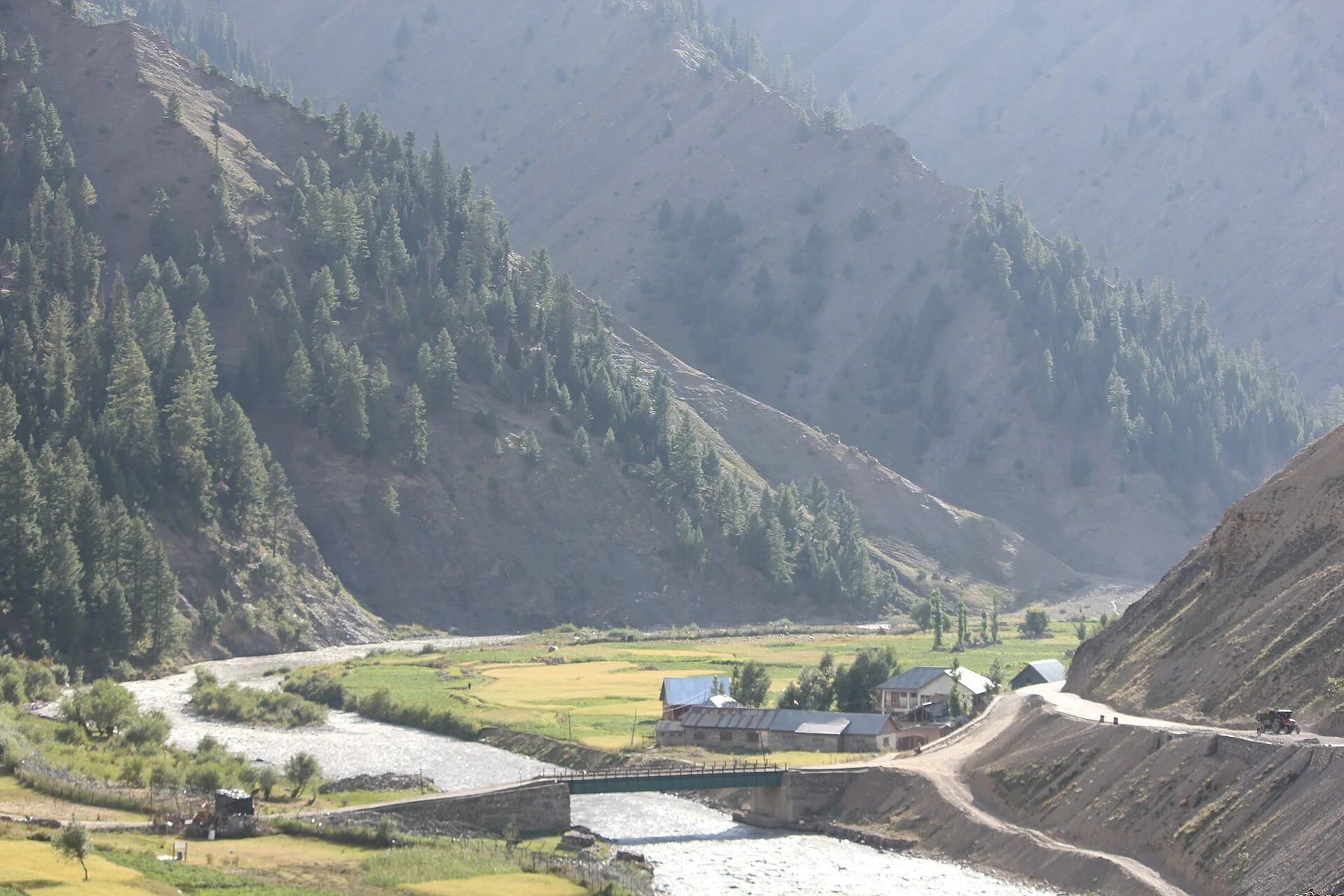
A clear Himalayan river, forested slopes and small villages form a quieter gateway to the Great Himalayan National Park.

River valleyHimalayan forestVillage stays

Location
Himachal Pradesh, India
Best window
Apr-Jun, Sep-Nov
Suggested stay
3-5 days
Go for
River valley and Himalayan trails
The reason to go

Tirthan River

Cold clear water structures the valley and supports walking, fishing and village life.

Check opening days or local access first, then connect the main site to the surrounding streets, paths or landscape instead of treating it as an isolated stop.

Look a little closer

Worth discovering

The details that make Tirthan Valley different.

Photo journal
01

Tirthan River

Cold clear water structures the valley and supports walking, fishing and village life.

Destination view
02

Great Himalayan National Park

Protected high country begins beyond the road network and extends into complex alpine terrain.

Destination view
03

Village and orchard belt

Small settlements make the lower valley a cultural landscape rather than a pure wilderness corridor.

Photo journal

A closer look at Tirthan Valley

7 photographs
The full story

Tirthan Valley: the story behind the landscape

A clear Himalayan river, forested slopes and small villages form a quieter gateway to the Great Himalayan National Park. The deeper story links its visible features with the people and changes behind them.

Tirthan Valley follows a clear mountain river through the lower reaches of Himachal Pradesh toward the Great Himalayan National Park. It is less about one monumental viewpoint than about the sequence of villages, forest, orchards and side valleys along the river corridor.

Many visits to Tirthan Valley begin with the experience described as “Tirthan River”. The more revealing question is why it exists here, how people used the surrounding ground and what remains visible from earlier phases. Cold clear water structures the valley and supports walking, fishing and village life.

Continue to practical planning
Brown Dipper (Cinclus pallasii) HimachalPradesh India Apr 2018See the complete photo journal
Landform

From underlying structure to visible landscape

Before roads, settlements or protected-area boundaries, the terrain of Tirthan Valley set the basic terms. Steep forested slopes rise from the valley floor and become progressively wilder toward protected high country. Tributary streams, waterfalls and alpine routes extend the landscape beyond the inhabited river edge.

Routes and settlements at Tirthan Valley follow the water system even when the map emphasises roads. “Tirthan River” exposes that older logic. Cold clear water structures the valley and supports walking, fishing and village life.

Human history

Settlement, movement and local knowledge

Tirthan Valley has been shaped as much by livelihoods and movement as by natural processes. Villages, orchards and small guesthouses create a locally rooted visitor economy. Agriculture and seasonal movement remain visible, while park access is more regulated and trail-based than the roadside sections of the valley.

The role of “Great Himalayan National Park” is especially revealing at Tirthan Valley. Protected high country begins beyond the road network and extends into complex alpine terrain. In the history of Tirthan Valley, it connects the wider regional context with a specific place that can still be examined today.

Turning point

How access and attention changed the place

Formal protection changed how Tirthan Valley was described and managed. At Tirthan Valley, new boundaries, visitor rules and conservation priorities created a public identity that still has to coexist with settlements, customary use and economic pressures. At Tirthan Valley, the consequences are clearest where traditional use, protection and tourism occupy the same ground.

Field notes

Landmarks that carry the deeper story

Look closely at the feature “Tirthan River” in Tirthan Valley; it carries information that a panoramic view can miss. Cold clear water structures the valley and supports walking, fishing and village life. For Tirthan Valley, that relationship is more informative than treating the feature only as a photograph or checklist item.

At Tirthan Valley, the feature “Great Himalayan National Park” is one of the most useful pieces of visible evidence. Protected high country begins beyond the road network and extends into complex alpine terrain. At Tirthan Valley, it gives a concrete reference point for reading change rather than merely collecting viewpoints.

At Tirthan Valley, the significance of the feature “Village and orchard belt” goes beyond its visual impact. Small settlements make the lower valley a cultural landscape rather than a pure wilderness corridor. Its position and condition at Tirthan Valley connect physical history with the way people use the place now.

Living landscape

A living landscape, not a frozen scene

A single visit to Tirthan Valley captures only one phase of its annual cycle. April to June offers comfortable temperatures and strong river flow. The monsoon changes road and trail conditions, while September to November usually brings clearer mountain weather and excellent visibility.

For Tirthan Valley, the main seasonal constraint is: the strongest planning window is Apr-Jun, Sep-Nov. For Tirthan Valley, outside it, check weather, daylight, road or ferry schedules and seasonal closures before committing to a fixed route.

For Tirthan Valley, one practical detail matters: cloud, wind and trail conditions can change quickly. For Tirthan Valley, put the highest or most exposed stop first and keep a lower-level alternative.

Placed within its wider geography, Tirthan Valley is not an isolated exception. For Tirthan Valley, the wider context shows that, the valley connects to Jalori Pass, the Seraj region and the larger protected mountain system of the Great Himalayan National Park. For Tirthan Valley, these links show how inhabited valleys provide the practical entrances to much more remote Himalayan terrain.
Travel notes

Plan your visit

Time needed
3-5 days
Getting around
Car to access points, then walking or hiking
Effort
Moderate
Plan first
Access conditions, permits or a local guide
Time of day
Start early for clearer conditions and more time
Best window
Apr-Jun, Sep-Nov
Traveller stories

Stories from people who have been here.

First-hand moments, practical notes and overlooked details from Tirthan Valley.

Loading traveller stories…

Browse all traveller stories ↗

Keep exploring

Where next?

All place stories