Ladakh beyond the main corridor

Zanskar

A high Himalayan valley system of river gorges, Buddhist monasteries, remote villages and severe mountain passes in southern Ladakh.

Himalayan valleysMonasteriesMountain passes

Location
Ladakh, India
Best window
Jun-Sep
Suggested stay
3-5 days
Go for
High-altitude valley journey
The reason to go

Phugtal Monastery

A monastic complex built into a cliff above a tributary valley expresses the close connection between terrain and religious life.

Start early and make this the first exposed stop of the day. Keep a lower route ready if cloud, heat, wind or trail conditions change during Jun-Sep.

Look a little closer

Worth discovering

The details that make Zanskar different.

Photo journal
01

Phugtal Monastery

A monastic complex built into a cliff above a tributary valley expresses the close connection between terrain and religious life.

Photo journal
02

Padum basin

The main inhabited basin concentrates fields, villages and monasteries beneath high mountain walls.

Photo journal
03

Zanskar river gorges

Deep river corridors reveal the scale and geological complexity of the Himalayan interior.

Photo journal

A closer look at Zanskar

13 photographs
Beyond the surface

Zanskar: the story behind the landscape

A high Himalayan valley system of river gorges, Buddhist monasteries, remote villages and severe mountain passes in southern Ladakh. This account follows the forces, communities and decisions that made the present landscape.

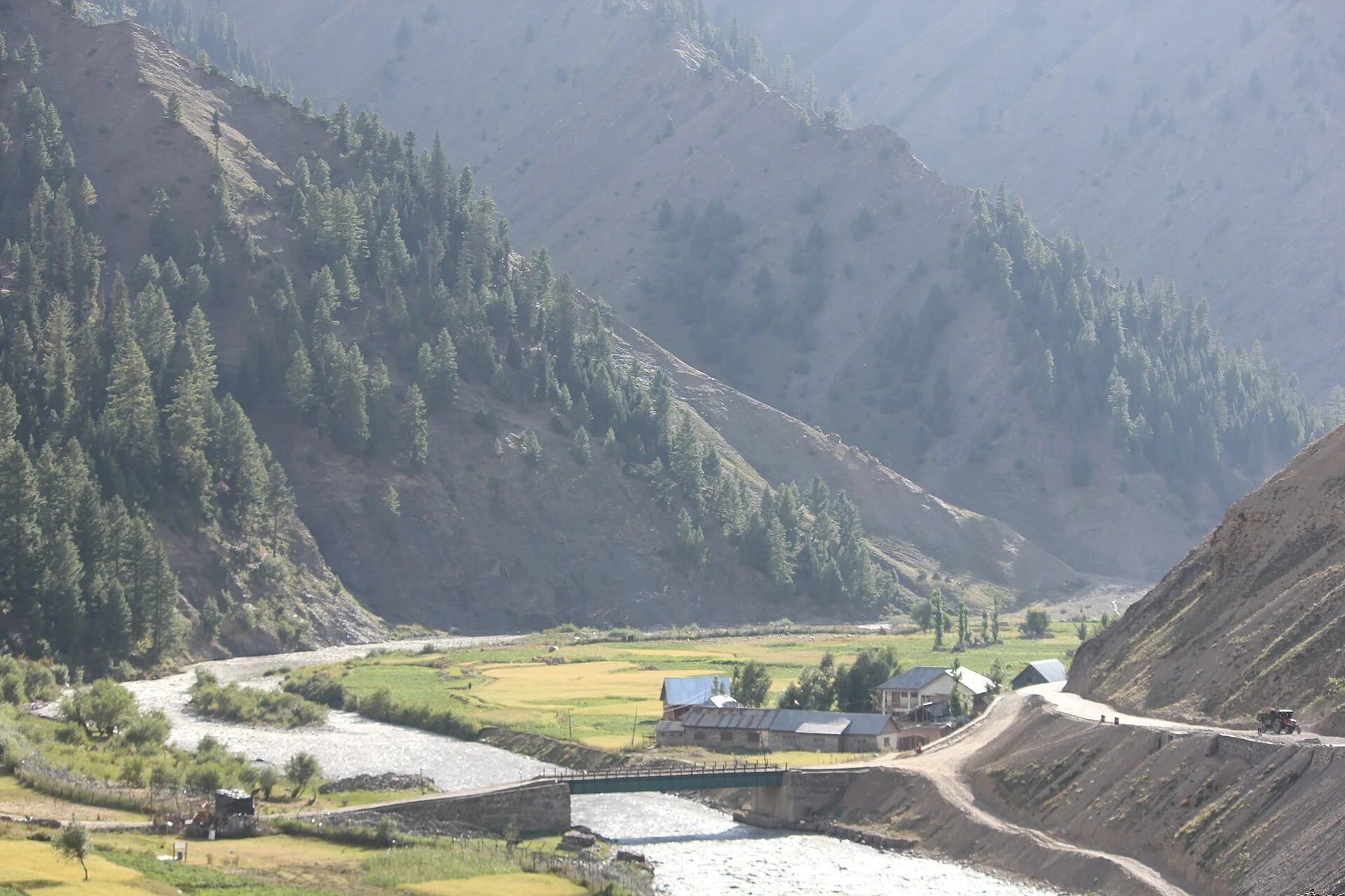
Zanskar occupies a high and deeply cut mountain region in southern Ladakh, enclosed by major Himalayan ranges and organised around the Zanskar river system. Villages, monasteries and cultivated terraces occupy rare areas of usable ground between bare slopes. Road access has expanded, but distance, altitude and winter isolation still define the region's physical and social character.

The familiar invitation at Zanskar is “Phugtal Monastery”, yet that image makes more sense when it is connected to the landform, the local economy and the changes that determined access. A monastic complex built into a cliff above a tributary valley expresses the close connection between terrain and religious life.

Continue to practical planning
Shila Tsarap Mountains Zanskar Oct22 A7C 04113See the complete photo journal
Natural history

Why the terrain has this form

Before roads, settlements or protected-area boundaries, the terrain of Zanskar set the basic terms. Broad high valleys narrow abruptly into gorges where rivers cut through layered rock. Snow peaks and dry mountain walls dominate the horizon, while irrigated fields create concentrated green zones around settlements. Passes connect Zanskar with neighbouring valleys, and their elevation makes geology, weather and scale impossible to separate from any journey through the region.

Relief controls far more than the view. At Zanskar, “Phugtal Monastery” reveals how elevation divides vegetation, weather, water and the routes available to people. A monastic complex built into a cliff above a tributary valley expresses the close connection between terrain and religious life.

Lives and livelihoods

The human landscape behind the scenery

At Zanskar, people learned to work with the landscape limits rather than arriving after its story was complete. Tibetan Buddhist culture is visible in monasteries such as Karsha and Phugtal, village festivals and the organisation of agricultural life. Barley fields, livestock and carefully managed water support communities in an environment with a very short growing season. New roads are changing trade and movement, yet older footpaths and seasonal patterns remain legible across the landscape.

At Zanskar, the feature described as “Padum basin” offers a second line of evidence. The main inhabited basin concentrates fields, villages and monasteries beneath high mountain walls. Within Zanskar, it shows how local knowledge and practical use became embedded in the landscape.

Change

The modern turning point

The decisive modern change at Zanskar was access. At Zanskar, transport and visitor infrastructure made the landscape easier to reach while concentrating pressure at the few points where roads, boats or trails enter it. Zanskar should therefore be read as an evolving cultural landscape rather than a timeless scene.

Details to read

Landmarks that carry the deeper story

At Zanskar, the feature “Phugtal Monastery” provides a precise clue to how the landscape works. A monastic complex built into a cliff above a tributary valley expresses the close connection between terrain and religious life. Its position and condition at Zanskar connect physical history with the way people use the place now.

At Zanskar, the feature “Padum basin” is one of the most useful pieces of visible evidence. The main inhabited basin concentrates fields, villages and monasteries beneath high mountain walls. Its position and condition at Zanskar connect physical history with the way people use the place now.

At Zanskar, the feature “Zanskar river gorges” provides a precise clue to how the landscape works. Deep river corridors reveal the scale and geological complexity of the Himalayan interior. Its position and condition at Zanskar connect physical history with the way people use the place now.

Present day

The place within its wider region

A single visit to Zanskar captures only one phase of its annual cycle. Summer provides the principal window for road travel and village access, with long days but strong altitude exposure. Spring arrives late in the upper valleys, while autumn quickly brings frost and reduced services. Winter transforms Zanskar into an exceptionally isolated cold desert where river ice and snow once defined the main routes in and out.

For Zanskar, the main seasonal constraint is: the strongest planning window is Jun-Sep. For Zanskar, outside it, check weather, daylight, road or ferry schedules and seasonal closures before committing to a fixed route.

For Zanskar, one practical detail matters: distances, fuel, food and mobile coverage can be less predictable than the map suggests. For Zanskar, carry offline maps and keep a margin in the schedule.

Placed within its wider geography, Zanskar is not an isolated exception. Zanskar connects geographically and culturally with Kargil, the Suru Valley, Lahaul and the wider Tibetan plateau. For Zanskar, seen within that network, it becomes more than a remote destination: it is a mountain crossroads where river systems, religious history and new infrastructure are reshaping long-standing relationships.
Travel notes

Plan your visit

Time needed
3-5 days
Getting around
Car to access points, then walking or hiking
Effort
Moderate to demanding
Plan first
Main transport and accommodation
Time of day
Start early for clearer conditions and more time
Best window
Jun-Sep
Traveller stories

Stories from people who have been here.

First-hand moments, practical notes and overlooked details from Zanskar.

Loading traveller stories…

Browse all traveller stories ↗

Keep exploring

Where next?

All place stories