Aotea Track
A multi-day route crosses forest, ridges and historic sites through the island interior.
Plan the least frequent boat, ferry or exposed coastal section first. Use early or late light and keep a weather alternative during Oct-Apr.
Forested ridges, hot springs, surf beaches and off-grid communities occupy the outer edge of New Zealand's Hauraki Gulf.
A multi-day route crosses forest, ridges and historic sites through the island interior.
Plan the least frequent boat, ferry or exposed coastal section first. Use early or late light and keep a weather alternative during Oct-Apr.
The details that make Aotea / Great Barrier Island different.
A multi-day route crosses forest, ridges and historic sites through the island interior.
Long surf-facing shores contrast with the sheltered bays of the gulf side.
Low artificial light strengthens the island's night-time and off-grid character.
Forested ridges, hot springs, surf beaches and off-grid communities occupy the outer edge of New Zealand's Hauraki Gulf. The view is only the surface of a longer story of formation, use and change.
Aotea / Great Barrier Island is best approached through the relationship between its setting and its lived landscape. Aotea, also known as Great Barrier Island, lies on the outer Hauraki Gulf beyond Auckland's more developed inner islands. Mountain ridges, native forest, wetlands and long beaches support a dispersed population with limited grid infrastructure. The island feels remote despite its proximity to New Zealand's largest city.
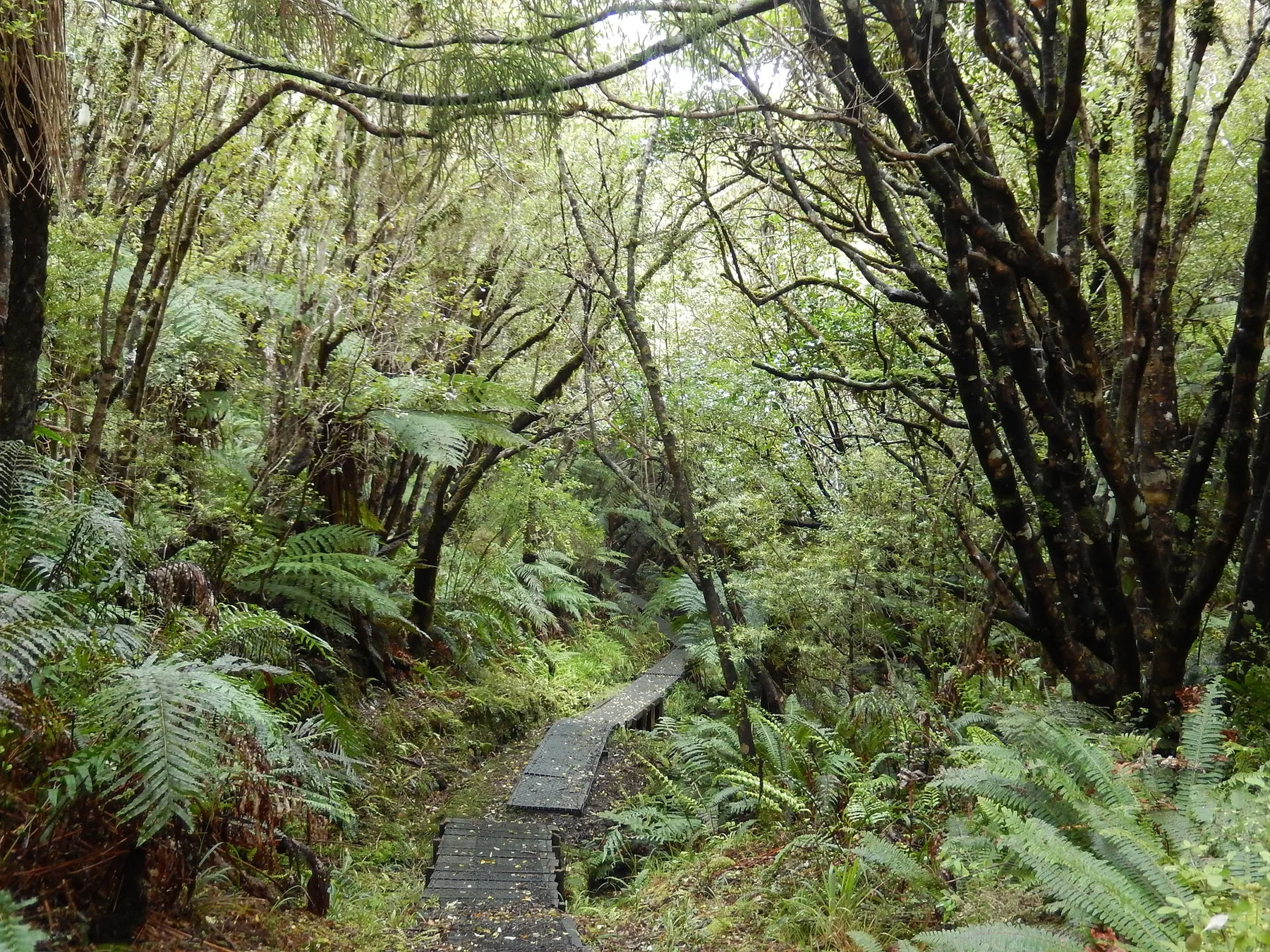
Visitors often encounter Aotea / Great Barrier Island through the idea of “Aotea Track”, but the destination is more than that single scene. Its landscape carries evidence of work, movement, adaptation and environmental change. A multi-day route crosses forest, ridges and historic sites through the island interior.
Continue to practical planningThe first layer of Aotea / Great Barrier Island is geological and ecological rather than scenic. The central highlands form a rugged spine with streams descending toward sheltered western bays and exposed eastern beaches. Forest recovery, wetlands and geothermal springs create varied habitats across a relatively compact island. Offshore rocks and channels reveal the island's role as the gulf's outer barrier.
The map understates the role of the sea. At Aotea / Great Barrier Island, “Aotea Track” makes clear that water is both a boundary and the route through which settlements, wildlife and outside connections developed. A multi-day route crosses forest, ridges and historic sites through the island interior.
The cultural layer of Aotea / Great Barrier Island is easiest to read in homes, fields, paths and local institutions. Communities are spread among small settlements and rely on local energy systems, ferries and aircraft. Maori history and place names remain fundamental to the island's identity, while conservation groups work to restore native species. Daily life reflects practical adaptation to distance, weather and limited services.
At Aotea / Great Barrier Island, “Eastern beaches” should not be treated as a decorative detail. Long surf-facing shores contrast with the sheltered bays of the gulf side. The feature records how construction, movement or livelihood adapted to local conditions at Aotea / Great Barrier Island.
Formal protection changed how Aotea / Great Barrier Island was described and managed. At Aotea / Great Barrier Island, new boundaries, visitor rules and conservation priorities created a public identity that still has to coexist with settlements, customary use and economic pressures. At Aotea / Great Barrier Island, the result is not a clean break with the past because earlier routes and habits continue to organise the present landscape.
Start with the feature “Aotea Track”, because it condenses a much larger part of the story of Aotea / Great Barrier Island. A multi-day route crosses forest, ridges and historic sites through the island interior. Within Aotea / Great Barrier Island, it is both an attraction and a record of the processes described above.
Look closely at the feature “Eastern beaches” in Aotea / Great Barrier Island; it carries information that a panoramic view can miss. Long surf-facing shores contrast with the sheltered bays of the gulf side. At Aotea / Great Barrier Island, the detail links local scale with the wider regional pattern.
Start with the feature “Dark-sky landscape”, because it condenses a much larger part of the story of Aotea / Great Barrier Island. Low artificial light strengthens the island's night-time and off-grid character. Within Aotea / Great Barrier Island, the feature explains why this destination differs from nearby landscapes.
Aotea / Great Barrier Island changes through the year because weather and biological cycles rearrange what can be seen and used. Late spring through early autumn brings warmer water, long days and the broadest transport schedule. Summer is the busiest period but the island remains less urbanised than nearby destinations. Winter can be wet and windy, giving forest tracks and ferry crossings a more demanding character.
For Aotea / Great Barrier Island, the main seasonal constraint is: the strongest planning window is Oct-Apr. For Aotea / Great Barrier Island, outside it, check weather, daylight, road or ferry schedules and seasonal closures before committing to a fixed route.
For Aotea / Great Barrier Island, one practical detail matters: distances, fuel, food and mobile coverage can be less predictable than the map suggests. For Aotea / Great Barrier Island, carry offline maps and keep a margin in the schedule.
Placed within its wider geography, Aotea / Great Barrier Island is not an isolated exception. For Aotea / Great Barrier Island, the wider context shows that, aotea connects ecologically with the Hauraki Gulf islands, Coromandel Peninsula and marine routes toward the Pacific. For Aotea / Great Barrier Island, it provides a useful contrast between metropolitan proximity and island self-reliance, showing how quickly New Zealand's geography can move beyond the urban network.
Dense native forest, long inlets, quiet beaches and a small southern community define New Zealand's third-largest island.
Explore this place
Dense forest, remote lakes and Tuhoe cultural authority define a large inland landscape in New Zealand’s North Island.
Explore this place
A high road and rail crossing links wet western forest with drier eastern valleys through the heart of New Zealand’s Southern Alps.
Explore this place