Suspension bridge

516 Arouca Bridge

A long pedestrian suspension bridge crosses the Paiva gorge high above the Aguieiras waterfall and river.

Suspension bridgeDramatic routeViewpointsOpen-grid deckAguieiras waterfall

Location
Arouca Geopark, Portugal
Best window
Mar-Jun, Sep-Oct
Suggested stay
2-3 hours
Go for
High suspension crossing
The reason to go

Cross the Paiva gorge on a 516-metre span

The open-grid deck makes the river visible far below while the narrow bridge line frames the gorge and Aguieiras waterfall.

Pair the bridge with a short section of the Paiva Walkways, but protect the booked crossing time first.

Look a little closer

Worth discovering

The details that make 516 Arouca Bridge different.

Destination view
01

Open-grid deck

The transparent metal floor intensifies the sense of height above the gorge.

Destination view
02

Aguieiras waterfall

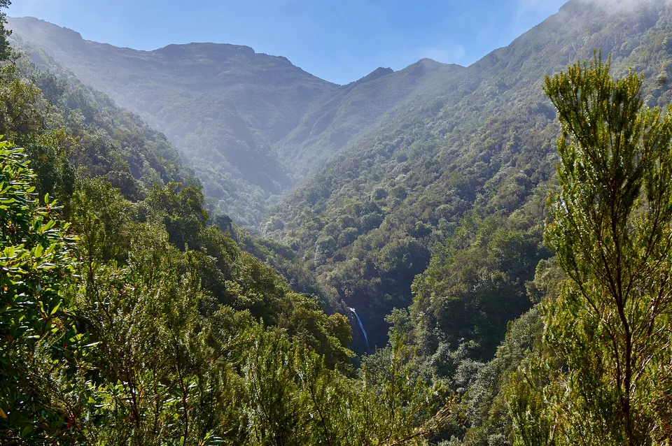
The bridge overlooks a multi-step waterfall and granite river corridor.

Destination view
03

Suspension geometry

Cables and towers create a precise line between two rugged valley sides.

Photo journal

A closer look at 516 Arouca Bridge

1 photograph
Beyond the surface

A deeper history of 516 Arouca Bridge

A long pedestrian suspension bridge crosses the Paiva gorge high above the Aguieiras waterfall and river. The view is only the surface of a longer story of formation, use and change.

516 Arouca Bridge is centred on Arouca Geopark, where a long pedestrian suspension bridge crosses the Paiva gorge high above the Aguieiras waterfall and river. The strongest reason to make the journey is to cross the Paiva gorge on a 516-metre span.

Visitors often encounter 516 Arouca Bridge through the idea of “Cross the Paiva gorge on a 516-metre span”, but the destination is more than that single scene. Its landscape carries evidence of work, movement, adaptation and environmental change. The open-grid deck makes the river visible far below while the narrow bridge line frames the gorge and Aguieiras waterfall.

Continue to practical planning
Passadiços do Rio Paiva - Portugal (27343355516)See the complete photo journal
Landform

Why the terrain has this form

Understanding 516 Arouca Bridge starts below the visible surface. Changes in height, rock, water and exposure make the sequence important: the approach, the most engineered or natural passage and the final overlook each reveal a different part of Arouca Geopark.

A route records decisions about gradient, exposure and access. At 516 Arouca Bridge, “Open-grid deck” shows why this line was chosen and what kind of movement it was designed to permit. The transparent metal floor intensifies the sense of height above the gorge.

Settlement and memory

People, work and memory

516 Arouca was conceived as a contemporary link in the Paiva visitor network, not as the restoration of an older crossing. Its name states its span in metres, and the bridge was built to connect steep sides of the gorge near Aguieiras waterfall.

The project belongs to Arouca's broader shift toward geotourism, using the municipality's geological heritage and the Paiva Walkways to create a reason for longer stays in an inland area historically shaped by farming, mining and small settlements.

Modern history

From local landscape to protected destination

Opening the bridge in 2021 changed the scale of the destination and introduced controlled entry, engineering inspections and weather-dependent closures as permanent parts of the experience.

On the ground

The evidence still visible on the ground

At 516 Arouca Bridge, the feature “Open-grid deck” is best understood as part of the surrounding system rather than an isolated stop. The transparent metal floor intensifies the sense of height above the gorge. At 516 Arouca Bridge, the detail links local scale with the wider regional pattern.

At 516 Arouca Bridge, the significance of the feature “Aguieiras waterfall” goes beyond its visual impact. The bridge overlooks a multi-step waterfall and granite river corridor. At 516 Arouca Bridge, the detail links local scale with the wider regional pattern.

At 516 Arouca Bridge, the significance of the feature “Suspension geometry” goes beyond its visual impact. Cables and towers create a precise line between two rugged valley sides. For 516 Arouca Bridge, that relationship is more informative than treating the feature only as a photograph or checklist item.

Living landscape

What continues to change

516 Arouca Bridge changes through the year because weather and biological cycles rearrange what can be seen and used. For 516 Arouca Bridge, the most reliable visiting window is Mar-Jun, Sep-Oct.

For 516 Arouca Bridge, one practical detail matters: crossings can be paused in strong wind or poor weather. For 516 Arouca Bridge, visitors uncomfortable with height should assess the exposure before booking.

For 516 Arouca Bridge, the most useful visiting period is: morning in stable wind.

Placed within its wider geography, 516 Arouca Bridge is not an isolated exception. Beyond the best-known image of 516 Arouca Bridge crossing, 516 Arouca Bridge is useful because aguieiras waterfall and suspension geometry place the route inside a broader landscape story.
Chronology

Key dates

  1. Arouca Geopark recognised

    The territory's geological sites became the basis for a coordinated geotourism strategy.

  2. Paiva Walkways open

    The river gorge gained a managed pedestrian route and a much larger visitor audience.

  3. 516 Arouca opens

    The 516-metre suspension bridge became the network's most visible engineered element.

Travel notes

Plan your visit

Time needed
2-3 hours
Getting around
Timed crossing combined with Paiva Walkways
Effort
Easy to moderate; significant exposure
Plan first
Ticket time, approach side and weather
Time of day
Morning in stable wind
Best window
Mar-Jun, Sep-Oct
Traveller stories

Stories from people who have been here.

First-hand moments, practical notes and overlooked details from 516 Arouca Bridge.

Loading traveller stories…

Browse all traveller stories ↗

Keep exploring

Where next?

All place stories