River boardwalk

Paiva Walkways

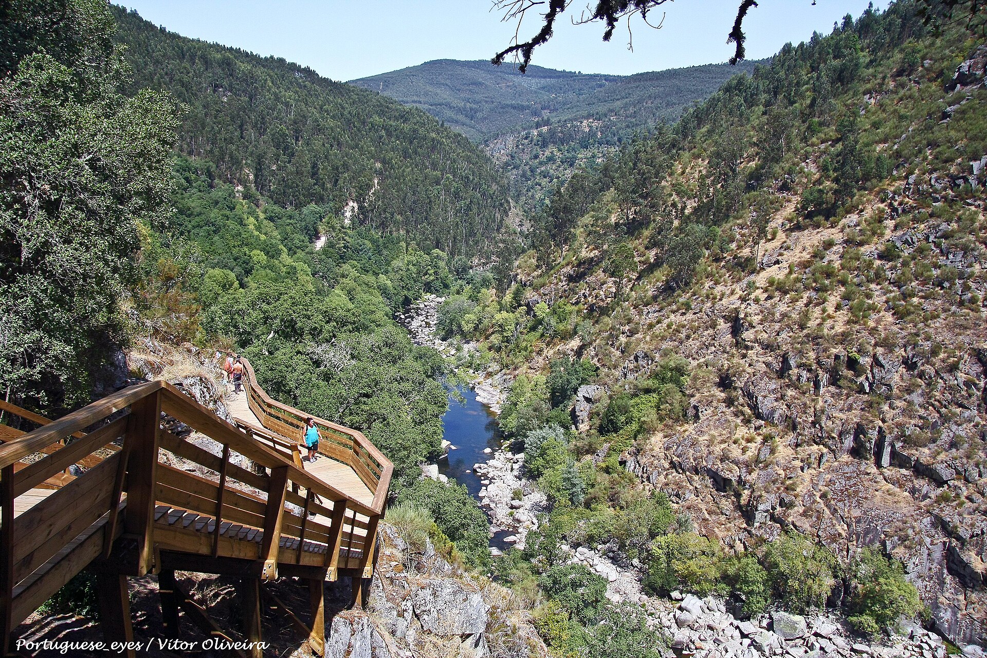
A long wooden walkway follows the Paiva River through granite walls, rapids and steep forested slopes.

River boardwalkDramatic routeViewpointsPaiva rapidsVau stairs

Location
Arouca Geopark, Portugal
Best window
Mar-Jun, Sep-Oct
Suggested stay
Full day
Go for
River boardwalk and geosite route
The reason to go

Walk the Paiva River from beach to gorge

The boardwalk keeps close to the river, passing whitewater, quartz-rich cliffs and long stair flights that reveal the valley from several heights.

Reserve the route and transfer together; the experience is better when the one-way logistics are solved in advance.

Look a little closer

Worth discovering

The details that make Paiva Walkways different.

Destination view
01

Paiva rapids

Fast water and polished granite form the visual centre of the route.

Destination view
02

Vau stairs

Long stair sections climb above the river and open views across the gorge.

Destination view
03

Geosite panels

The route links geological features with river ecology and local land use.

Photo journal

A closer look at Paiva Walkways

3 photographs
Deep background

What made Paiva Walkways distinctive

A long wooden walkway follows the Paiva River through granite walls, rapids and steep forested slopes. Its character becomes clearer when geology, settlement and modern protection are considered together.

Paiva Walkways is centred on Arouca Geopark, where a long wooden walkway follows the Paiva River through granite walls, rapids and steep forested slopes. The strongest reason to make the journey is to walk the Paiva River from beach to gorge.

Many visits to Paiva Walkways begin with the experience described as “Walk the Paiva River from beach to gorge”. The more revealing question is why it exists here, how people used the surrounding ground and what remains visible from earlier phases. The boardwalk keeps close to the river, passing whitewater, quartz-rich cliffs and long stair flights that reveal the valley from several heights.

Continue to practical planning
Passadiços do Rio Paiva - Portugal (26453675850)See the complete photo journal
Origins

How the landscape was assembled

At Paiva Walkways, the form of the landscape explains many of the choices that came later. Changes in height, rock, water and exposure make the sequence important: the approach, the most engineered or natural passage and the final overlook each reveal a different part of Arouca Geopark.

The path is inseparable from the terrain it crosses. At Paiva Walkways, “Paiva rapids” turns engineering or trail logic into something visible underfoot. Fast water and polished granite form the visual centre of the route.

Human history

People, work and memory

The Paiva valley was long crossed and worked locally, but the continuous timber walkway is a twenty-first-century tourism and conservation project rather than an old road. It was designed to concentrate foot traffic along a difficult river gorge within the Arouca Geopark.

The first section opened in 2015. Fire damaged part of the structure soon afterward, and rebuilding became part of the route's early history; later extensions connected it with the 516 Arouca suspension bridge.

Modern history

The change that redefined the place

The walkways changed a relatively little-known river corridor into a major destination, bringing economic benefits to nearby communities while requiring timed access, maintenance and active management of crowding and fire risk.

Details to read

What to read in the landscape

At Paiva Walkways, the feature “Paiva rapids” is one of the most useful pieces of visible evidence. Fast water and polished granite form the visual centre of the route. Within Paiva Walkways, it is both an attraction and a record of the processes described above.

At Paiva Walkways, the feature “Vau stairs” provides a precise clue to how the landscape works. Long stair sections climb above the river and open views across the gorge. Its position and condition at Paiva Walkways connect physical history with the way people use the place now.

At Paiva Walkways, the significance of the feature “Geosite panels” goes beyond its visual impact. The route links geological features with river ecology and local land use. At Paiva Walkways, the detail links local scale with the wider regional pattern.

Present day

A living landscape, not a frozen scene

A single visit to Paiva Walkways captures only one phase of its annual cycle. For Paiva Walkways, the most reliable visiting window is Mar-Jun, Sep-Oct.

For Paiva Walkways, one practical detail matters: the walk is longer and steeper than a conventional boardwalk. For Paiva Walkways, carry water and check fire, flood or heat closures.

For Paiva Walkways, the most useful visiting period is: morning before heat reaches the valley.

Placed within its wider geography, Paiva Walkways is not an isolated exception. Beyond the best-known image of Paiva Walkways crossing, Paiva Walkways is useful because vau stairs and geosite panels place the route inside a broader landscape story.
Chronology

Key dates

  1. Opening of the Passadicos do Paiva

    A timber route made a long section of the Paiva gorge accessible on foot.

  2. Fire and reconstruction

    Damage to the new structure required repairs and highlighted the vulnerability of the wooded valley.

  3. Connection with 516 Arouca

    The suspension bridge added a second major engineered crossing to the visitor landscape.

Travel notes

Plan your visit

Time needed
Full day
Getting around
One-way walk with shuttle or return transfer
Effort
Moderate; many stairs
Plan first
Timed entry, shuttle and direction of travel
Time of day
Morning before heat reaches the valley
Best window
Mar-Jun, Sep-Oct
Traveller stories

Stories from people who have been here.

First-hand moments, practical notes and overlooked details from Paiva Walkways.

Loading traveller stories…

Browse all traveller stories ↗

Keep exploring

Where next?

All place stories