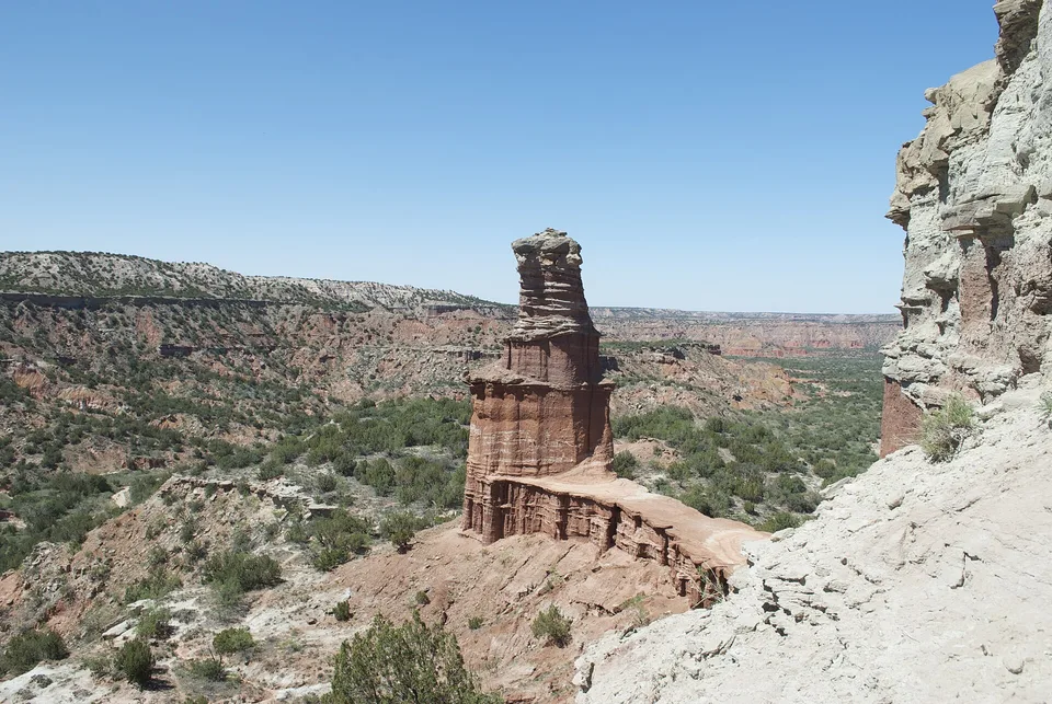
The contrast between large animals, open grassland and layered red rock gives the park a character distinct from better-known desert canyons.
Begin before heat and hard overhead light; save the widest overlook for late afternoon if access and trail time allow.
Look a little closer
Worth discovering
The details that make Caprock Canyons different.
Destination view
01
Upper Canyon Trail
A demanding route enters the park's layered interior.
Photo journal
02
Texas state bison herd
Free-ranging animals often use roads and camp areas.
Photo journal
03
Lake Theo
Water and grassland soften the canyon landscape.
Photo journal
A closer look at Caprock Canyons
9 photographs
01Caprock Canyons Haynes Ridge 200502Caprock Canyons — view 203Bison at Caprock Canyons04Caprock Canyons 2014 605Lake Theo 106Caprock Canyons 2014 107Bison at Caprock Canyons08Lake Theo 209Caprock Canyons prairie dog town
Beyond the surface
Caprock Canyons: the story behind the landscape
Red cliffs and breaks mark the edge of the Llano Estacado and protect the Texas state bison herd. The view is only the surface of a longer story of formation, use and change.
4 min readTexas Panhandle, United States
Caprock Canyons is centred on Texas Panhandle, where red cliffs and breaks mark the edge of the Llano Estacado and protect the Texas state bison herd. The strongest reason to make the journey is to watch bison move through red canyon country.
The familiar invitation at Caprock Canyons is “Watch bison move through red canyon country”, yet that image makes more sense when it is connected to the landform, the local economy and the changes that determined access. The contrast between large animals, open grassland and layered red rock gives the park a character distinct from better-known desert canyons.
At Caprock Canyons, the physical story begins with the structure of the ground. Erosion exposes rock, cliffs and drainage patterns that are easiest to understand from both the rim and the lower route. Heat and shade can differ sharply within a short distance.
The landscape of Caprock Canyons can look static, yet wind, runoff and temperature continue to reshape it. “Upper Canyon Trail” is a concise example of that ongoing change. A demanding route enters the park's layered interior.
02
Human history
The cultural layer of the place
The Caprock Escarpment marked a major boundary in Comanche and other Plains peoples' territories. Canyons provided water and shelter along routes otherwise exposed to the Llano Estacado.
Ranching expanded after the Red River War, and the JA Ranch became one of the region's largest operations. Descendants of the southern plains bison herd were later preserved by rancher Charles Goodnight and ultimately became the Texas State Bison Herd.
03
Reorganisation
The modern turning point
Creation of the state park protected canyon geology and gave the bison herd a public home. The animals are not decorative additions; they represent a narrow genetic and historical survival from the commercial slaughter era.
04
Field notes
The evidence still visible on the ground
Start with the feature “Upper Canyon Trail”, because it condenses a much larger part of the story of Caprock Canyons. A demanding route enters the park's layered interior. Within Caprock Canyons, the feature explains why this destination differs from nearby landscapes.
At Caprock Canyons, the feature “Texas state bison herd” provides a precise clue to how the landscape works. Free-ranging animals often use roads and camp areas. Within Caprock Canyons, the feature explains why this destination differs from nearby landscapes.
At Caprock Canyons, the feature “Lake Theo” provides a precise clue to how the landscape works. Water and grassland soften the canyon landscape. Within Caprock Canyons, the feature explains why this destination differs from nearby landscapes.
05
Present day
The place within its wider region
Caprock Canyons changes through the year because weather and biological cycles rearrange what can be seen and used. For Caprock Canyons, the most reliable visiting window is Mar-May, Sep-Nov.
For Caprock Canyons, the stated visiting window is Mar-May, Sep-Nov, but its practical meaning depends on local weather, water and transport rather than the calendar alone.
Placed within its wider geography, Caprock Canyons is not an isolated exception. Beyond the best-known image of Caprock Canyons feature, Caprock Canyons matters because texas state bison herd and lake theo place the destination inside a broader regional story.
Chronology
Key dates
Comanche and Plains landscape
Canyons supplied water, shelter and travel routes below the high plains.
Ranching follows military conquest
Large cattle operations occupied former bison range.
Texas State Bison Herd relocated
Descendants of the Goodnight herd became central to park conservation.
Travel notes
Plan your visit
Time needed
2-3 days
Getting around
Road access and hiking
Effort
Moderate
Plan first
Heat, trail exposure and permits if required
Time of day
Sunrise or late afternoon
Best window
Mar-May, Sep-Nov
Traveller stories
Stories from people who have been here.
First-hand moments, practical notes and overlooked details from Caprock Canyons.