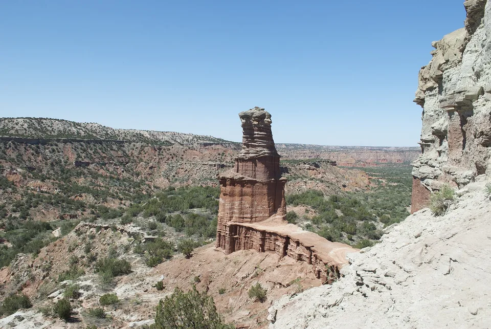
Walk the loop at sunrise among the toadstool formations
Low light creates long shadows that make the small formations feel like a miniature stone city.
Begin before heat and hard overhead light; save the widest overlook for late afternoon if access and trail time allow.
Look a little closer
Worth discovering
The details that make Toadstool Geologic Park different.
Destination view
01
Toadstool loop
A short route passes the best-known balanced formations.
Destination view
02
Fossil trackways
Ancient animal traces appear in exposed sediment.
Destination view
03
Hudson-Meng area
Archaeology and prairie history add a second layer nearby.
Photo journal
A closer look at Toadstool Geologic Park
4 photographs
01Toadstool Geologic Park, 6 July 2005, no. 302Toadstool Geologic Park, 6 July 2005, no. 503Toadstool Geologic Park, 6 July 2005, no. 1704Toadstool Geologic Park, 6 July 2005, no. 22
Origins and change
Toadstool Geologic Park: land, people and change
Pale clay badlands, fossil beds and mushroom-shaped rock formations create a compact alien landscape. The deeper story links its visible features with the people and changes behind them.
4 min readNorthwestern Nebraska, United States
Toadstool Geologic Park is centred on Northwestern Nebraska, where pale clay badlands, fossil beds and mushroom-shaped rock formations create a compact alien landscape. The strongest reason to make the journey is to walk the loop at sunrise among the toadstool formations.
The familiar invitation at Toadstool Geologic Park is “Walk the loop at sunrise among the toadstool formations”, yet that image makes more sense when it is connected to the landform, the local economy and the changes that determined access. Low light creates long shadows that make the small formations feel like a miniature stone city.
Before roads, settlements or protected-area boundaries, the terrain of Toadstool Geologic Park set the basic terms. Erosion exposes rock, cliffs and drainage patterns that are easiest to understand from both the rim and the lower route. Heat and shade can differ sharply within a short distance.
Movement is the organising idea at Toadstool Geologic Park. “Toadstool loop” explains how the route negotiates an obstacle that would otherwise divide the landscape. A short route passes the best-known balanced formations.
02
Cultural landscape
The cultural layer of the place
Toadstool's eroded formations expose Oligocene sediments and fossil tracks from mammals that lived roughly 30 million years ago. The badlands lie within a broader Lakota and Plains cultural landscape later crossed by ranchers and rail routes.
Federal management and paleontological research made the area a public geology site within the Oglala National Grassland. Replica sod-house remains and nearby ranch history add a much younger human layer to the fossil terrain.
03
Change
A landscape reorganised
Designation as a recreation and research area shifted attention from marginal grazing land to deep-time evidence. Foot traffic and fossil collecting now require control because exposed surfaces are both scientifically valuable and easily damaged.
04
Visible evidence
The evidence still visible on the ground
At Toadstool Geologic Park, the significance of the feature “Toadstool loop” goes beyond its visual impact. A short route passes the best-known balanced formations. At Toadstool Geologic Park, it gives a concrete reference point for reading change rather than merely collecting viewpoints.
At Toadstool Geologic Park, the significance of the feature “Fossil trackways” goes beyond its visual impact. Ancient animal traces appear in exposed sediment. Within Toadstool Geologic Park, the feature explains why this destination differs from nearby landscapes.
At Toadstool Geologic Park, the significance of the feature “Hudson-Meng area” goes beyond its visual impact. Archaeology and prairie history add a second layer nearby. Within Toadstool Geologic Park, it is both an attraction and a record of the processes described above.
05
Present day
Season, scale and the present day
A single visit to Toadstool Geologic Park captures only one phase of its annual cycle. For Toadstool Geologic Park, the most reliable visiting window is Apr-Oct.
For Toadstool Geologic Park, the stated visiting window is Apr-Oct, but its practical meaning depends on local weather, water and transport rather than the calendar alone.
Placed within its wider geography, Toadstool Geologic Park is not an isolated exception. Beyond the best-known image of Toadstool Geologic Park feature, Toadstool Geologic Park matters because fossil trackways and hudson-meng area place the destination inside a broader regional story.
Chronology
Key dates
Oligocene floodplains
Sediments preserved bones and trackways of extinct mammals.
Ranching and homesteading
Settler use followed Indigenous dispossession across the high plains.
Public geological park
Federal interpretation and trails made the fossil landscape accessible.
Travel notes
Plan your visit
Time needed
2-3 days
Getting around
Road access and hiking
Effort
Moderate
Plan first
Heat, trail exposure and permits if required
Time of day
Sunrise or late afternoon
Best window
Apr-Oct
Traveller stories
Stories from people who have been here.
First-hand moments, practical notes and overlooked details from Toadstool Geologic Park.