Rock-cut gorge path

Congost de Mont-rebei

A narrow path cut into limestone walls follows a reservoir gorge with long exposed views and almost no built-up development.

Rock-cut gorge pathDramatic routeViewpointsRock-cut ledgeMontsec gorge walls

Location
Aragon–Catalonia border, Spain
Best window
Mar-Jun, Sep-Nov
Suggested stay
Full day
Go for
Rock-cut trail above turquoise water
The reason to go

Walk the carved shelf above the Noguera Ribagorcana

The best section is the old mule path cut directly into the gorge wall, where the reservoir lies far below and the opposite cliff fills the view.

Choose the trailhead and return plan before setting out; an out-and-back can be much longer than the viewpoint-only visit.

Look a little closer

Worth discovering

The details that make Congost de Mont-rebei different.

Destination view
01

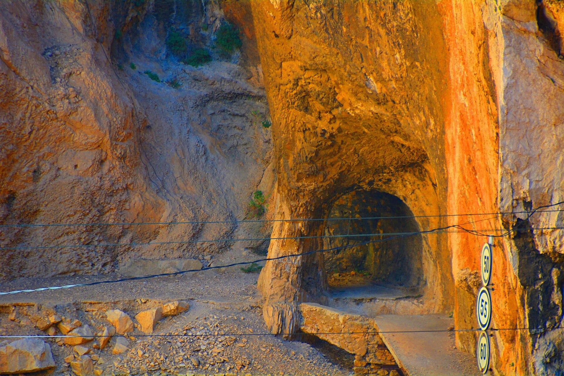
Rock-cut ledge

The historic path is carved into a near-vertical limestone wall above the water.

Destination view
02

Montsec gorge walls

Layered cliffs close around the reservoir and create a long natural corridor.

Destination view
03

Kayaks below the trail

From the path, small boats show the scale of the cliff and the height of the route.

Photo journal

A closer look at Congost de Mont-rebei

3 photographs
The full story

How time shaped Congost de Mont-rebei

A narrow path cut into limestone walls follows a reservoir gorge with long exposed views and almost no built-up development. Its character becomes clearer when geology, settlement and modern protection are considered together.

Congost de Mont-rebei is centred on Aragon–Catalonia border, where a narrow path cut into limestone walls follows a reservoir gorge with long exposed views and almost no built-up development. The strongest reason to make the journey is to walk the carved shelf above the Noguera Ribagorcana.

The familiar invitation at Congost de Mont-rebei is “Walk the carved shelf above the Noguera Ribagorcana”, yet that image makes more sense when it is connected to the landform, the local economy and the changes that determined access. The best section is the old mule path cut directly into the gorge wall, where the reservoir lies far below and the opposite cliff fills the view.

Continue to practical planning
Mas de Carlets, Corçà (març 2013) - panoramioSee the complete photo journal
Physical setting

Why the terrain has this form

The first layer of Congost de Mont-rebei is geological and ecological rather than scenic. Changes in height, rock, water and exposure make the sequence important: the approach, the most engineered or natural passage and the final overlook each reveal a different part of Aragon–Catalonia border.

Movement is the organising idea at Congost de Mont-rebei. “Rock-cut ledge” explains how the route negotiates an obstacle that would otherwise divide the landscape. The historic path is carved into a near-vertical limestone wall above the water.

Human history

Settlement, movement and local knowledge

The ledge through Mont-rebei is tied to the older foot and mule connections of the Noguera Ribagorcana valley. The gorge became a border between Aragon and Catalonia, but the river corridor continued to link farms, villages and mountain routes on both sides.

Construction of the Canelles reservoir in the mid-twentieth century submerged lower crossings and altered access. A higher path was cut into the limestone wall so the gorge could still be traversed above the new water level; the modern route follows this engineered shelf rather than an untouched prehistoric trail.

Reorganisation

How access and attention changed the place

The reservoir transformed the visual scale of the gorge and separated communities that had once used valley-floor links. Today's path, bridges and kayak routes make that change legible from several elevations.

Details to read

The evidence still visible on the ground

At Congost de Mont-rebei, the feature “Rock-cut ledge” is one of the most useful pieces of visible evidence. The historic path is carved into a near-vertical limestone wall above the water. Within Congost de Mont-rebei, the feature explains why this destination differs from nearby landscapes.

Start with the feature “Montsec gorge walls”, because it condenses a much larger part of the story of Congost de Mont-rebei. Layered cliffs close around the reservoir and create a long natural corridor. At Congost de Mont-rebei, the detail links local scale with the wider regional pattern.

At Congost de Mont-rebei, the feature “Kayaks below the trail” is best understood as part of the surrounding system rather than an isolated stop. From the path, small boats show the scale of the cliff and the height of the route. Within Congost de Mont-rebei, the feature explains why this destination differs from nearby landscapes.

Living landscape

What continues to change

Congost de Mont-rebei changes through the year because weather and biological cycles rearrange what can be seen and used. For Congost de Mont-rebei, the most reliable visiting window is Mar-Jun, Sep-Nov.

For Congost de Mont-rebei, one practical detail matters: shade is limited and there are exposed sections without continuous barriers. For Congost de Mont-rebei, avoid the route in strong heat, storms or poor visibility.

For Congost de Mont-rebei, the most useful visiting period is: early morning for cooler rock and calmer water.

Placed within its wider geography, Congost de Mont-rebei is not an isolated exception. Beyond the best-known image of Congost de Mont-rebei crossing, Congost de Mont-rebei is useful because montsec gorge walls and kayaks below the trail place the route inside a broader landscape story.

Chronology

Key dates

  1. A working valley route

    Local movement followed the river corridor and mule paths connecting settlements on the two sides of the Montsec range.

  2. Canelles changes the valley

    The dam and reservoir raised water levels, erased lower crossings and required a new path higher in the cliff.

  3. A protected gorge corridor

    Walking and paddling now reveal both the limestone structure and the infrastructure that reshaped access through it.

Travel notes

Plan your visit

Time needed
Full day
Getting around
Walking route from La Masieta or Montfalco
Effort
Moderate; exposed edges
Plan first
Parking or transfer, water and return logistics
Time of day
Early morning for cooler rock and calmer water
Best window
Mar-Jun, Sep-Nov
Traveller stories

Stories from people who have been here.

First-hand moments, practical notes and overlooked details from Congost de Mont-rebei.

Loading traveller stories…

Browse all traveller stories ↗

Keep exploring

Where next?

All place stories