Jebel escarpment
The mountain front captures monsoon moisture above the coastal plain.
Plan the least frequent boat, ferry or exposed coastal section first. Use early or late light and keep a weather alternative during Jul-Sep, Nov-Feb.
Monsoon cloud, green escarpments and frankincense country form a seasonal landscape unlike the rest of the Arabian Peninsula.
The mountain front captures monsoon moisture above the coastal plain.
Plan the least frequent boat, ferry or exposed coastal section first. Use early or late light and keep a weather alternative during Jul-Sep, Nov-Feb.
The details that make Dhofar Highlands different.
The mountain front captures monsoon moisture above the coastal plain.
Seasonal water and green slopes show the effect of khareef.
Boswellia trees and archaeological sites connect ecology with ancient trade.
Monsoon cloud, green escarpments and frankincense country form a seasonal landscape unlike the rest of the Arabian Peninsula. The deeper story links its visible features with the people and changes behind them.
Dhofar Highlands occupies the mountain and coastal zone around Salalah. Monsoon cloud, green escarpments and frankincense country form a seasonal landscape unlike the rest of the Arabian Peninsula. Dhofar links the Empty Quarter, Arabian Sea and Horn of Africa through ecology and trading history, making it one of Arabia’s most distinctive transition zones.
Many visits to Dhofar Highlands begin with the experience described as “Jebel escarpment”. The more revealing question is why it exists here, how people used the surrounding ground and what remains visible from earlier phases. The mountain front captures monsoon moisture above the coastal plain.
Continue to practical planningThe first layer of Dhofar Highlands is geological and ecological rather than scenic. During khareef, moist air covers the seaward slopes in cloud and grass, while the interior side quickly returns to arid plateau and desert.
Routes and settlements at Dhofar Highlands follow the water system even when the map emphasises roads. “Jebel escarpment” exposes that older logic. The mountain front captures monsoon moisture above the coastal plain.
The cultural layer of Dhofar Highlands is easiest to read in homes, fields, paths and local institutions. Frankincense cultivation, pastoralism, fishing and historic ports connect the highlands with long-distance trade across the Arabian Sea.
At Dhofar Highlands, “Wadi Darbat” should not be treated as a decorative detail. Seasonal water and green slopes show the effect of khareef. The feature records how construction, movement or livelihood adapted to local conditions at Dhofar Highlands.
The modern identity of Dhofar Highlands emerged as livelihoods, transport and outside attention changed their balance. At Dhofar Highlands, the present destination was assembled from places that previously served practical, seasonal or community purposes. At Dhofar Highlands, the consequences are clearest where traditional use, protection and tourism occupy the same ground.
At Dhofar Highlands, the feature “Jebel escarpment” provides a precise clue to how the landscape works. The mountain front captures monsoon moisture above the coastal plain. At Dhofar Highlands, it gives a concrete reference point for reading change rather than merely collecting viewpoints.
At Dhofar Highlands, the significance of the feature “Wadi Darbat” goes beyond its visual impact. Seasonal water and green slopes show the effect of khareef. Within Dhofar Highlands, the feature explains why this destination differs from nearby landscapes.
Start with the feature “Frankincense landscape”, because it condenses a much larger part of the story of Dhofar Highlands. Boswellia trees and archaeological sites connect ecology with ancient trade. Within Dhofar Highlands, the feature explains why this destination differs from nearby landscapes.
A single visit to Dhofar Highlands captures only one phase of its annual cycle. The monsoon months create the greenest conditions but also fog and crowds; winter is clearer and well suited to wider coastal travel.
For Dhofar Highlands, the main seasonal constraint is: the strongest planning window is Jul-Sep, Nov-Feb. For Dhofar Highlands, outside it, check weather, daylight, road or ferry schedules and seasonal closures before committing to a fixed route.
For Dhofar Highlands, one practical detail matters: distances, fuel, food and mobile coverage can be less predictable than the map suggests. For Dhofar Highlands, carry offline maps and keep a margin in the schedule.
Placed within its wider geography, Dhofar Highlands is not an isolated exception. For Dhofar Highlands, the wider context shows that, dhofar links the Empty Quarter, Arabian Sea and Horn of Africa through ecology and trading history, making it one of Arabia’s most distinctive transition zones.
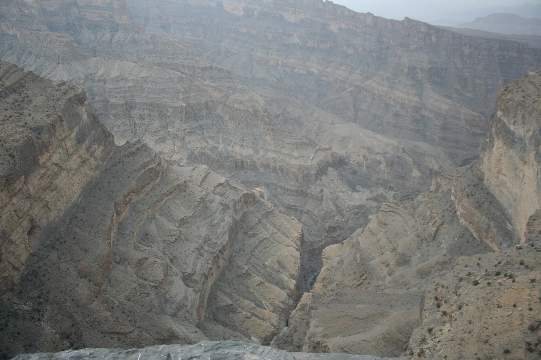
A narrow but mostly level trail follows the wall of Wadi Ghul to an abandoned village and hidden pool beneath Oman’s highest mountains.
Explore this place
Long beaches, dry hills and fishing settlements form a wind-exposed island off Oman’s eastern coast.
Explore this place
Bare mountains descend directly into deep marine inlets at the northern tip of Oman, creating a coast of cliffs, villages and narrow water passages.
Explore this place