South Australian edge

Eyre Peninsula

A large South Australian peninsula of granite bays, open-ocean cliffs, fishing towns and semi-arid interior roads far beyond the main east-coast circuit.

Granite coastFishing townsSouthern Ocean

Location
South Australia, Australia
Best window
Mar-May, Sep-Nov
Suggested stay
3-5 days
Go for
Long southern coast road
The reason to go

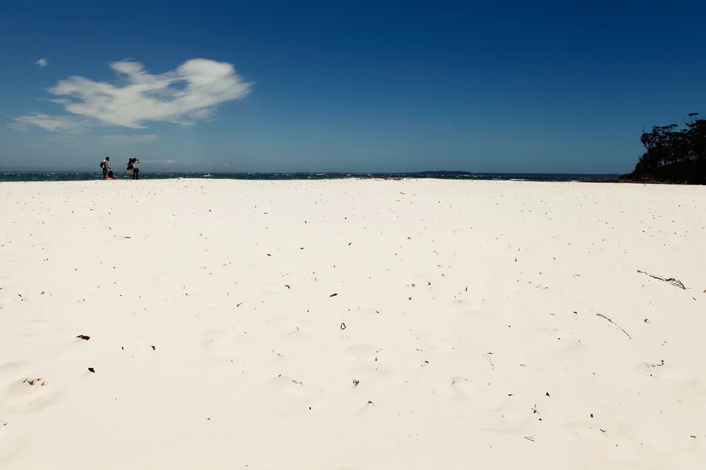
Coffin Bay

Sheltered water, dunes and oyster country create a gentler contrast to the peninsula's open-ocean side.

Plan the least frequent boat, ferry or exposed coastal section first. Use early or late light and keep a weather alternative during Mar-May, Sep-Nov.

Look a little closer

Worth discovering

The details that make Eyre Peninsula different.

Photo journal
01

Coffin Bay

Sheltered water, dunes and oyster country create a gentler contrast to the peninsula's open-ocean side.

Photo journal
02

Lincoln National Park

Granite headlands, beaches and walking routes extend south from the principal regional city.

Destination view
03

West-coast cliffs

Remote roads reach exposed viewpoints above the Southern Ocean and Great Australian Bight approaches.

Photo journal

A closer look at Eyre Peninsula

13 photographs
Beyond the surface

Eyre Peninsula: the story behind the landscape

A large South Australian peninsula of granite bays, open-ocean cliffs, fishing towns and semi-arid interior roads far beyond the main east-coast circuit. This account follows the forces, communities and decisions that made the present landscape.

Eyre Peninsula projects into the Southern Ocean between Spencer Gulf and the Great Australian Bight. Its long coast includes sheltered bays, surf beaches, granite headlands and high exposed cliffs. Port Lincoln and smaller fishing towns provide bases, but the region's identity depends on the substantial distances between them.

The familiar invitation at Eyre Peninsula is “Coffin Bay”, yet that image makes more sense when it is connected to the landform, the local economy and the changes that determined access. Sheltered water, dunes and oyster country create a gentler contrast to the peninsula's open-ocean side.

Continue to practical planning
From Adelaide to Streaky Bay around the Eyre Peninsula (13113007495)See the complete photo journal
Physical setting

The physical foundations of the place

At Eyre Peninsula, the form of the landscape explains many of the choices that came later. The east coast is generally more protected, while the west faces heavier ocean swell and a more severe cliff line. Granite outcrops, dunes and mallee vegetation create repeated transitions between coast and dry interior. National parks protect major sections of shoreline, but working ports and aquaculture remain equally visible.

On an island, coast, altitude and exposure work together. At Eyre Peninsula, the feature described as “Coffin Bay” shows how a short distance can separate sheltered ground from a very different ocean-facing environment. Sheltered water, dunes and oyster country create a gentler contrast to the peninsula's open-ocean side.

Lives and livelihoods

Lives shaped by the terrain

At Eyre Peninsula, human history is written into settlement and land use rather than separated from the scenery. Fishing, aquaculture, grain and regional services shape the peninsula's towns. Aboriginal histories extend across land and sea country, while European maritime history appears in harbours, lighthouses and wreck sites. Tourism is dispersed and often integrated with local food and marine industries.

The role of “Lincoln National Park” is especially revealing at Eyre Peninsula. Granite headlands, beaches and walking routes extend south from the principal regional city. In the history of Eyre Peninsula, it connects the wider regional context with a specific place that can still be examined today.

Change

A landscape reorganised

The decisive modern change at Eyre Peninsula was access. At Eyre Peninsula, transport and visitor infrastructure made the landscape easier to reach while concentrating pressure at the few points where roads, boats or trails enter it. At Eyre Peninsula, the consequences are clearest where traditional use, protection and tourism occupy the same ground.

On the ground

Where the story becomes visible

Start with the feature “Coffin Bay”, because it condenses a much larger part of the story of Eyre Peninsula. Sheltered water, dunes and oyster country create a gentler contrast to the peninsula's open-ocean side. At Eyre Peninsula, it gives a concrete reference point for reading change rather than merely collecting viewpoints.

At Eyre Peninsula, the feature “Lincoln National Park” is best understood as part of the surrounding system rather than an isolated stop. Granite headlands, beaches and walking routes extend south from the principal regional city. For Eyre Peninsula, that relationship is more informative than treating the feature only as a photograph or checklist item.

At Eyre Peninsula, the feature “West-coast cliffs” is one of the most useful pieces of visible evidence. Remote roads reach exposed viewpoints above the Southern Ocean and Great Australian Bight approaches. Its position and condition at Eyre Peninsula connect physical history with the way people use the place now.

Living landscape

What continues to change

At Eyre Peninsula, season is part of the landscape history, not merely a planning detail. Spring and autumn provide moderate temperatures for road travel and walking. Summer can be hot inland but attractive along the coast, with bushfire risk requiring attention. Winter is cooler and windier, though it can be rewarding for wildlife and dramatic sea conditions.

For Eyre Peninsula, the main seasonal constraint is: the strongest planning window is Mar-May, Sep-Nov. For Eyre Peninsula, outside it, check weather, daylight, road or ferry schedules and seasonal closures before committing to a fixed route.

For Eyre Peninsula, one practical detail matters: wind, sea state and tide can matter as much as distance. For Eyre Peninsula, check conditions before boat trips, exposed cliffs or tidal sections.

Placed within its wider geography, Eyre Peninsula is not an isolated exception. For Eyre Peninsula, the wider context shows that, the peninsula cannot be reduced to one beach or wildlife encounter. For Eyre Peninsula, a circuit through Port Lincoln, Coffin Bay, the west coast and inland towns reveals both sheltered gulf water and the exposed southern edge of the continent.

Travel notes

Plan your visit

Time needed
3-5 days
Getting around
Car or local transport, plus coastal walks and occasional boat links
Effort
Moderate
Plan first
Accommodation and seasonal transport
Time of day
Morning for movement; late light for viewpoints
Best window
Mar-May, Sep-Nov
Traveller stories

Stories from people who have been here.

First-hand moments, practical notes and overlooked details from Eyre Peninsula.

Loading traveller stories…

Browse all traveller stories ↗

Keep exploring

Where next?

All place stories