Wetlands

Lake Tele

A circular lake lies inside one of the Congo Basin's largest swamp forests and is reached through river channels and flooded vegetation.

WetlandsWildlifeWater routesLake Tele basinSwamp-forest canoe route

Location
Likouala swamp forest, Republic of the Congo
Best window
Dec-Feb, Jun-Aug
Suggested stay
2-4 days
Go for
Wetland and wildlife journey
The reason to go

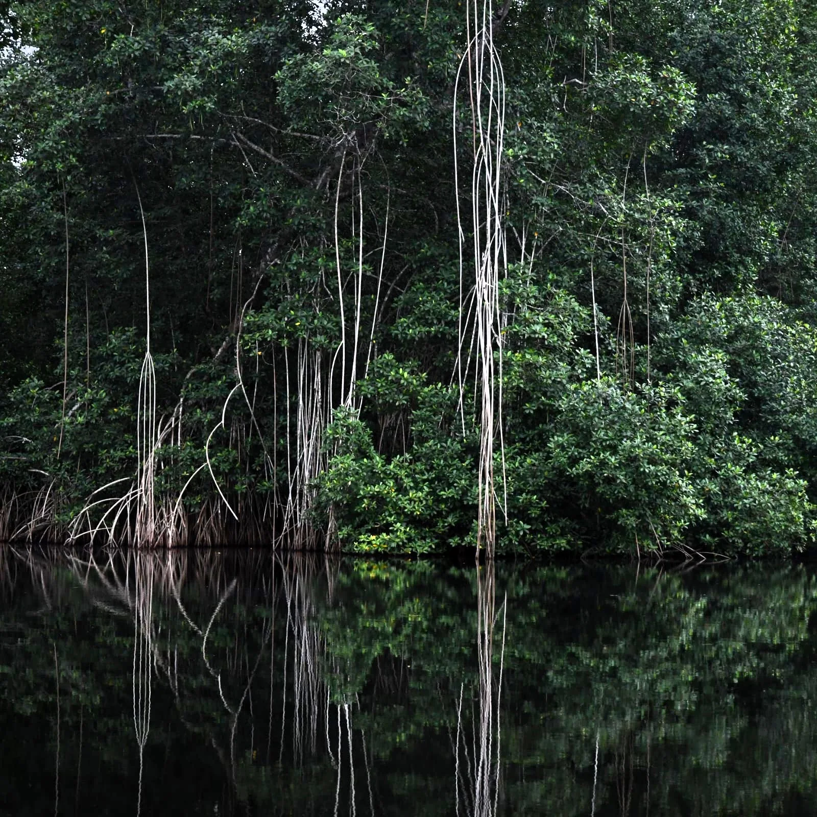
Reach the lake by canoe through swamp forest

The gradual approach is more memorable than the shoreline itself: narrow water, roots and flooded trees open unexpectedly onto a broad quiet lake.

Use an experienced local guide and begin early, when wildlife activity, water levels and cooler conditions are most favourable.
Look a little closer

Worth discovering

The details that make Lake Tele different.

Destination view
01

Lake Tele basin

The nearly circular lake sits within extensive wetlands.

Destination view
02

Swamp-forest canoe route

Local boat travel is essential to understanding the landscape.

Destination view
03

Community reserve

Conservation is closely linked to surrounding villages.

Photo journal

A closer look at Lake Tele

1 photograph
Beyond the surface

A deeper history of Lake Tele

A circular lake lies inside one of the Congo Basin's largest swamp forests and is reached through river channels and flooded vegetation. This account follows the forces, communities and decisions that made the present landscape.

Lake Tele is centred on Likouala swamp forest, where a circular lake lies inside one of the Congo Basin's largest swamp forests and is reached through river channels and flooded vegetation. The strongest reason to make the journey is to reach the lake by canoe through swamp forest.

Many visits to Lake Tele begin with the experience described as “Reach the lake by canoe through swamp forest”. The more revealing question is why it exists here, how people used the surrounding ground and what remains visible from earlier phases. The gradual approach is more memorable than the shoreline itself: narrow water, roots and flooded trees open unexpectedly onto a broad quiet lake.

Continue to practical planning
1.5 DJI 0859See the complete photo journal
Landform

How the landscape was assembled

At Lake Tele, the form of the landscape explains many of the choices that came later. Water level determines the route, wildlife concentration and what ground is accessible. Boat or canoe travel often reveals more than a road-based visit.

A route records decisions about gradient, exposure and access. At Lake Tele, “Lake Tele basin” shows why this line was chosen and what kind of movement it was designed to permit. The nearly circular lake sits within extensive wetlands.

Lives and livelihoods

The cultural layer of the place

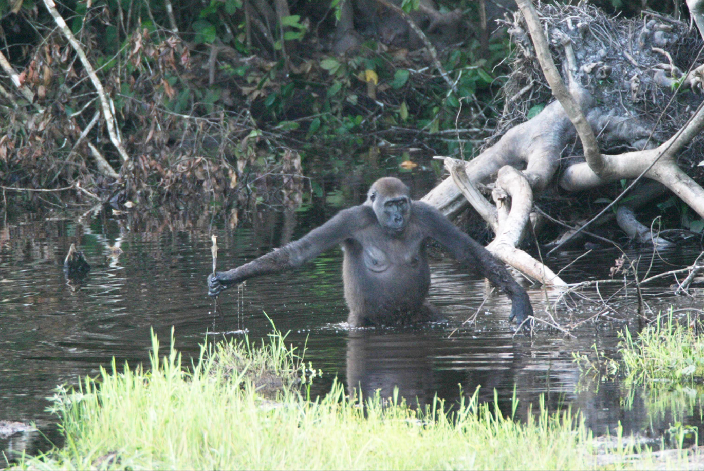
Lake Tele lies within the Likouala swamp forest, where villages depend on fishing, forest products and waterways rather than roads. The remote lake also became famous outside the region through stories of Mokele-mbembe, a supposed unknown animal; expeditions searching for it often said more about foreign fascination than local ecology.

The Lake Tele Community Reserve was established in 2001 with a model intended to combine wetland protection and community use. Surveys later confirmed globally important peatlands and large gorilla populations in the wider basin.

Modern history

What altered the old balance

Scientific attention has shifted from cryptozoological myth toward carbon storage, fisheries and community governance. Drainage, fire and future infrastructure would affect a peat system whose global climate value was recognised only recently.

Visible evidence

The small features that reveal the larger pattern

At Lake Tele, the feature “Lake Tele basin” provides a precise clue to how the landscape works. The nearly circular lake sits within extensive wetlands. Its position and condition at Lake Tele connect physical history with the way people use the place now.

Start with the feature “Swamp-forest canoe route”, because it condenses a much larger part of the story of Lake Tele. Local boat travel is essential to understanding the landscape. At Lake Tele, the detail links local scale with the wider regional pattern.

Look closely at the feature “Community reserve” in Lake Tele; it carries information that a panoramic view can miss. Conservation is closely linked to surrounding villages. Within Lake Tele, it is both an attraction and a record of the processes described above.

Living landscape

Why the landscape still feels dynamic

At Lake Tele, light, water and temperature reveal different structures at different times of year. For Lake Tele, the most reliable visiting window is Dec-Feb, Jun-Aug.

For Lake Tele, the stated visiting window is Dec-Feb, Jun-Aug, but its practical meaning depends on local weather, water and transport rather than the calendar alone.

Placed within its wider geography, Lake Tele is not an isolated exception. Beyond the best-known image of Lake Tele feature, Lake Tele matters because swamp-forest canoe route and community reserve place the destination inside a broader regional story.

Chronology

Key dates

  1. Water-based village landscape

    Fishing and canoe travel organised life in the Likouala wetlands.

  2. Mokele-mbembe expeditions

    Foreign searches popularised the lake while often marginalising local knowledge.

  3. Community reserve and peatland science

    Protection and research reframed the basin around biodiversity and carbon.

Travel notes

Plan your visit

Time needed
2-4 days
Getting around
Boat or canoe, plus short walks from landing points
Effort
Easy to moderate
Plan first
Water level, boat and local guide
Time of day
Early morning and late afternoon
Best window
Dec-Feb, Jun-Aug
Traveller stories

Stories from people who have been here.

First-hand moments, practical notes and overlooked details from Lake Tele.

Loading traveller stories…

Browse all traveller stories ↗

Keep exploring

Where next?

All place stories