River routes

Lena Pillars

A forty-kilometre wall of limestone towers rises directly above the Lena River.

River routesWaterfallsLocal lifeLena River approachClifftop viewpoint

Location
Sakha Republic, Russia
Best window
Jun-Sep
Suggested stay
2-4 days
Go for
River and landscape journey
The reason to go

Arrive beneath the pillars by river

The river approach is the reason to go: the rock wall grows slowly from the taiga horizon, then fills the entire bank before the landing and viewpoint climb.

Check water level and boat availability first; the route is strongest when the river becomes the main transport line rather than a short add-on.

Look a little closer

Worth discovering

The details that make Lena Pillars different.

Destination view
01

Lena River approach

The pillars are most dramatic from a low boat on the broad river.

Destination view
02

Clifftop viewpoint

A steep path reveals the scale of the river corridor and forest.

Destination view
03

Permafrost landscape

Seasonal ground, taiga and exposed rock meet in one compact site.

Photo journal

A closer look at Lena Pillars

6 photographs
The full story

The landscape memory of Lena Pillars

A forty-kilometre wall of limestone towers rises directly above the Lena River. The deeper story links its visible features with the people and changes behind them.

Lena Pillars is centred on Sakha Republic, where a forty-kilometre wall of limestone towers rises directly above the Lena River. The strongest reason to make the journey is to arrive beneath the pillars by river.

The strongest visual shorthand for Lena Pillars is the experience described as “Arrive beneath the pillars by river”. Behind it lies a more complex relationship between physical processes, settlement and the modern idea of the place as a destination. The river approach is the reason to go: the rock wall grows slowly from the taiga horizon, then fills the entire bank before the landing and viewpoint climb.

Continue to practical planning
Lena Pillars — view 4See the complete photo journal
Physical setting

Why the terrain has this form

Understanding Lena Pillars starts below the visible surface. The river is both the visual centre and the practical route. Rapids, springs, cataracts or floodplains create a sequence that is lost when the visit is reduced to one roadside viewpoint.

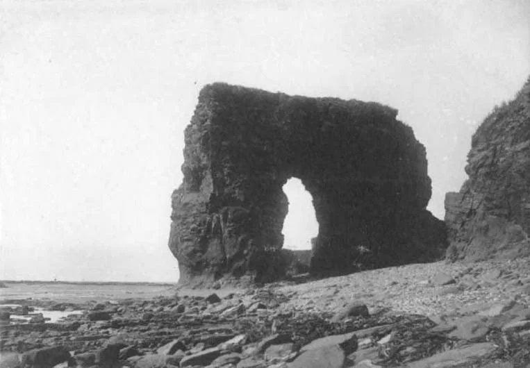
Water is not simply scenery at Lena Pillars; it organises erosion, habitat and movement. “Lena River approach” is where those roles become easiest to separate and understand. The pillars are most dramatic from a low boat on the broad river.

Settlement and memory

The cultural layer of the place

The pillars are built mainly from Cambrian limestone deposited in a shallow sea more than 500 million years ago. Freeze-thaw weathering and erosion along the Lena isolated narrow towers above one of Siberia's great river corridors.

For Sakha communities, the Lena has long been a route for settlement, fishing and seasonal movement. Russian expansion and river navigation later made the same corridor central to administration and trade across Yakutia.

Modern history

From local landscape to protected destination

The creation of Lena Pillars Nature Park in the 1990s, followed by UNESCO listing in 2012, shifted the cliffs from a regional river landmark into an internationally protected geological site reached mainly by boat from Yakutsk.

Field notes

The evidence still visible on the ground

At Lena Pillars, the feature “Lena River approach” is one of the most useful pieces of visible evidence. The pillars are most dramatic from a low boat on the broad river. Within Lena Pillars, the feature explains why this destination differs from nearby landscapes.

At Lena Pillars, the feature “Clifftop viewpoint” is one of the most useful pieces of visible evidence. A steep path reveals the scale of the river corridor and forest. At Lena Pillars, it gives a concrete reference point for reading change rather than merely collecting viewpoints.

At Lena Pillars, the feature “Permafrost landscape” is one of the most useful pieces of visible evidence. Seasonal ground, taiga and exposed rock meet in one compact site. Within Lena Pillars, it is both an attraction and a record of the processes described above.

Present day

The place within its wider region

At Lena Pillars, light, water and temperature reveal different structures at different times of year. For Lena Pillars, the most reliable visiting window is Jun-Sep.

For Lena Pillars, the stated visiting window is Jun-Sep, but its practical meaning depends on local weather, water and transport rather than the calendar alone.

Placed within its wider geography, Lena Pillars is not an isolated exception. Beyond the best-known image of Lena Pillars feature, Lena Pillars matters because clifftop viewpoint and permafrost landscape place the destination inside a broader regional story.

Chronology

Key dates

  1. A tropical sea leaves limestone

    Marine sediments formed the rock later carved into the pillars.

  2. The Lena becomes a colonial artery

    Russian forts, trade and river transport expanded along a route already used by Sakha communities.

  3. World Heritage inscription

    The pillars gained international recognition for exceptional permafrost and erosion processes.

Travel notes

Plan your visit

Time needed
2-4 days
Getting around
Boat, canoe or raft, with short land transfers
Effort
Moderate
Plan first
Water level, operator and return transport
Time of day
Start early and follow river conditions
Best window
Jun-Sep
Traveller stories

Stories from people who have been here.

First-hand moments, practical notes and overlooked details from Lena Pillars.

Loading traveller stories…

Browse all traveller stories ↗

Keep exploring

Where next?

All place stories