Border volcano plateau

Mount Elgon

A huge extinct volcano rises above farms and forest with moorland plateaus, caves and long ridges along the Uganda-Kenya border.

MoorlandCavesVolcanic massif

Location
Uganda-Kenya border, Uganda / Kenya
Best window
Jan-Mar, Jun-Sep
Suggested stay
2-4 days
Go for
Volcanic highlands
The reason to go

Wagagai and the caldera

The upper mountain opens into a broad volcanic landscape rather than a narrow summit ridge.

Start early and make this the first exposed stop of the day. Keep a lower route ready if cloud, heat, wind or trail conditions change during Jan-Mar, Jun-Sep.

Look a little closer

Worth discovering

The details that make Mount Elgon different.

Destination view
01

Wagagai and the caldera

The upper mountain opens into a broad volcanic landscape rather than a narrow summit ridge.

Photo journal
02

Mountain caves

Large caves on the slopes are among Elgon’s most distinctive geological features.

Destination view
03

Sipi escarpment

Waterfalls and farmland on the western side reveal the mountain’s transition into lower country.

Photo journal

A closer look at Mount Elgon

6 photographs
Beyond the surface

The making of Mount Elgon

A huge extinct volcano rises above farms and forest with moorland plateaus, caves and long ridges along the Uganda-Kenya border. The deeper story links its visible features with the people and changes behind them.

Mount Elgon is an enormous ancient volcanic massif straddling Uganda and Kenya. Its broad upper slopes and caldera differ from the sharper profiles of East Africa’s better-known peaks, creating a high plateau landscape rather than a single summit cone.

The familiar invitation at Mount Elgon is “Wagagai and the caldera”, yet that image makes more sense when it is connected to the landform, the local economy and the changes that determined access. The upper mountain opens into a broad volcanic landscape rather than a narrow summit ridge.

Continue to practical planning
Jackson's peak as you hike in Mt Elgon National park UgandaSee the complete photo journal
Natural history

The landform before the landmark

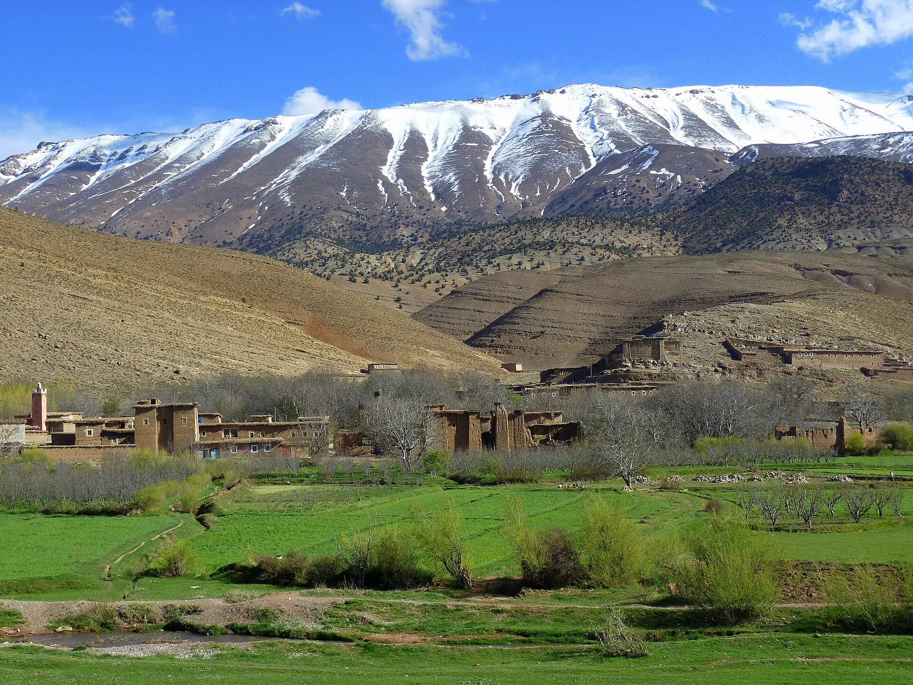
At Mount Elgon, the form of the landscape explains many of the choices that came later. Forest belts rise into bamboo, heath and open moorland. Cliffs, caves and deeply cut valleys break the broad slopes, while the upper caldera contains wide views and unusual volcanic landforms.

Altitude turns distance into effort and creates abrupt ecological boundaries. At Mount Elgon, “Wagagai and the caldera” provides a useful reference point for understanding that vertical structure. The upper mountain opens into a broad volcanic landscape rather than a narrow summit ridge.

Lives and livelihoods

Settlement, movement and local knowledge

At Mount Elgon, human history is written into settlement and land use rather than separated from the scenery. Dense agricultural settlement surrounds the mountain and several communities maintain long relationships with its forest and grazing resources. Access routes from Uganda and Kenya reveal different local patterns even though the high ecosystem is continuous.

At Mount Elgon, the feature described as “Mountain caves” offers a second line of evidence. Large caves on the slopes are among Elgon’s most distinctive geological features. Within Mount Elgon, it shows how local knowledge and practical use became embedded in the landscape.

Change

A landscape reorganised

The decisive modern change at Mount Elgon was access. At Mount Elgon, transport and visitor infrastructure made the landscape easier to reach while concentrating pressure at the few points where roads, boats or trails enter it. Mount Elgon should therefore be read as an evolving cultural landscape rather than a timeless scene.

On the ground

The small features that reveal the larger pattern

Start with the feature “Wagagai and the caldera”, because it condenses a much larger part of the story of Mount Elgon. The upper mountain opens into a broad volcanic landscape rather than a narrow summit ridge. At Mount Elgon, the detail links local scale with the wider regional pattern.

At Mount Elgon, the feature “Mountain caves” is one of the most useful pieces of visible evidence. Large caves on the slopes are among Elgon’s most distinctive geological features. For Mount Elgon, that relationship is more informative than treating the feature only as a photograph or checklist item.

Look closely at the feature “Sipi escarpment” in Mount Elgon; it carries information that a panoramic view can miss. Waterfalls and farmland on the western side reveal the mountain’s transition into lower country. Within Mount Elgon, it is both an attraction and a record of the processes described above.

Season and scale

What continues to change

At Mount Elgon, season is part of the landscape history, not merely a planning detail. The drier periods from January to March and June to September are generally best for longer routes. Rain can be heavy and trail conditions on the plateau change quickly with weather.

For Mount Elgon, the main seasonal constraint is: the strongest planning window is Jan-Mar, Jun-Sep. For Mount Elgon, outside it, check weather, daylight, road or ferry schedules and seasonal closures before committing to a fixed route.

For Mount Elgon, one practical detail matters: cloud, wind and trail conditions can change quickly. For Mount Elgon, put the highest or most exposed stop first and keep a lower-level alternative.

Placed within its wider geography, Mount Elgon is not an isolated exception. For Mount Elgon, the wider context shows that, elgon forms part of a wider highland corridor between eastern Uganda and western Kenya. For Mount Elgon, nearby waterfalls, farming districts and the lower Sipi area show how the massif shapes both ecology and settlement far beyond the park boundary.

Travel notes

Plan your visit

Time needed
2-4 days
Getting around
Car to access points, then walking or hiking
Effort
Moderate
Plan first
Accommodation and seasonal transport
Time of day
Start early for clearer conditions and more time
Best window
Jan-Mar, Jun-Sep
Traveller stories

Stories from people who have been here.

First-hand moments, practical notes and overlooked details from Mount Elgon.

Loading traveller stories…

Browse all traveller stories ↗

Keep exploring

Where next?

All place stories