Western Solomons archipelago

New Georgia Islands

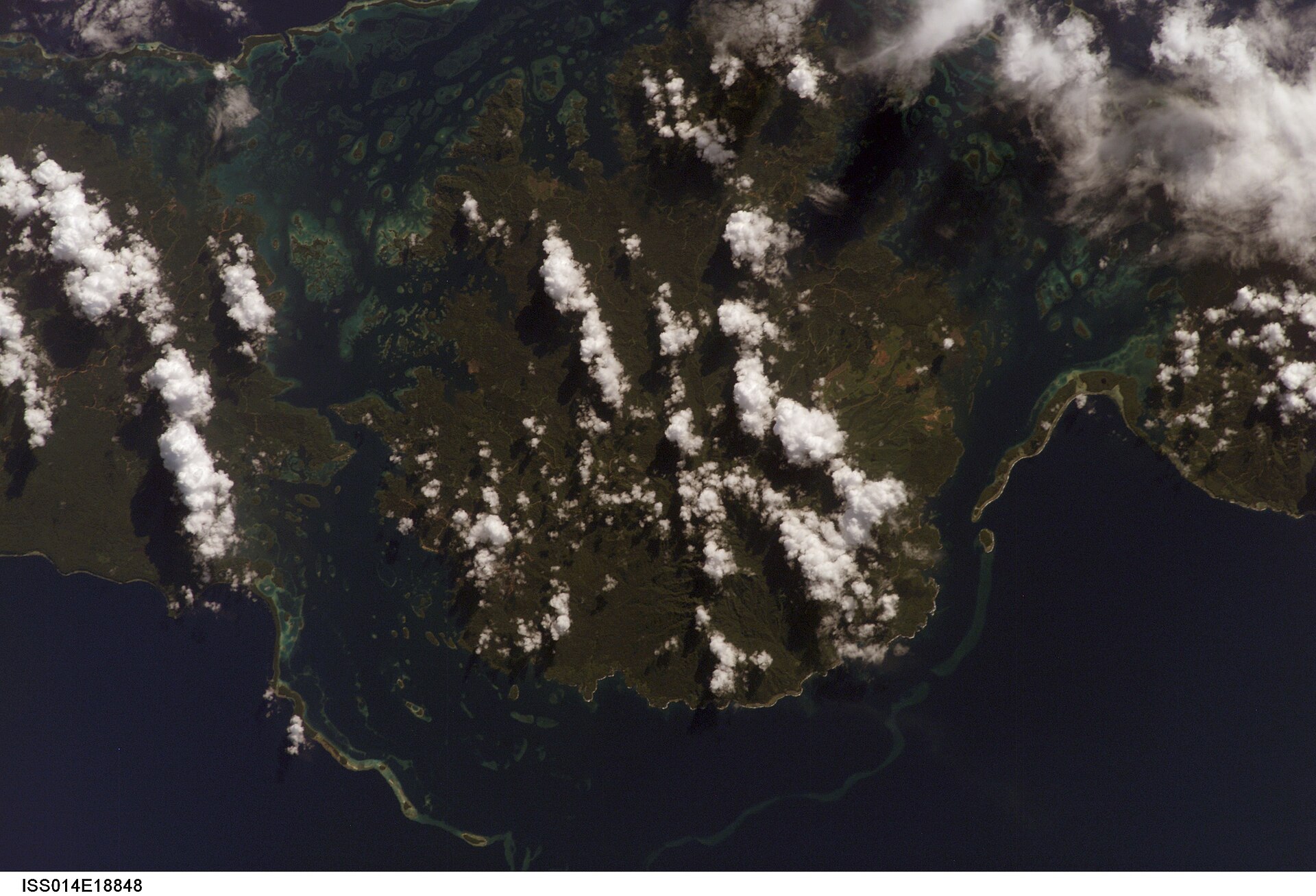
Large forested islands, lagoons, reefs and wartime sites form a complex maritime landscape in the western Solomon Islands.

Marovo LagoonRainforest islandsWartime history

Location
Western Province, Solomon Islands
Best window
May-Oct
Suggested stay
3-5 days
Go for
Lagoon, village and history route
The reason to go

Marovo Lagoon

Vast sheltered water, barrier islands and village routes form the defining landscape of the group.

Plan the least frequent boat, ferry or exposed coastal section first. Use early or late light and keep a weather alternative during May-Oct.

Look a little closer

Worth discovering

The details that make New Georgia Islands different.

Destination view
01

Marovo Lagoon

Vast sheltered water, barrier islands and village routes form the defining landscape of the group.

Destination view
02

Munda and Roviana

Airfield history, reefs and accessible communities provide a practical entry point.

Destination view
03

Rainforest interiors

Large islands contain rivers and forest far beyond the coastal travel corridors.

Photo journal

A closer look at New Georgia Islands

4 photographs
The full story

New Georgia Islands beyond the first view

Large forested islands, lagoons, reefs and wartime sites form a complex maritime landscape in the western Solomon Islands. The view is only the surface of a longer story of formation, use and change.

New Georgia Islands is best approached through the relationship between its setting and its lived landscape. The New Georgia group contains large mountainous islands surrounded by reefs, channels and one of the world largest saltwater lagoons. Rainforest reaches the coast, while villages and gardens occupy narrow strips of usable land beside water.

The strongest visual shorthand for New Georgia Islands is the experience described as “Marovo Lagoon”. Behind it lies a more complex relationship between physical processes, settlement and the modern idea of the place as a destination. Vast sheltered water, barrier islands and village routes form the defining landscape of the group.

Continue to practical planning
Kennedy Island, Kasolo Island, Pudding PlumSee the complete photo journal
Origins

The landform before the landmark

At New Georgia Islands, the form of the landscape explains many of the choices that came later. Marovo Lagoon is enclosed by a double barrier system of islands and reef, creating long sheltered waterways. Elsewhere, steep volcanic islands face deeper channels and open sea. Boat travel is essential, and distances are larger than they appear on a map.

On an island, coast, altitude and exposure work together. At New Georgia Islands, the feature described as “Marovo Lagoon” shows how a short distance can separate sheltered ground from a very different ocean-facing environment. Vast sheltered water, barrier islands and village routes form the defining landscape of the group.

Cultural landscape

Settlement, movement and local knowledge

At New Georgia Islands, human history is written into settlement and land use rather than separated from the scenery. Communities depend on fishing, gardens, timber and inter-island transport. Wood carving traditions are especially strong in the Marovo area. Second World War airfields, wrecks and battle sites add a recent historical layer around Munda and nearby islands.

The role of “Munda and Roviana” is especially revealing at New Georgia Islands. Airfield history, reefs and accessible communities provide a practical entry point. In the history of New Georgia Islands, it connects the wider regional context with a specific place that can still be examined today.

Turning point

A landscape reorganised

The decisive modern change at New Georgia Islands was access. At New Georgia Islands, transport and visitor infrastructure made the landscape easier to reach while concentrating pressure at the few points where roads, boats or trails enter it. At New Georgia Islands, the consequences are clearest where traditional use, protection and tourism occupy the same ground.

Visible evidence

The small features that reveal the larger pattern

At New Georgia Islands, the feature “Marovo Lagoon” provides a precise clue to how the landscape works. Vast sheltered water, barrier islands and village routes form the defining landscape of the group. For New Georgia Islands, that relationship is more informative than treating the feature only as a photograph or checklist item.

At New Georgia Islands, the feature “Munda and Roviana” is one of the most useful pieces of visible evidence. Airfield history, reefs and accessible communities provide a practical entry point. For New Georgia Islands, that relationship is more informative than treating the feature only as a photograph or checklist item.

At New Georgia Islands, the significance of the feature “Rainforest interiors” goes beyond its visual impact. Large islands contain rivers and forest far beyond the coastal travel corridors. Its position and condition at New Georgia Islands connect physical history with the way people use the place now.

Living landscape

The current chapter

New Georgia Islands changes through the year because weather and biological cycles rearrange what can be seen and used. The drier season usually offers more reliable boat conditions and road access around Munda. Tropical rain, heat and humidity remain constant, and flight or boat schedules can change. Cyclone exposure is lower than farther south but not absent.

For New Georgia Islands, the main seasonal constraint is: the strongest planning window is May-Oct. For New Georgia Islands, outside it, check weather, daylight, road or ferry schedules and seasonal closures before committing to a fixed route.

For New Georgia Islands, one practical detail matters: ferries, tunnels and weather can change the order of the day. For New Georgia Islands, build the route around the least frequent connection, not the closest viewpoint.

Placed within its wider geography, New Georgia Islands is not an isolated exception. For New Georgia Islands, the wider context shows that, the group connects the urban centre of Honiara with more remote western islands and Bougainville. For New Georgia Islands, its scale requires several bases to understand lagoon, forest and historical landscapes together.
Travel notes

Plan your visit

Time needed
3-5 days
Getting around
Car or local transport, plus ferries or boats and short walks
Effort
Moderate
Plan first
Main transport and accommodation
Time of day
Start early for clearer conditions and more time
Best window
May-Oct
Traveller stories

Stories from people who have been here.

First-hand moments, practical notes and overlooked details from New Georgia Islands.

Loading traveller stories…

Browse all traveller stories ↗

Keep exploring

Where next?

All place stories