Shoreline reef
Coral begins close enough to shore for the reef to remain visually connected with the beach.
Plan the least frequent boat, ferry or exposed coastal section first. Use early or late light and keep a weather alternative during Mar-Oct.
A fringing coral reef lies unusually close to shore beneath the arid limestone ridges of Cape Range in northwestern Australia.
Coral begins close enough to shore for the reef to remain visually connected with the beach.
Plan the least frequent boat, ferry or exposed coastal section first. Use early or late light and keep a weather alternative during Mar-Oct.
The details that make Ningaloo Coast different.
Coral begins close enough to shore for the reef to remain visually connected with the beach.
Dry limestone canyons create a parallel inland landscape only a short distance from the lagoon.
Large migrations make the coast change character across the year.
A fringing coral reef lies unusually close to shore beneath the arid limestone ridges of Cape Range in northwestern Australia. Its character becomes clearer when geology, settlement and modern protection are considered together.
Ningaloo Coast is best approached through the relationship between its setting and its lived landscape. Ningaloo creates one of the world's strongest land-sea contrasts. Coral reef begins close to beaches, while the dry Cape Range rises immediately inland. Turquoise lagoons, white sand, limestone gorges and sparse vegetation occupy the same narrow coastal strip.
The familiar invitation at Ningaloo Coast is “Shoreline reef”, yet that image makes more sense when it is connected to the landform, the local economy and the changes that determined access. Coral begins close enough to shore for the reef to remain visually connected with the beach.
Continue to practical planningThe first layer of Ningaloo Coast is geological and ecological rather than scenic. The reef system supports coral, fish, turtles, rays and large seasonal marine visitors. On land, karst and erosion have cut gorges through Cape Range. Groundwater links some coastal and inland habitats in less visible ways.
Routes and settlements at Ningaloo Coast follow the water system even when the map emphasises roads. “Shoreline reef” exposes that older logic. Coral begins close enough to shore for the reef to remain visually connected with the beach.
At Ningaloo Coast, human history is written into settlement and land use rather than separated from the scenery. Exmouth, Coral Bay, pastoral stations and smaller coastal sites form the human geography. Tourism, fishing, conservation and resource pressures all meet along a coast with limited water and infrastructure. Indigenous connections to sea country extend far beyond modern park boundaries.
A close look at “Cape Range gorges” makes the cultural layer of Ningaloo Coast more concrete. Dry limestone canyons create a parallel inland landscape only a short distance from the lagoon. At Ningaloo Coast, the surviving form links present-day identity with earlier work and settlement.
Formal protection changed how Ningaloo Coast was described and managed. At Ningaloo Coast, new boundaries, visitor rules and conservation priorities created a public identity that still has to coexist with settlements, customary use and economic pressures. At Ningaloo Coast, the consequences are clearest where traditional use, protection and tourism occupy the same ground.
At Ningaloo Coast, the feature “Shoreline reef” provides a precise clue to how the landscape works. Coral begins close enough to shore for the reef to remain visually connected with the beach. Within Ningaloo Coast, it is both an attraction and a record of the processes described above.
Start with the feature “Cape Range gorges”, because it condenses a much larger part of the story of Ningaloo Coast. Dry limestone canyons create a parallel inland landscape only a short distance from the lagoon. At Ningaloo Coast, the detail links local scale with the wider regional pattern.
At Ningaloo Coast, the feature “Seasonal marine life” is best understood as part of the surrounding system rather than an isolated stop. Large migrations make the coast change character across the year. Its position and condition at Ningaloo Coast connect physical history with the way people use the place now.
Ningaloo Coast changes through the year because weather and biological cycles rearrange what can be seen and used. Marine cycles are central: whale sharks, humpback whales, turtles and coral spawning appear at different times. The cooler dry months are generally most comfortable on land, while summer heat and cyclones can be severe.
For Ningaloo Coast, the main seasonal constraint is: the strongest planning window is Mar-Oct. For Ningaloo Coast, outside it, check weather, daylight, road or ferry schedules and seasonal closures before committing to a fixed route.
For Ningaloo Coast, one practical detail matters: distances, fuel, food and mobile coverage can be less predictable than the map suggests. For Ningaloo Coast, carry offline maps and keep a margin in the schedule.
Placed within its wider geography, Ningaloo Coast is not an isolated exception. For Ningaloo Coast, the wider context shows that, ningaloo belongs to a larger northwestern Australian system including the Exmouth Gulf, Pilbara coast and offshore currents. For Ningaloo Coast, its ecological integrity depends on both the reef and the arid terrestrial landscapes beside it.

Escarpments, wetlands and remote coasts form a vast Aboriginal cultural landscape in northern Australia.
Explore this place
Cool volcanic uplands, rainforest, crater lakes, waterfalls and farming towns rise behind tropical north Queensland coast.
Explore this place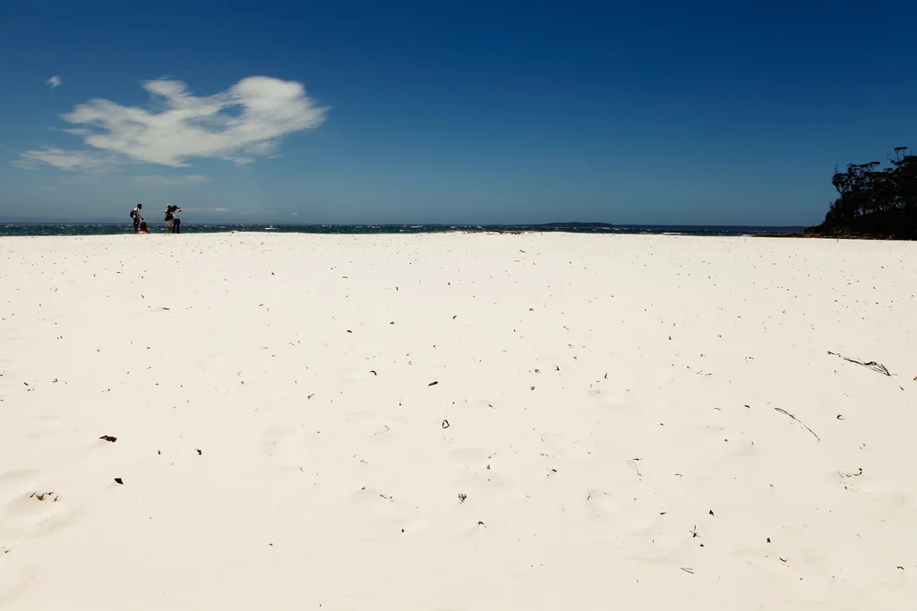
White-sand beaches, heathland, forest and clear bays form an Aboriginal-managed national park on the New South Wales south coast.
Explore this place