Living ancient lake

Lake Ohrid

An ancient lake, endemic freshwater ecosystem and historic urban shoreline meet within a mountain basin shared by North Macedonia and Albania.

Ancient lakeHistoric OhridEndemic species

Location
Ohrid-Prespa basin, North Macedonia
Best window
Apr-Oct
Suggested stay
3-5 days
Go for
Lake and heritage circuit
The reason to go

Ohrid old town

Churches, houses and fortifications descend toward the lake in one of the Balkans' most important historic urban landscapes.

Start early and make this the first exposed stop of the day. Keep a lower route ready if cloud, heat, wind or trail conditions change during Apr-Oct.

Look a little closer

Worth discovering

The details that make Lake Ohrid different.

Destination view
01

Ohrid old town

Churches, houses and fortifications descend toward the lake in one of the Balkans' most important historic urban landscapes.

Destination view
02

Ancient freshwater system

Long isolation has allowed numerous endemic species to develop within the lake.

Destination view
03

Transboundary basin

North Macedonian and Albanian shores form one ecological landscape with distinct cultural perspectives.

Photo journal

A closer look at Lake Ohrid

12 photographs
Deep background

Lake Ohrid beyond the first view

An ancient lake, endemic freshwater ecosystem and historic urban shoreline meet within a mountain basin shared by North Macedonia and Albania. Its character becomes clearer when geology, settlement and modern protection are considered together.

Lake Ohrid is both a natural system and a cultural landscape. Its deep, clear waters support an exceptional freshwater ecosystem, while towns, churches, monasteries and archaeological sites line a basin inhabited for millennia. The combination is unusually coherent: natural and urban heritage are visible within the same shoreline panorama.

The strongest visual shorthand for Lake Ohrid is the experience described as “Ohrid old town”. Behind it lies a more complex relationship between physical processes, settlement and the modern idea of the place as a destination. Churches, houses and fortifications descend toward the lake in one of the Balkans' most important historic urban landscapes.

Continue to practical planning
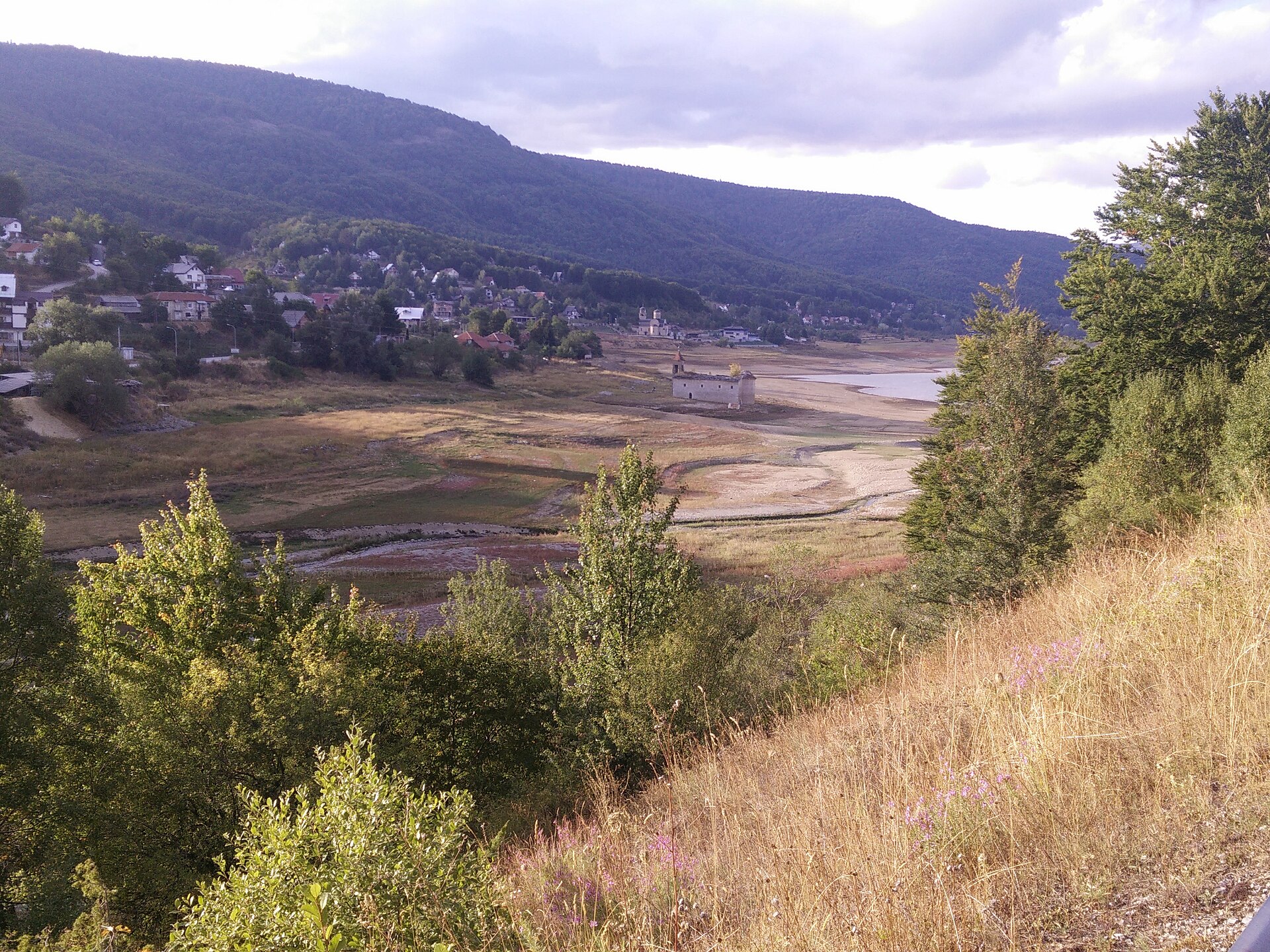
Lake Ohrid — view 4See the complete photo journal
Origins

From underlying structure to visible landscape

At Lake Ohrid, the physical story begins with the structure of the ground. The lake occupies a tectonic basin between mountain ranges. Springs, including underground connections from the Prespa system, feed its waters, while the Black Drin carries water northward. Steep slopes, reed margins and open views create different shoreline characters on the Macedonian and Albanian sides.

The visible shoreline or channel at Lake Ohrid is only one stage in a larger cycle. “Ohrid old town” demonstrates how flow, season and terrain interact. Churches, houses and fortifications descend toward the lake in one of the Balkans' most important historic urban landscapes.

Settlement and memory

Lives shaped by the terrain

Lake Ohrid has been shaped as much by livelihoods and movement as by natural processes. Ohrid town contains layers from antiquity through Byzantine and Ottoman periods, with churches, houses, fortifications and lakeside neighbourhoods arranged on a hill above the water. Smaller settlements, fishing traditions and agricultural land continue around the basin, preventing the heritage from being limited to one historic centre.

At Lake Ohrid, “Ancient freshwater system” should not be treated as a decorative detail. Long isolation has allowed numerous endemic species to develop within the lake. The feature records how construction, movement or livelihood adapted to local conditions at Lake Ohrid.

Turning point

How access and attention changed the place

Formal protection changed how Lake Ohrid was described and managed. At Lake Ohrid, new boundaries, visitor rules and conservation priorities created a public identity that still has to coexist with settlements, customary use and economic pressures. At Lake Ohrid, the result is not a clean break with the past because earlier routes and habits continue to organise the present landscape.

Field notes

Three details that explain the whole place

At Lake Ohrid, the feature “Ohrid old town” is best understood as part of the surrounding system rather than an isolated stop. Churches, houses and fortifications descend toward the lake in one of the Balkans' most important historic urban landscapes. At Lake Ohrid, it gives a concrete reference point for reading change rather than merely collecting viewpoints.

At Lake Ohrid, the significance of the feature “Ancient freshwater system” goes beyond its visual impact. Long isolation has allowed numerous endemic species to develop within the lake. Its position and condition at Lake Ohrid connect physical history with the way people use the place now.

At Lake Ohrid, the feature “Transboundary basin” is best understood as part of the surrounding system rather than an isolated stop. North Macedonian and Albanian shores form one ecological landscape with distinct cultural perspectives. Within Lake Ohrid, it is both an attraction and a record of the processes described above.

Living landscape

The current chapter

A single visit to Lake Ohrid captures only one phase of its annual cycle. Spring and autumn offer mild conditions and clearer urban rhythms. Summer brings warm water and the highest visitor pressure along the main shoreline. Winter can be cold and still, with snow on surrounding mountains and a much stronger sense of the lake as a year-round inhabited basin.

For Lake Ohrid, the main seasonal constraint is: the strongest planning window is Apr-Oct. For Lake Ohrid, outside it, check weather, daylight, road or ferry schedules and seasonal closures before committing to a fixed route.

For Lake Ohrid, one practical detail matters: cloud, wind and trail conditions can change quickly. For Lake Ohrid, put the highest or most exposed stop first and keep a lower-level alternative.

Placed within its wider geography, Lake Ohrid is not an isolated exception. Lake Ohrid is linked ecologically and geographically with Lake Prespa, Galicica National Park and the Albanian city of Pogradec. For Lake Ohrid, seeing both sides of the border reveals one shared watershed with different settlement patterns, languages and approaches to the shore.
Travel notes

Plan your visit

Time needed
3-5 days
Getting around
Car to access points, then walking or hiking
Effort
Moderate
Plan first
Opening days and any limited-entry sites
Time of day
Start early for clearer conditions and more time
Best window
Apr-Oct
Traveller stories

Stories from people who have been here.

First-hand moments, practical notes and overlooked details from Lake Ohrid.

Loading traveller stories…

Browse all traveller stories ↗

Keep exploring

Where next?

All place stories