Savanna beneath the Atakora

Pendjari

A West African savanna park of floodplains, wooded hills and seasonal waterholes within the wider W-Arly-Pendjari conservation landscape.

WildlifeSavannaAtakora

Location
Atakora, Benin
Best window
Dec-Apr
Suggested stay
3-5 days
Go for
West African safari
The reason to go

Wildlife in a wider cultural and ecological landscape

Pendjari offers one of West Africa's strongest large-mammal landscapes, but the Atakora escarpment, seasonal rivers and nearby communities give the park a character distinct from eastern and southern African reserves.

Stay long enough to connect Pendjari's headline landscape with one quieter local route rather than treating it as a single viewpoint.

Look a little closer

Worth discovering

The details that make Pendjari different.

Destination view
01

A transboundary refuge

Pendjari forms part of a protected system extending across Benin, Burkina Faso and Niger, allowing wildlife to move beyond one park boundary.

Destination view
02

Seasonal concentration

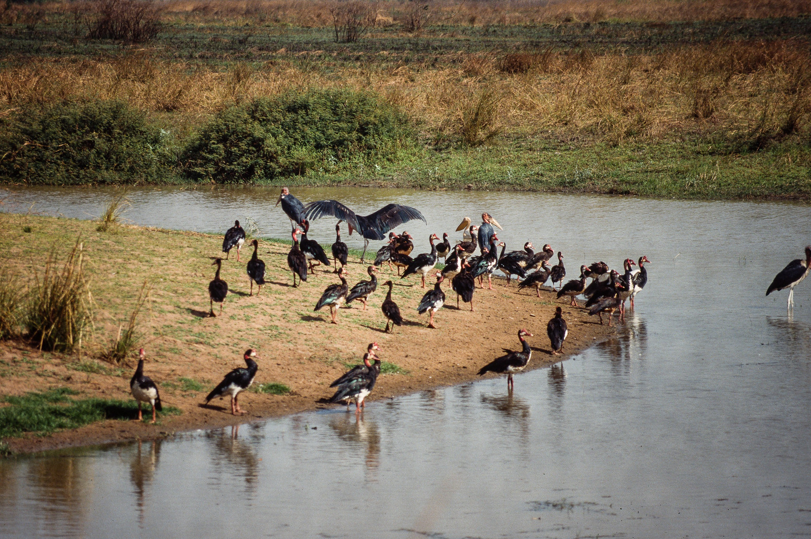
As water contracts during the dry season, animals and birds gather around remaining pools and the Pendjari River.

Destination view
03

Atakora backdrop

Low mountain ridges and cliffs break the horizontal savanna and influence drainage, vegetation and settlement.

Photo journal

A closer look at Pendjari

4 photographs
Origins and change

What made Pendjari distinctive

A West African savanna park of floodplains, wooded hills and seasonal waterholes within the wider W-Arly-Pendjari conservation landscape. The view is only the surface of a longer story of formation, use and change.

Pendjari offers one of West Africa's strongest large-mammal landscapes, but the Atakora escarpment, seasonal rivers and nearby communities give the park a character distinct from eastern and southern African reserves.

The strongest visual shorthand for Pendjari is the experience described as “West African safari”. Behind it lies a more complex relationship between physical processes, settlement and the modern idea of the place as a destination. At Pendjari, allow enough time to connect Pendjari's headline landscape with one quieter local route instead of reducing Pendjari to a single viewpoint.

Continue to practical planning
Parc national de la Pendjari-Campement (1)See the complete photo journal
Natural history

Why the terrain has this form

At Pendjari, the form of the landscape explains many of the choices that came later. Open savanna, woodland, floodplain, river channels and the Atakora foothills create a varied dry-season wildlife environment.

On an island, coast, altitude and exposure work together. At Pendjari, the feature described as “A transboundary refuge” shows how a short distance can separate sheltered ground from a very different ocean-facing environment. Pendjari forms part of a protected system extending across Benin, Burkina Faso and Niger, allowing wildlife to move beyond one park boundary.

Lives and livelihoods

People, work and memory

The Atakora and Pendjari country has long supported farming, hunting and transhumance by communities including the Gourmantche, Berba and Fulani. Colonial authorities progressively converted parts of this lived landscape into hunting and faunal reserves, separating wildlife policy from customary use.

A protected area was established in the 1950s and Pendjari became a national park after Benin's independence. Together with Arly in Burkina Faso and W in Niger, it now forms the core of the W-Arly-Pendjari complex, one of West Africa's most important remaining savanna systems.

Change

The change that redefined the place

International management investment improved patrols and tourism infrastructure, but insecurity in the border region has also closed or constrained access. The park's modern history is shaped as much by regional security and relations with neighbouring communities as by elephants, lions and waterholes.

Details to read

The evidence still visible on the ground

At Pendjari, the feature “A transboundary refuge” is one of the most useful pieces of visible evidence. Pendjari forms part of a protected system extending across Benin, Burkina Faso and Niger, allowing wildlife to move beyond one park boundary. At Pendjari, the detail links local scale with the wider regional pattern.

At Pendjari, the feature “Seasonal concentration” provides a precise clue to how the landscape works. As water contracts during the dry season, animals and birds gather around remaining pools and the Pendjari River. Its position and condition at Pendjari connect physical history with the way people use the place now.

At Pendjari, the significance of the feature “Atakora backdrop” goes beyond its visual impact. Low mountain ridges and cliffs break the horizontal savanna and influence drainage, vegetation and settlement. At Pendjari, it gives a concrete reference point for reading change rather than merely collecting viewpoints.

Continuity

Why the landscape still feels dynamic

At Pendjari, season is part of the landscape history, not merely a planning detail. December to April brings easier roads and stronger wildlife concentration. The wet season transforms vegetation and can close tracks.

For Pendjari, the most useful time of day is: dawn and late afternoon drives.

For Pendjari, plan this first: current security status and authorised operator.

Placed within its wider geography, Pendjari is not an isolated exception. For Pendjari, the wider context shows that, tata Somba architecture and the Atakora region connect a park visit to northern Benin's living cultural landscape.

Chronology

Key dates

  1. Faunal reserve formalised

    Colonial conservation placed the Pendjari basin under increasingly strict wildlife regulation.

  2. National park status

    Independent Dahomey, later Benin, established Pendjari as a national park.

  3. World Heritage complex expanded

    Pendjari and Arly joined the W parks within a transboundary UNESCO site.

In context

Get to know the place

The landscape

Open savanna, woodland, floodplain, river channels and the Atakora foothills create a varied dry-season wildlife environment.

People and place

Communities around the park have long used the wider landscape for farming, hunting and pastoralism; conservation outcomes depend strongly on security and local benefit.

Seasonal character

December to April brings easier roads and stronger wildlife concentration. The wet season transforms vegetation and can close tracks.

Beyond the main view

Tata Somba architecture and the Atakora region connect a park visit to northern Benin's living cultural landscape.

Travel notes

Plan your visit

Time needed
3-5 days
Getting around
4x4 with park guide
Effort
Easy to moderate
Plan first
Current security status and authorised operator
Time of day
Dawn and late afternoon drives
Best window
Dec-Apr
Keep exploring

Where next?

All place stories