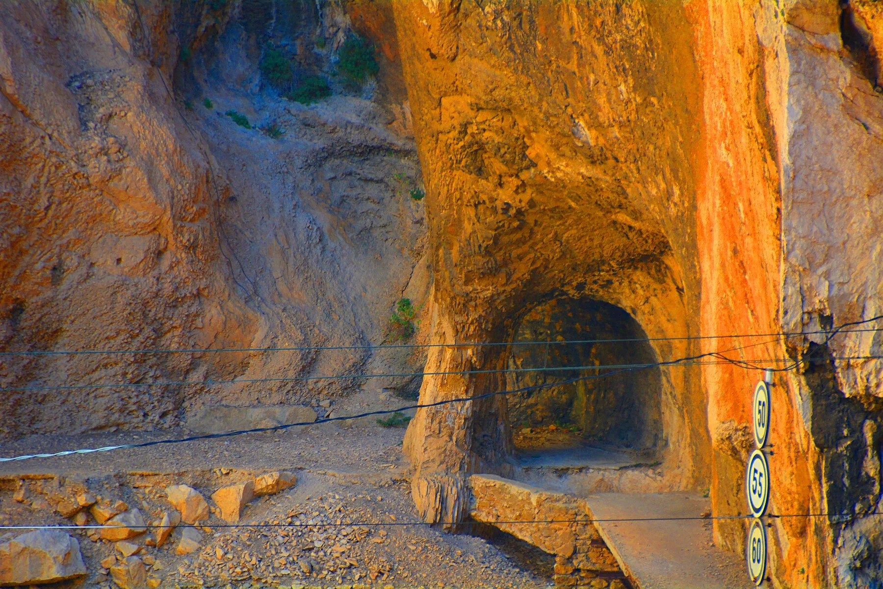
Northern limestone

Picos de Europa

A compact limestone range of deep gorges, green valleys and high massifs rising unusually close to Spain's northern coast.

Limestone peaksGorgesPastoral valleys

Location
Cantabrian Mountains, Spain
Best window
May-Oct
Suggested stay
3-5 days
Go for
Mountain and valley circuit
The reason to go

Cares gorge

A narrow river corridor cuts between high walls and exposes the scale of erosion within the central massifs.

Plan the least frequent boat, ferry or exposed coastal section first. Use early or late light and keep a weather alternative during May-Oct.

Look a little closer

Worth discovering

The details that make Picos de Europa different.

Destination view
01

Cares gorge

A narrow river corridor cuts between high walls and exposes the scale of erosion within the central massifs.

Destination view
02

Covadonga lakes

Glacial lakes, pasture and mountain views create one of the clearest introductions to the western massif.

Destination view
03

Mountain settlements

Stone villages and working valleys connect the high terrain with food traditions and seasonal pastoral life.

Photo journal

A closer look at Picos de Europa

13 photographs
Deep background

How time shaped Picos de Europa

A compact limestone range of deep gorges, green valleys and high massifs rising unusually close to Spain's northern coast. This account follows the forces, communities and decisions that made the present landscape.

Picos de Europa compresses alpine-looking peaks, narrow gorges, pasture and inhabited valleys into a relatively small area shared by Asturias, Cantabria and Castile and Leon. The range rises close to the Bay of Biscay, so Atlantic moisture feeds the green lower slopes while the upper limestone remains pale, broken and vertical.

The familiar invitation at Picos de Europa is “Cares gorge”, yet that image makes more sense when it is connected to the landform, the local economy and the changes that determined access. A narrow river corridor cuts between high walls and exposes the scale of erosion within the central massifs.

Continue to practical planning
Camino Vadiniense entre Fuente Dé y Portilla de la Reina 002See the complete photo journal
Landform

The physical foundations of the place

The first layer of Picos de Europa is geological and ecological rather than scenic. Three principal massifs give the range its structure. Between them, rivers have cut deep passages such as the Cares gorge, while glacial and karst processes shaped basins, sinkholes and high meadows. The contrast between humid valleys and exposed rock is one of the defining visual features of the Picos.

Relief controls far more than the view. At Picos de Europa, “Cares gorge” reveals how elevation divides vegetation, weather, water and the routes available to people. A narrow river corridor cuts between high walls and exposes the scale of erosion within the central massifs.

Lives and livelihoods

Lives shaped by the terrain

At Picos de Europa, daily life gives the terrain a historical meaning that a viewpoint alone cannot provide. Villages, seasonal livestock movement and local cheeses are part of the mountain landscape rather than additions to it. Settlements such as Sotres, Bulnes and Potes occupy different edges of the range, and roads often pass quickly from working pasture into very steep terrain. The cultural geography changes from one valley to the next.

The role of “Covadonga lakes” is especially revealing at Picos de Europa. Glacial lakes, pasture and mountain views create one of the clearest introductions to the western massif. In the history of Picos de Europa, it connects the wider regional context with a specific place that can still be examined today.

Turning point

The modern turning point

The decisive modern change at Picos de Europa was access. At Picos de Europa, transport and visitor infrastructure made the landscape easier to reach while concentrating pressure at the few points where roads, boats or trails enter it. At Picos de Europa, the result is not a clean break with the past because earlier routes and habits continue to organise the present landscape.

Visible evidence

The evidence still visible on the ground

At Picos de Europa, the feature “Cares gorge” provides a precise clue to how the landscape works. A narrow river corridor cuts between high walls and exposes the scale of erosion within the central massifs. At Picos de Europa, the detail links local scale with the wider regional pattern.

At Picos de Europa, the feature “Covadonga lakes” is best understood as part of the surrounding system rather than an isolated stop. Glacial lakes, pasture and mountain views create one of the clearest introductions to the western massif. Within Picos de Europa, it is both an attraction and a record of the processes described above.

At Picos de Europa, the significance of the feature “Mountain settlements” goes beyond its visual impact. Stone villages and working valleys connect the high terrain with food traditions and seasonal pastoral life. Within Picos de Europa, it is both an attraction and a record of the processes described above.

Season and scale

Season, scale and the present day

At Picos de Europa, season is part of the landscape history, not merely a planning detail. Late spring brings water, flowers and lingering snow on higher ground. Summer offers the broadest access but can concentrate visitors around the best-known routes. September and early October often provide quieter valleys and clearer air, while winter conditions can change rapidly above the inhabited areas.

For Picos de Europa, the main seasonal constraint is: the strongest planning window is May-Oct. For Picos de Europa, outside it, check weather, daylight, road or ferry schedules and seasonal closures before committing to a fixed route.

For Picos de Europa, one practical detail matters: cloud, wind and trail conditions can change quickly. For Picos de Europa, put the highest or most exposed stop first and keep a lower-level alternative.

Placed within its wider geography, Picos de Europa is not an isolated exception. For Picos de Europa, the wider context shows that, the Picos make more sense when linked with the northern coast and the broader Cantabrian Mountains. For Picos de Europa, within short distances, the landscape moves from beaches and estuaries to beech forest, high pasture and limestone summits. For Picos de Europa, that compression distinguishes the region from larger mountain systems farther inland.

Travel notes

Plan your visit

Time needed
3-5 days
Getting around
Car to access points, then walking or hiking
Effort
Moderate
Plan first
Accommodation and seasonal transport
Time of day
Start early for clearer conditions and more time
Best window
May-Oct
Traveller stories

Stories from people who have been here.

First-hand moments, practical notes and overlooked details from Picos de Europa.

Loading traveller stories…

Browse all traveller stories ↗

Keep exploring

Where next?

All place stories