Alpine pass track

Routeburn Track

A multi-day track crosses beech forest, waterfalls and an alpine saddle between two national parks.

Alpine pass trackDramatic routeViewpointsHarris SaddleLake Harris

Location
Fiordland and Mount Aspiring, New Zealand
Best window
Nov-Apr
Suggested stay
2-3 days
Go for
Great Walk alpine crossing
The reason to go

Cross Harris Saddle between two national parks

The route rises from forest into a high basin and traverses above Lake Harris before descending through a different mountain catchment.

Secure huts and both road transfers together; the trailheads are far apart despite the compact map distance.

Look a little closer

Worth discovering

The details that make Routeburn Track different.

Photo journal
01

Harris Saddle

The highest point opens views toward the Hollyford and Route Burn valleys.

Photo journal
02

Lake Harris

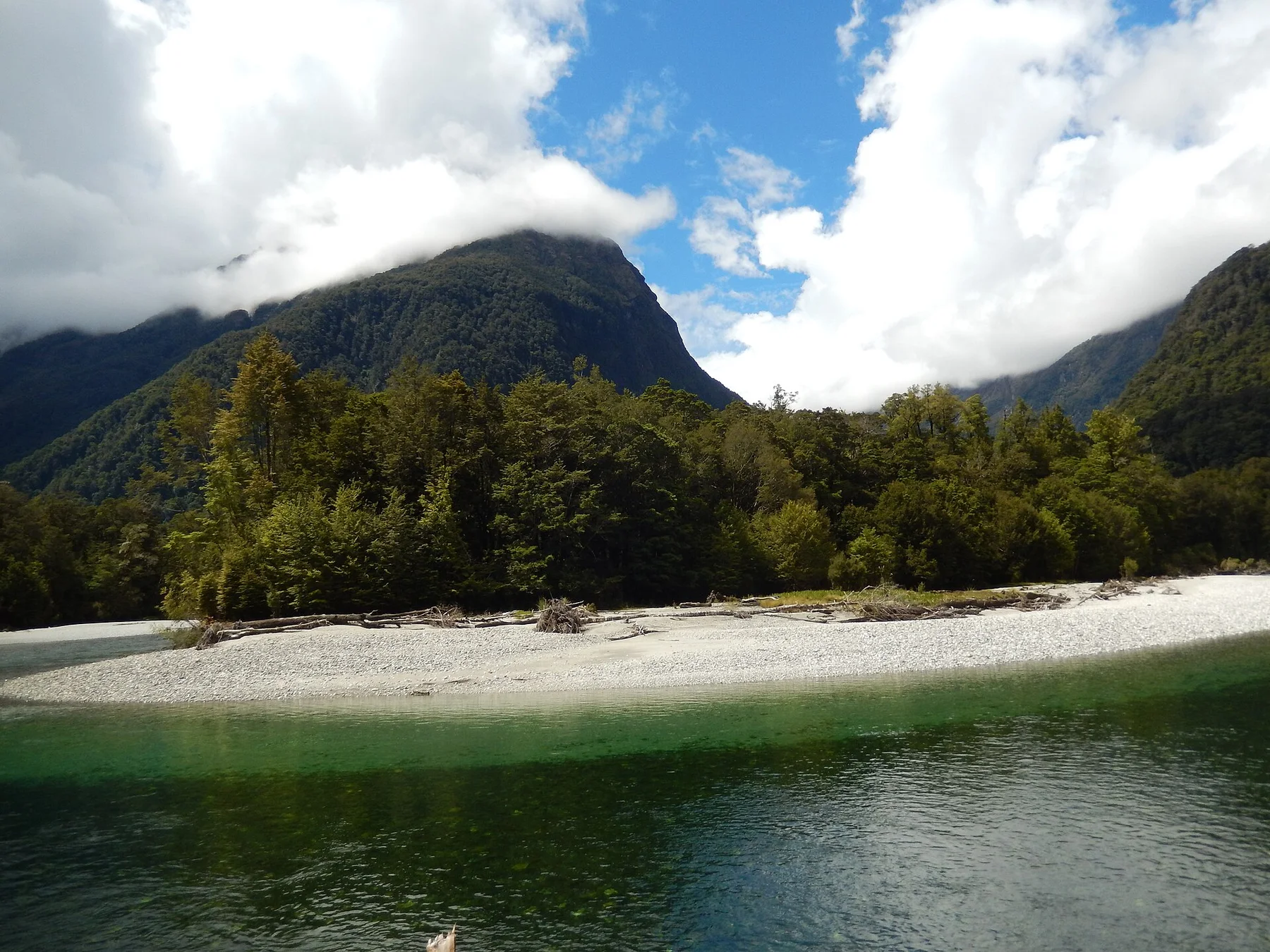
A dark alpine lake sits below the exposed traverse near the saddle.

Photo journal
03

Earland Falls

A high waterfall crosses the lower forest route and can require an alternate flood path.

Photo journal

A closer look at Routeburn Track

12 photographs
Landscape and history

How time shaped Routeburn Track

A multi-day track crosses beech forest, waterfalls and an alpine saddle between two national parks. The deeper story links its visible features with the people and changes behind them.

Routeburn Track is centred on Fiordland and Mount Aspiring, where a multi-day track crosses beech forest, waterfalls and an alpine saddle between two national parks. The strongest reason to make the journey is to cross Harris Saddle between two national parks.

The strongest visual shorthand for Routeburn Track is the experience described as “Cross Harris Saddle between two national parks”. Behind it lies a more complex relationship between physical processes, settlement and the modern idea of the place as a destination. The route rises from forest into a high basin and traverses above Lake Harris before descending through a different mountain catchment.

Continue to practical planning
Routeburn Track (16353579169)See the complete photo journal
Natural history

From underlying structure to visible landscape

The first layer of Routeburn Track is geological and ecological rather than scenic. Changes in height, rock, water and exposure make the sequence important: the approach, the most engineered or natural passage and the final overlook each reveal a different part of Fiordland and Mount Aspiring.

The path is inseparable from the terrain it crosses. At Routeburn Track, “Harris Saddle” turns engineering or trail logic into something visible underfoot. The highest point opens views toward the Hollyford and Route Burn valleys.

Cultural landscape

The cultural layer of the place

The Routeburn crosses a landscape traversed by Maori travelling between inland valleys and the west coast in search of pounamu. European surveyors, runholders and early tourists later reused parts of these mountain routes.

Track building and hut construction during the twentieth century created the present Great Walk between the Route Burn and Hollyford catchments. Unlike a road, it preserved a point-to-point passage whose two trailheads remain separated by a long vehicle journey.

Change

The transition visible today

Great Walk branding, bookings and hut upgrades converted an older crossing into a regulated international itinerary, while storm damage repeatedly demonstrates that the route remains subject to landslides and river change.

Field notes

Three details that explain the whole place

Start with the feature “Harris Saddle”, because it condenses a much larger part of the story of Routeburn Track. The highest point opens views toward the Hollyford and Route Burn valleys. Within Routeburn Track, the feature explains why this destination differs from nearby landscapes.

At Routeburn Track, the significance of the feature “Lake Harris” goes beyond its visual impact. A dark alpine lake sits below the exposed traverse near the saddle. For Routeburn Track, that relationship is more informative than treating the feature only as a photograph or checklist item.

At Routeburn Track, the feature “Earland Falls” provides a precise clue to how the landscape works. A high waterfall crosses the lower forest route and can require an alternate flood path. At Routeburn Track, the detail links local scale with the wider regional pattern.

Living landscape

The current chapter

At Routeburn Track, season is part of the landscape history, not merely a planning detail. For Routeburn Track, the most reliable visiting window is Nov-Apr.

For Routeburn Track, one practical detail matters: snow and severe weather are possible even in summer. For Routeburn Track, follow conservation authority alerts and hut instructions.

For Routeburn Track, the most useful visiting period is: early departure from each hut.

Placed within its wider geography, Routeburn Track is not an isolated exception. Beyond the best-known image of Routeburn Track crossing, Routeburn Track is useful because lake harris and earland falls place the route inside a broader landscape story.
Chronology

Key dates

  1. Pounamu routes across the ranges

    Maori travellers used mountain passes linking interior valleys with western resource areas.

  2. Huts and maintained track

    Government and club work established a formal recreational crossing.

  3. Great Walk management

    Bookings, transfers and repairs organise one of New Zealand's busiest multi-day tracks.

Travel notes

Plan your visit

Time needed
2-3 days
Getting around
Booked huts and point-to-point transport
Effort
Moderate to demanding
Plan first
Hut booking, transfers and alpine weather
Time of day
Early departure from each hut
Best window
Nov-Apr
Traveller stories

Stories from people who have been here.

First-hand moments, practical notes and overlooked details from Routeburn Track.

Loading traveller stories…

Browse all traveller stories ↗

Keep exploring

Where next?

All place stories