Baltic land and sea

Saaremaa

Estonia's largest island combines juniper coast, meteorite geology, windmills, manor landscapes and a strong maritime identity.

Juniper coastMeteorite craterIsland villages

Location
Baltic Sea, Estonia
Best window
May-Sep
Suggested stay
3-5 days
Go for
Baltic island road trip
The reason to go

Kaali crater field

Meteorite impacts created a rare geological landmark within the island's settled interior.

Plan the least frequent boat, ferry or exposed coastal section first. Use early or late light and keep a weather alternative during May-Sep.

Look a little closer

Worth discovering

The details that make Saaremaa different.

Photo journal
01

Kaali crater field

Meteorite impacts created a rare geological landmark within the island's settled interior.

Destination view
02

Western coast

Cliffs, juniper and open Baltic horizons define Saaremaa's exposed edge.

Destination view
03

Kuressaare and village heritage

A castle town, windmills and stone-built settlements connect urban and rural island history.

Photo journal

A closer look at Saaremaa

17 photographs
Landscape and history

Reading the layers of Saaremaa

Estonia's largest island combines juniper coast, meteorite geology, windmills, manor landscapes and a strong maritime identity. The view is only the surface of a longer story of formation, use and change.

Saaremaa is Estonia's largest island and one of the Baltic region's most varied cultural landscapes. Low coastlines, wooded interior, small villages and the town of Kuressaare are connected by quiet roads that make the island easy to explore at a measured pace. Its character is maritime, but geology, agriculture and built heritage are equally important.

Visitors often encounter Saaremaa through the idea of “Kaali crater field”, but the destination is more than that single scene. Its landscape carries evidence of work, movement, adaptation and environmental change. Meteorite impacts created a rare geological landmark within the island's settled interior.

Continue to practical planning
De zee kuste Rontomme Oesel ende een deel van Curlandt beginnende van Dagher oort tot Derwinde, also hem tlandt daer verthoont, ende in zijn ghedaente is - Luca Ioannis Aurigarius autore ; Ioannis à... - btv1b532358081 (1 of 3)See the complete photo journal
Natural history

From underlying structure to visible landscape

Understanding Saaremaa starts below the visible surface. The island's western and southern shores include cliffs, shallow bays, coastal meadows and juniper scrub. Inland, forest and former agricultural land surround the Kaali meteorite crater field, one of Saaremaa's most distinctive geological features. The low relief makes subtle changes in vegetation, wind exposure and shoreline form especially visible.

On an island, coast, altitude and exposure work together. At Saaremaa, the feature described as “Kaali crater field” shows how a short distance can separate sheltered ground from a very different ocean-facing environment. Meteorite impacts created a rare geological landmark within the island's settled interior.

Lives and livelihoods

The cultural layer of the place

At Saaremaa, human history is written into settlement and land use rather than separated from the scenery. Windmills, stone walls, churches and manor complexes record centuries of local farming and Baltic exchange. Kuressaare Castle anchors the island's urban history, while village museums and small producers keep craft and food traditions present. Ferry connections have reduced isolation, but Saaremaa still maintains a strong sense of island scale and seasonal rhythm.

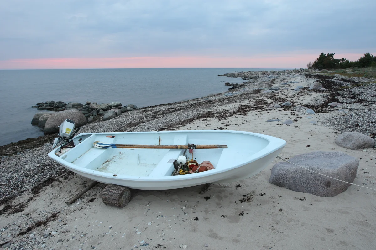
At Saaremaa, the feature described as “Western coast” offers a second line of evidence. Cliffs, juniper and open Baltic horizons define Saaremaa's exposed edge. Within Saaremaa, it shows how local knowledge and practical use became embedded in the landscape.

Modern history

A landscape reorganised

The decisive modern change at Saaremaa was access. At Saaremaa, transport and visitor infrastructure made the landscape easier to reach while concentrating pressure at the few points where roads, boats or trails enter it. At Saaremaa, that transition remains visible in the contrast between older working features and visitor infrastructure.

Visible evidence

The small features that reveal the larger pattern

At Saaremaa, the feature “Kaali crater field” is best understood as part of the surrounding system rather than an isolated stop. Meteorite impacts created a rare geological landmark within the island's settled interior. Its position and condition at Saaremaa connect physical history with the way people use the place now.

At Saaremaa, the significance of the feature “Western coast” goes beyond its visual impact. Cliffs, juniper and open Baltic horizons define Saaremaa's exposed edge. Within Saaremaa, the feature explains why this destination differs from nearby landscapes.

Start with the feature “Kuressaare and village heritage”, because it condenses a much larger part of the story of Saaremaa. A castle town, windmills and stone-built settlements connect urban and rural island history. Within Saaremaa, it is both an attraction and a record of the processes described above.

Continuity

The current chapter

At Saaremaa, season is part of the landscape history, not merely a planning detail. Late spring and summer provide long northern light, active coastal meadows and the broadest range of services. Early autumn is quieter and often well suited to cycling and village travel. Winter brings short days, ice and a more inward-looking atmosphere, making the island feel physically closer to its Baltic weather systems.

For Saaremaa, the main seasonal constraint is: the strongest planning window is May-Sep. For Saaremaa, outside it, check weather, daylight, road or ferry schedules and seasonal closures before committing to a fixed route.

For Saaremaa, one practical detail matters: wind, sea state and tide can matter as much as distance. For Saaremaa, check conditions before boat trips, exposed cliffs or tidal sections.

Placed within its wider geography, Saaremaa is not an isolated exception. Saaremaa can be linked with Muhu, Hiiumaa and Estonia's western mainland coast. For Saaremaa, together these islands and peninsulas form a low, water-shaped region where ferry routes, bird migration, traditional land management and small settlements create a coherent alternative to capital-centred travel.
Travel notes

Plan your visit

Time needed
3-5 days
Getting around
Car or local transport, plus coastal walks and occasional boat links
Effort
Moderate
Plan first
Opening days and any limited-entry sites
Time of day
Morning for movement; late light for viewpoints
Best window
May-Sep
Traveller stories

Stories from people who have been here.

First-hand moments, practical notes and overlooked details from Saaremaa.

Loading traveller stories…

Browse all traveller stories ↗

Keep exploring

Where next?

All place stories