Bolong channels
Tidal waterways create the delta's principal routes and ecological structure.
Plan the least frequent boat, ferry or exposed coastal section first. Use early or late light and keep a weather alternative during Nov-May.
Mangrove channels, shell islands, salt flats and fishing communities form a dense estuarine landscape south of Dakar.
Tidal waterways create the delta's principal routes and ecological structure.
Plan the least frequent boat, ferry or exposed coastal section first. Use early or late light and keep a weather alternative during Nov-May.
The details that make Saloum Delta different.
Tidal waterways create the delta's principal routes and ecological structure.
Accumulated shells form raised cultural landscapes with archaeological significance.
Boat-based livelihoods connect villages across an environment where roads are secondary.
Mangrove channels, shell islands, salt flats and fishing communities form a dense estuarine landscape south of Dakar. This account follows the forces, communities and decisions that made the present landscape.
The Saloum Delta spreads across Senegal's central coast as a network of tidal channels, mangrove forest, islands and salt-affected land. Villages and fishing camps occupy higher ground within the estuary. The landscape is both ecologically rich and deeply historical, with evidence of long-term human adaptation to changing water and sediment.
Many visits to Saloum Delta begin with the experience described as “Bolong channels”. The more revealing question is why it exists here, how people used the surrounding ground and what remains visible from earlier phases. Tidal waterways create the delta's principal routes and ecological structure.
Continue to practical planningBefore roads, settlements or protected-area boundaries, the terrain of Saloum Delta set the basic terms. Mangroves line narrow bolongs that open into broad tidal spaces. Shell mounds accumulated over centuries create raised islands and archaeological sites. Salinity varies across the delta, influencing vegetation, agriculture and fish habitats, while seasonal freshwater input changes the balance between river and ocean.
The apparent flatness is deceptive. At Saloum Delta, “Bolong channels” shows how small differences in water level reorganise habitat, routes and human use. Tidal waterways create the delta's principal routes and ecological structure.
At Saloum Delta, people learned to work with the landscape limits rather than arriving after its story was complete. Serer and Niominka communities maintain strong fishing, shellfish and boat traditions. Villages depend on tidal timing for transport and access to resources. Tourism, conservation and changing fish stocks bring new pressures, but local knowledge remains essential for navigating the channels and understanding where productive habitats persist.
At Saloum Delta, the feature described as “Shell islands” offers a second line of evidence. Accumulated shells form raised cultural landscapes with archaeological significance. Within Saloum Delta, it shows how local knowledge and practical use became embedded in the landscape.
Formal protection changed how Saloum Delta was described and managed. At Saloum Delta, new boundaries, visitor rules and conservation priorities created a public identity that still has to coexist with settlements, customary use and economic pressures. At Saloum Delta, the current visitor experience is the newest layer rather than the whole history.
At Saloum Delta, the significance of the feature “Bolong channels” goes beyond its visual impact. Tidal waterways create the delta's principal routes and ecological structure. At Saloum Delta, it gives a concrete reference point for reading change rather than merely collecting viewpoints.
At Saloum Delta, the feature “Shell islands” is one of the most useful pieces of visible evidence. Accumulated shells form raised cultural landscapes with archaeological significance. Within Saloum Delta, it is both an attraction and a record of the processes described above.
Look closely at the feature “Fishing communities” in Saloum Delta; it carries information that a panoramic view can miss. Boat-based livelihoods connect villages across an environment where roads are secondary. For Saloum Delta, that relationship is more informative than treating the feature only as a photograph or checklist item.
A single visit to Saloum Delta captures only one phase of its annual cycle. The dry season offers easier travel, abundant birdlife and lower humidity. During the rains, freshwater alters the estuary and vegetation becomes more intense, though road and boat logistics can be less predictable. Tides remain the daily rhythm in every season and shape departures more than a fixed clock.
For Saloum Delta, the main seasonal constraint is: the strongest planning window is Nov-May. For Saloum Delta, outside it, check weather, daylight, road or ferry schedules and seasonal closures before committing to a fixed route.
For Saloum Delta, one practical detail matters: ferries, tunnels and weather can change the order of the day. For Saloum Delta, build the route around the least frequent connection, not the closest viewpoint.
Placed within its wider geography, Saloum Delta is not an isolated exception. The Saloum Delta connects inland agricultural zones with the Atlantic and continues south toward the Gambia River system. For Saloum Delta, its shell landscapes and mangroves show how coastal West Africa has been shaped by both natural sediment processes and sustained human harvesting over long periods.

Savanna woodland, gallery forest and the Gambia River support a large wildlife landscape in southeastern Senegal.
Explore this place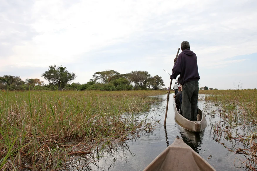
A broad river enters Botswana through papyrus channels and fishing settlements before spreading into the Okavango Delta.
Explore this place
Two long, low coral islands support coconut groves, a small community and bright lagoon water far north of Mauritius.
Explore this place