Hidden Himalayan valley

Tsum Valley

Stone villages, Buddhist monasteries and cultivated terraces occupy a high Himalayan valley beneath the Ganesh Himal range.

Buddhist heritageStone villagesHigh terraces

Location
Ganesh Himal, Nepal
Best window
Mar-May, Oct-Nov
Suggested stay
2-4 days
Go for
Himalayan cultural valley
The reason to go

Chhokang Paro

A broad upper-valley settlement reveals the relationship between clustered stone houses and cultivated terraces.

Check opening days or local access first, then connect the main site to the surrounding streets, paths or landscape instead of treating it as an isolated stop.

Look a little closer

Worth discovering

The details that make Tsum Valley different.

Destination view
01

Chhokang Paro

A broad upper-valley settlement reveals the relationship between clustered stone houses and cultivated terraces.

Destination view
02

Mu Gompa

A high monastery anchors the valley's Buddhist geography near the northern end of settlement.

Photo journal
03

Mani walls and chortens

Religious structures shape paths and village entrances throughout the inhabited landscape.

Photo journal

A closer look at Tsum Valley

3 photographs
Beyond the surface

The making of Tsum Valley

Stone villages, Buddhist monasteries and cultivated terraces occupy a high Himalayan valley beneath the Ganesh Himal range. The view is only the surface of a longer story of formation, use and change.

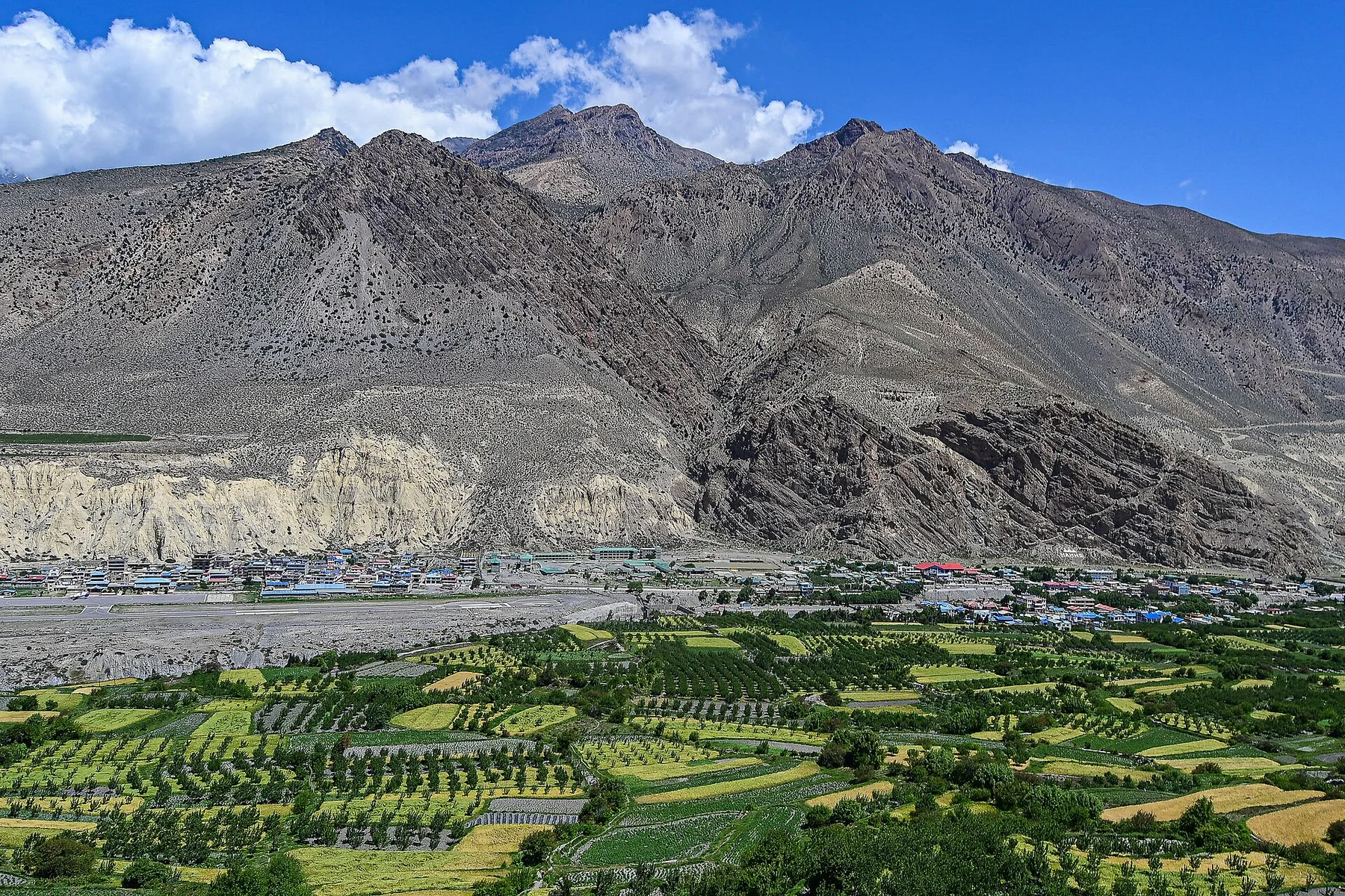
Tsum Valley branches away from the main Budhi Gandaki corridor into a high landscape of stone settlements, terraced fields, forest and Himalayan walls. The valley's relative isolation helped preserve a strong Tibetan Buddhist cultural identity, visible in monasteries, mani walls, chortens and the organisation of villages.

Visitors often encounter Tsum Valley through the idea of “Chhokang Paro”, but the destination is more than that single scene. Its landscape carries evidence of work, movement, adaptation and environmental change. A broad upper-valley settlement reveals the relationship between clustered stone houses and cultivated terraces.

Continue to practical planning
Chorten of ChuleSee the complete photo journal
Landform

The physical foundations of the place

Before roads, settlements or protected-area boundaries, the terrain of Tsum Valley set the basic terms. The lower sections are narrow and forested, while the upper valley opens toward broader high-altitude ground beneath the Ganesh Himal. Rivers, avalanche paths and glacially influenced terrain create a landscape in which cultivated areas occupy carefully selected pockets of gentler land.

Architecture at Tsum Valley responds to environment as much as style. “Chhokang Paro” makes that relationship particularly clear. A broad upper-valley settlement reveals the relationship between clustered stone houses and cultivated terraces.

Human history

How people learned to live here

At Tsum Valley, human history is written into settlement and land use rather than separated from the scenery. Villages such as Chhokang Paro and Nile combine stone houses, fields and religious structures. Monastic centres, pilgrimage traditions and local restrictions on hunting reflect a cultural relationship with the surrounding environment. Agriculture and animal husbandry remain important despite growing trekking activity.

A close look at “Mu Gompa” makes the cultural layer of Tsum Valley more concrete. A high monastery anchors the valley's Buddhist geography near the northern end of settlement. At Tsum Valley, the surviving form links present-day identity with earlier work and settlement.

Change

How access and attention changed the place

Formal protection changed how Tsum Valley was described and managed. At Tsum Valley, new boundaries, visitor rules and conservation priorities created a public identity that still has to coexist with settlements, customary use and economic pressures. At Tsum Valley, the result is not a clean break with the past because earlier routes and habits continue to organise the present landscape.

Details to read

Three details that explain the whole place

At Tsum Valley, the significance of the feature “Chhokang Paro” goes beyond its visual impact. A broad upper-valley settlement reveals the relationship between clustered stone houses and cultivated terraces. At Tsum Valley, it gives a concrete reference point for reading change rather than merely collecting viewpoints.

Start with the feature “Mu Gompa”, because it condenses a much larger part of the story of Tsum Valley. A high monastery anchors the valley's Buddhist geography near the northern end of settlement. At Tsum Valley, it gives a concrete reference point for reading change rather than merely collecting viewpoints.

At Tsum Valley, the feature “Mani walls and chortens” provides a precise clue to how the landscape works. Religious structures shape paths and village entrances throughout the inhabited landscape. At Tsum Valley, it gives a concrete reference point for reading change rather than merely collecting viewpoints.

Present day

Season, scale and the present day

At Tsum Valley, light, water and temperature reveal different structures at different times of year. Spring brings flowering forest and clearer periods between winter and monsoon. Autumn is generally associated with stable views and harvest activity. The summer monsoon affects lower approaches, while winter cold and snow strongly shape life in the upper valley.

For Tsum Valley, the main seasonal constraint is: the strongest planning window is Mar-May, Oct-Nov. For Tsum Valley, outside it, check weather, daylight, road or ferry schedules and seasonal closures before committing to a fixed route.

For Tsum Valley, one practical detail matters: opening days can be more limiting than travel time. For Tsum Valley, check the principal site first, then organise the wider route around it.

Placed within its wider geography, Tsum Valley is not an isolated exception. For Tsum Valley, the wider context shows that, tsum is part of the wider Manaslu region and historically connected through trade and pilgrimage toward Tibet. For Tsum Valley, the contrast with the main circuit valleys shows how Himalayan routes can hold distinct cultural landscapes within the same mountain system.

Travel notes

Plan your visit

Time needed
2-4 days
Getting around
Walking locally, with a car or regional transport between stops
Effort
Moderate
Plan first
Access conditions, permits or a local guide
Time of day
Morning and late afternoon
Best window
Mar-May, Oct-Nov
Traveller stories

Stories from people who have been here.

First-hand moments, practical notes and overlooked details from Tsum Valley.

Loading traveller stories…

Browse all traveller stories ↗

Keep exploring

Where next?

All place stories