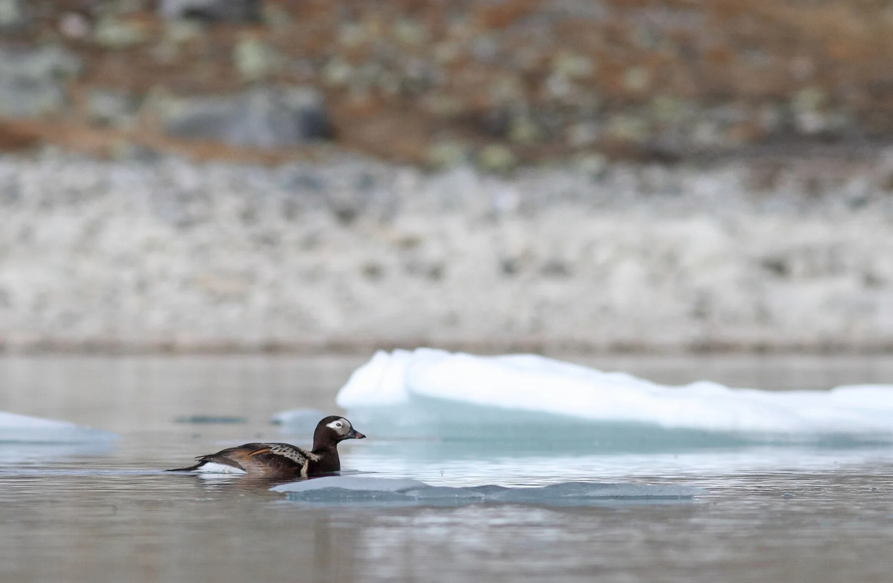
Combine a migration watch with the island street-art trail
Rare birds may arrive overnight, while murals and installations turn the compact settlement into an open-air gallery.
Plan the least frequent boat or flight first, then use the remaining time for the signature route rather than trying to collect every viewpoint.
Look a little closer
Worth discovering
The details that make Utsira different.
Photo journal
01
Utsira lighthouse
Twin historic towers stand on the island high point.
Destination view
02
Bird migration
The isolated position attracts unusual seasonal species.
Destination view
03
Street art
Murals appear across harbour and village buildings.
Photo journal
A closer look at Utsira
8 photographs
01Highland-cow-Utsira02Utsira — view 203Utsira hamn04Utsira, Norway 2021-08-06 (10)05Black Highland cow and calf at Utsira06Utsira by night07Utsira Lighthouse 08.08 2006 00308Jps - panoramio
Landscape and history
Reading the layers of Utsira
Norway's smallest municipality occupies a treeless North Sea island known for birds, lighthouses and outdoor art. Its character becomes clearer when geology, settlement and modern protection are considered together.
4 min readNorth Sea, Norway
Utsira is centred on North Sea, where norway's smallest municipality occupies a treeless North Sea island known for birds, lighthouses and outdoor art. The strongest reason to make the journey is to combine a migration watch with the island street-art trail.
The strongest visual shorthand for Utsira is the experience described as “Combine a migration watch with the island street-art trail”. Behind it lies a more complex relationship between physical processes, settlement and the modern idea of the place as a destination. Rare birds may arrive overnight, while murals and installations turn the compact settlement into an open-air gallery.
On an island, coast, altitude and exposure work together. At Utsira, the feature described as “Utsira lighthouse” shows how a short distance can separate sheltered ground from a very different ocean-facing environment. Twin historic towers stand on the island high point.
Utsira is not a uniform area. Changes in elevation, exposure, water and substrate produce distinct environments over short distances, which is why a route through the place often reveals more than a fixed viewpoint.
02
Cultural landscape
The cultural layer of the place
Utsira's exposed position made fishing, pilotage and navigation more important than farming. Archaeological finds show older occupation, while the modern settlement developed around sheltered landings and the work of guiding ships through the North Sea approaches to Haugesund.
Twin lighthouse towers were completed in the nineteenth century; one remains active and the other has become a cultural landmark. Improved harbour works and regular ferries made permanent residence more secure, while a pioneering wind-and-hydrogen demonstration in the early 2000s linked the island's weather to a new energy history.
03
Modern history
The change that redefined the place
Navigation technology first made Utsira valuable to outsiders, then renewable-energy research gave the same wind a different role. Lighthouse buildings, pilot houses, harbour walls and turbine infrastructure allow the island's economic changes to be read in a short circuit on foot.
04
On the ground
The small features that reveal the larger pattern
At Utsira, the feature “Utsira lighthouse” is best understood as part of the surrounding system rather than an isolated stop. Twin historic towers stand on the island high point. At Utsira, the detail links local scale with the wider regional pattern.
At Utsira, the feature “Bird migration” provides a precise clue to how the landscape works. The isolated position attracts unusual seasonal species. Within Utsira, the feature explains why this destination differs from nearby landscapes.
Look closely at the feature “Street art” in Utsira; it carries information that a panoramic view can miss. Murals appear across harbour and village buildings. At Utsira, the detail links local scale with the wider regional pattern.
05
Continuity
Why the landscape still feels dynamic
At Utsira, light, water and temperature reveal different structures at different times of year. For Utsira, the most reliable visiting window is May-Sep.
For Utsira, the stated visiting window is May-Sep, but its practical meaning depends on local weather, water and transport rather than the calendar alone.
Placed within its wider geography, Utsira is not an isolated exception. Beyond the best-known image of Utsira feature, Utsira matters because bird migration and street art place the destination inside a broader regional story.
Chronology
Key dates
Lighthouses established
Twin towers strengthened navigation on a hazardous North Sea route.
Harbour and ferry access improve
Engineered landings reduced the isolation imposed by swell and exposed coast.
Wind-hydrogen pilot begins
A demonstration system tested storage of local wind power as hydrogen for island electricity.
Travel notes
Plan your visit
Time needed
3-5 days
Getting around
Local transport, walking and boat or ferry connections
Effort
Easy to moderate
Plan first
Main flight or ferry, accommodation and weather backup
Time of day
Morning movement; late light for coast
Best window
May-Sep
Traveller stories
Stories from people who have been here.
First-hand moments, practical notes and overlooked details from Utsira.