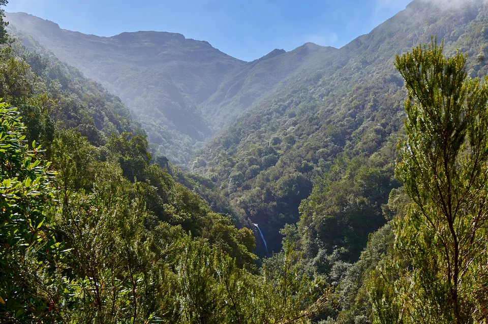
Atlantic caldera

Sete Cidades

A volcanic basin where crater lakes, cloud-softened ridges and small roads turn a compact corner of Sao Miguel into a layered Atlantic landscape.

CalderaCrater lakesAtlantic weather

Location
Azores, Portugal
Best window
Apr-Oct
Suggested stay
2-4 days
Go for
Slow volcanic wandering
The reason to go

Lagoa Azul and Lagoa Verde

The two principal lakes occupy the caldera floor and change colour with cloud, wind and the angle of the sun.

Plan the least frequent boat, ferry or exposed coastal section first. Use early or late light and keep a weather alternative during Apr-Oct.

Look a little closer

Worth discovering

The details that make Sete Cidades different.

Photo journal
01

Lagoa Azul and Lagoa Verde

The two principal lakes occupy the caldera floor and change colour with cloud, wind and the angle of the sun.

Photo journal
02

Vista do Rei ridge

High ground above the lakes opens the basin toward the Atlantic and makes the volcanic structure immediately legible.

Photo journal
03

Caldera roads

Narrow roads connect pasture, forest, viewpoints and the village, turning movement through the landscape into part of its character.

Photo journal

A closer look at Sete Cidades

14 photographs
Deep background

Sete Cidades beyond the first view

A volcanic basin where crater lakes, cloud-softened ridges and small roads turn a compact corner of Sao Miguel into a layered Atlantic landscape. This account follows the forces, communities and decisions that made the present landscape.

Sete Cidades occupies the floor and rim of a broad volcanic caldera in western Sao Miguel. Blue and green lake surfaces, pasture, forest and hydrangea-lined roads sit within the same bowl, while openings in the ridge reveal the Atlantic only a short distance away. The result is not one viewpoint but a sequence of changing scales, from sheltered village streets to exposed crater edges.

The familiar invitation at Sete Cidades is “Lagoa Azul and Lagoa Verde”, yet that image makes more sense when it is connected to the landform, the local economy and the changes that determined access. The two principal lakes occupy the caldera floor and change colour with cloud, wind and the angle of the sun.

Continue to practical planning
Lagoa Rasa (Sete Cidades) 2See the complete photo journal
Landform

The landform before the landmark

The first layer of Sete Cidades is geological and ecological rather than scenic. The caldera controls almost every visual relationship. Roads climb and descend along old volcanic slopes, cloud can erase the rim in minutes, and the lakes shift from deep blue to muted grey as light moves across the basin. Forest plantations, open grazing land and steep inner walls create a landscape that feels enclosed until the ocean suddenly appears beyond the ridge.

Relief controls far more than the view. At Sete Cidades, “Lagoa Azul and Lagoa Verde” reveals how elevation divides vegetation, weather, water and the routes available to people. The two principal lakes occupy the caldera floor and change colour with cloud, wind and the angle of the sun.

Lives and livelihoods

People, work and memory

At Sete Cidades, people learned to work with the landscape limits rather than arriving after its story was complete. The village of Sete Cidades gives the caldera a lived-in centre rather than the character of an empty scenic reserve. Houses, a church, small fields and local roads occupy the gentler ground between the lakes. Across Sao Miguel, dairy farming and settlement have long adapted to volcanic soils, frequent rain and the limited flat land available on the island.

The role of “Vista do Rei ridge” is especially revealing at Sete Cidades. High ground above the lakes opens the basin toward the Atlantic and makes the volcanic structure immediately legible. In the history of Sete Cidades, it connects the wider regional context with a specific place that can still be examined today.

Turning point

A landscape reorganised

Formal protection changed how Sete Cidades was described and managed. At Sete Cidades, new boundaries, visitor rules and conservation priorities created a public identity that still has to coexist with settlements, customary use and economic pressures. At Sete Cidades, the consequences are clearest where traditional use, protection and tourism occupy the same ground.

Field notes

Where the story becomes visible

At Sete Cidades, the significance of the feature “Lagoa Azul and Lagoa Verde” goes beyond its visual impact. The two principal lakes occupy the caldera floor and change colour with cloud, wind and the angle of the sun. For Sete Cidades, that relationship is more informative than treating the feature only as a photograph or checklist item.

At Sete Cidades, the significance of the feature “Vista do Rei ridge” goes beyond its visual impact. High ground above the lakes opens the basin toward the Atlantic and makes the volcanic structure immediately legible. For Sete Cidades, that relationship is more informative than treating the feature only as a photograph or checklist item.

Start with the feature “Caldera roads”, because it condenses a much larger part of the story of Sete Cidades. Narrow roads connect pasture, forest, viewpoints and the village, turning movement through the landscape into part of its character. Within Sete Cidades, the feature explains why this destination differs from nearby landscapes.

Season and scale

The place within its wider region

A single visit to Sete Cidades captures only one phase of its annual cycle. Spring and early summer bring fresh vegetation and flowering roadsides, while summer usually offers the clearest sequence of viewpoints. Autumn can be quieter and intensely green. Weather remains part of the experience in every season: low cloud, rain and wind often change the landscape faster than a fixed itinerary can anticipate.

For Sete Cidades, the main seasonal constraint is: the strongest planning window is Apr-Oct. For Sete Cidades, outside it, check weather, daylight, road or ferry schedules and seasonal closures before committing to a fixed route.

For Sete Cidades, one practical detail matters: cloud, wind and trail conditions can change quickly. For Sete Cidades, put the highest or most exposed stop first and keep a lower-level alternative.

Placed within its wider geography, Sete Cidades is not an isolated exception. Sete Cidades belongs to a wider island system of crater lakes, hot springs, coastal cliffs and working agricultural land. For Sete Cidades, linking the western caldera with Lagoa do Fogo, Furnas and the north coast reveals how many different landscapes can exist within one relatively small Atlantic island.

Travel notes

Plan your visit

Time needed
2-4 days
Getting around
Car to access points, then walking or hiking
Effort
Moderate
Plan first
Accommodation and seasonal transport
Time of day
Start early for clearer conditions and more time
Best window
Apr-Oct
Traveller stories

Stories from people who have been here.

First-hand moments, practical notes and overlooked details from Sete Cidades.

Loading traveller stories…

Browse all traveller stories ↗

Keep exploring

Where next?

All place stories