Dune ridges
Tall sand forms provide wide views across both the Indian Ocean and sheltered lagoon channels.
Plan the least frequent boat, ferry or exposed coastal section first. Use early or late light and keep a weather alternative during May-Nov.
Sand islands, seagrass shallows, coral reefs and coastal communities form a broad marine landscape off southern Mozambique.
Tall sand forms provide wide views across both the Indian Ocean and sheltered lagoon channels.
Plan the least frequent boat, ferry or exposed coastal section first. Use early or late light and keep a weather alternative during May-Nov.
The details that make Bazaruto Archipelago different.
Tall sand forms provide wide views across both the Indian Ocean and sheltered lagoon channels.
Shallow productive waters support dugongs, turtles and fisheries important to local communities.
Villages and boat routes reveal the archipelago as an inhabited marine landscape.
Sand islands, seagrass shallows, coral reefs and coastal communities form a broad marine landscape off southern Mozambique. The view is only the surface of a longer story of formation, use and change.
Bazaruto Archipelago is best approached through the relationship between its setting and its lived landscape. Bazaruto is a chain of sand islands and shallow waters off the Inhambane coast. High dunes rise above turquoise channels, while tidal flats and seagrass beds create a marine landscape that changes visibly through the day. The islands are connected to the mainland by boats rather than bridges.
The familiar invitation at Bazaruto Archipelago is “Dune ridges”, yet that image makes more sense when it is connected to the landform, the local economy and the changes that determined access. Tall sand forms provide wide views across both the Indian Ocean and sheltered lagoon channels.
Continue to practical planningAt Bazaruto Archipelago, the physical story begins with the structure of the ground. Wind and currents continually move sand along the archipelago. Reef, seagrass and mangrove habitats support fish, turtles and dugongs. From dune crests, the contrast between open ocean, sheltered lagoon and pale sand makes the structure of the island chain easy to read.
Because land is limited, every ridge, bay and passage acquires practical importance. At Bazaruto Archipelago, “Dune ridges” is where that compressed geography becomes easiest to read. Tall sand forms provide wide views across both the Indian Ocean and sheltered lagoon channels.
At Bazaruto Archipelago, people learned to work with the landscape limits rather than arriving after its story was complete. Communities have long depended on fishing, small-scale agriculture and marine transport. Tourism includes both luxury lodges and local boat operations, creating uneven economic relationships. Access to water, waste management and fisheries remain central issues on islands with limited infrastructure.
The role of “Seagrass habitat” is especially revealing at Bazaruto Archipelago. Shallow productive waters support dugongs, turtles and fisheries important to local communities. In the history of Bazaruto Archipelago, it connects the wider regional context with a specific place that can still be examined today.
Formal protection changed how Bazaruto Archipelago was described and managed. At Bazaruto Archipelago, new boundaries, visitor rules and conservation priorities created a public identity that still has to coexist with settlements, customary use and economic pressures. At Bazaruto Archipelago, the result is not a clean break with the past because earlier routes and habits continue to organise the present landscape.
At Bazaruto Archipelago, the feature “Dune ridges” provides a precise clue to how the landscape works. Tall sand forms provide wide views across both the Indian Ocean and sheltered lagoon channels. At Bazaruto Archipelago, it gives a concrete reference point for reading change rather than merely collecting viewpoints.
At Bazaruto Archipelago, the feature “Seagrass habitat” is best understood as part of the surrounding system rather than an isolated stop. Shallow productive waters support dugongs, turtles and fisheries important to local communities. Within Bazaruto Archipelago, it is both an attraction and a record of the processes described above.
At Bazaruto Archipelago, the feature “Island settlements” provides a precise clue to how the landscape works. Villages and boat routes reveal the archipelago as an inhabited marine landscape. Within Bazaruto Archipelago, the feature explains why this destination differs from nearby landscapes.
A single visit to Bazaruto Archipelago captures only one phase of its annual cycle. The dry season brings milder temperatures and generally calmer travel conditions. Summer is hotter, wetter and includes cyclone risk. Tides influence beaches, channels and boat access throughout the year, so the same coast can look very different within a few hours.
For Bazaruto Archipelago, the main seasonal constraint is: the strongest planning window is May-Nov. For Bazaruto Archipelago, outside it, check weather, daylight, road or ferry schedules and seasonal closures before committing to a fixed route.
For Bazaruto Archipelago, one practical detail matters: ferries, tunnels and weather can change the order of the day. For Bazaruto Archipelago, build the route around the least frequent connection, not the closest viewpoint.
Placed within its wider geography, Bazaruto Archipelago is not an isolated exception. For Bazaruto Archipelago, the wider context shows that, the archipelago should be understood as a working seascape rather than an empty resort setting. For Bazaruto Archipelago, conservation of dugongs and reefs depends on regional fisheries, community participation and the health of mainland coastal systems as well as protected water around the islands.
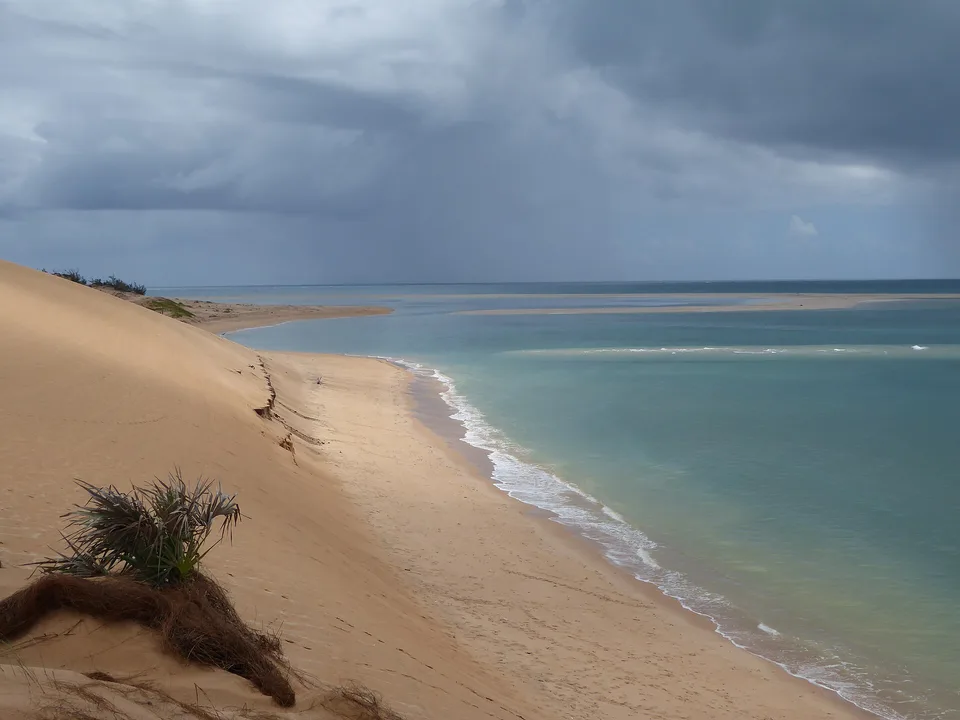
High dunes, freshwater lakes and broad sand flats create a quieter island inside the Bazaruto Archipelago.
Explore this place
A small island of coral-stone ruins, mangroves, silversmith traditions and tidal streets within northern Mozambique's Quirimbas Archipelago.
Explore this place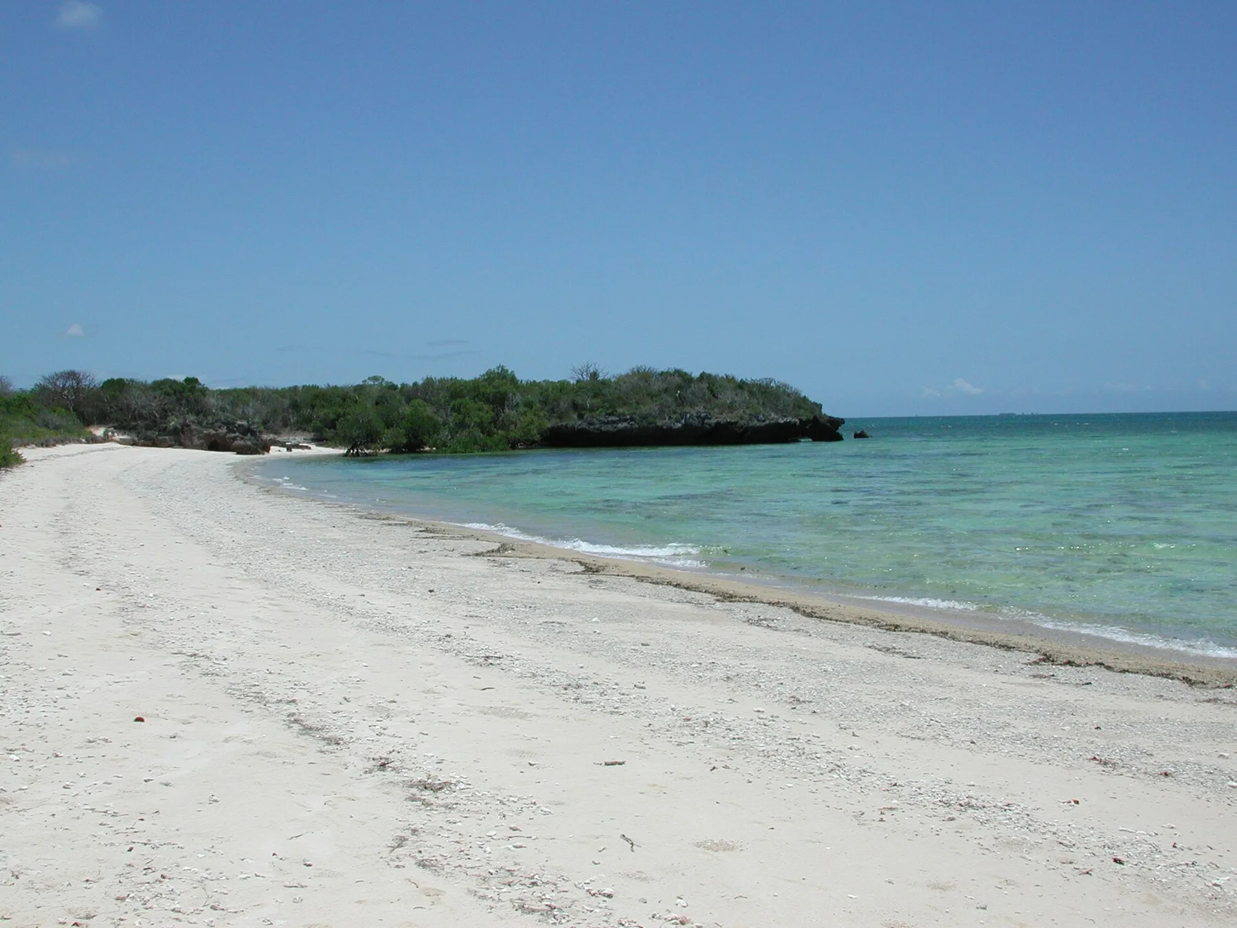
Coral islands, mangroves, tidal flats and Swahili settlements stretch along the far northern coast of Mozambique.
Explore this place