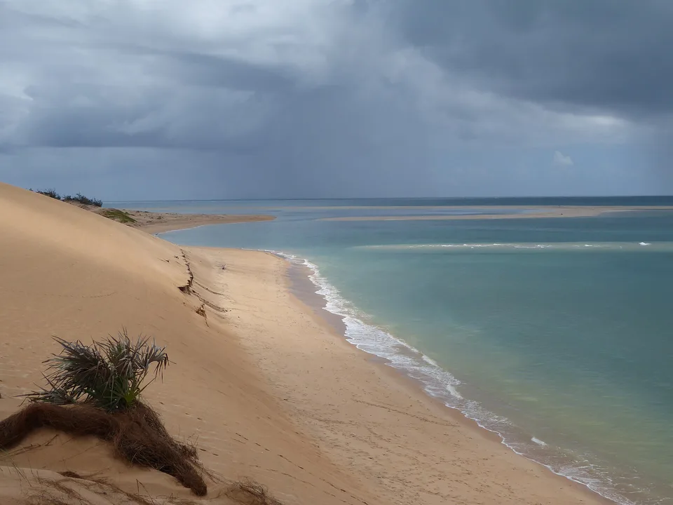
Coral stone in the Quirimbas

Ibo Island

A small island of coral-stone ruins, mangroves, silversmith traditions and tidal streets within northern Mozambique's Quirimbas Archipelago.

Island historyMangrovesSwahili coast

Location
Quirimbas Archipelago, Mozambique
Best window
May-Oct
Suggested stay
3-5 days
Go for
Tidal history and slow streets
The reason to go

A trading island where the tide sets the pace

Ibo's forts and old houses carry Indian Ocean history, but the island remains most vivid through present-day fishing, craft, footpaths and boat links across the mangroves.

Stay long enough to connect Ibo Island's headline landscape with one quieter local route rather than treating it as a single viewpoint.

Look a little closer

Worth discovering

The details that make Ibo Island different.

Destination view
01

A town built from coral stone

Historic houses, warehouses and fortifications used local coral materials and reflect centuries of coastal exchange.

Destination view
02

Silversmith continuity

Local artisans maintain a metalworking tradition associated with the island's long commercial networks.

Destination view
03

Roads that become tidal edges

Shallow water, mudflats and mangrove channels determine when and how boats, people and goods move.

Photo journal

A closer look at Ibo Island

4 photographs
The full story

Ibo Island: land, people and change

A small island of coral-stone ruins, mangroves, silversmith traditions and tidal streets within northern Mozambique's Quirimbas Archipelago. Its character becomes clearer when geology, settlement and modern protection are considered together.

Ibo Island is best approached through the relationship between its setting and its lived landscape. Ibo's forts and old houses carry Indian Ocean history, but the island remains most vivid through present-day fishing, craft, footpaths and boat links across the mangroves.

Many visits to Ibo Island begin with the experience described as “Tidal history and slow streets”. The more revealing question is why it exists here, how people used the surrounding ground and what remains visible from earlier phases. At Ibo Island, allow enough time to connect Ibo Island's headline landscape with one quieter local route instead of reducing Ibo Island to a single viewpoint.

Continue to practical planning
Îles Quirimba, Ibo et MatemoSee the complete photo journal
Physical setting

The physical foundations of the place

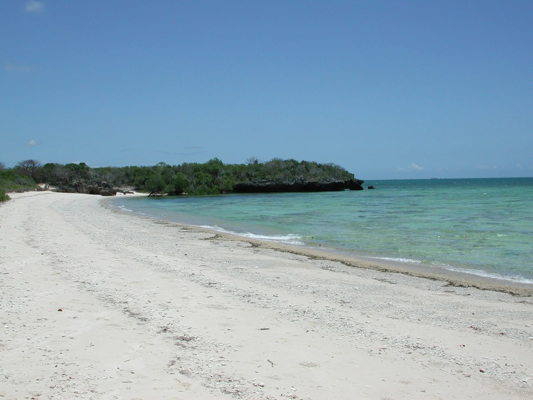
Understanding Ibo Island starts below the visible surface. Low coral islands, mangrove channels, sandbanks and warm shallow sea surround a settlement where built heritage and tidal ecology are inseparable.

On an island, coast, altitude and exposure work together. At Ibo Island, the feature described as “A town built from coral stone” shows how a short distance can separate sheltered ground from a very different ocean-facing environment. Historic houses, warehouses and fortifications used local coral materials and reflect centuries of coastal exchange.

Lives and livelihoods

The cultural layer of the place

Ibo grew within Indian Ocean trade linking the Swahili coast, Arabia, India and the African interior. Muslim merchants, Makua communities and Portuguese authorities used the island's harbour for ivory, gold, cloth and enslaved people, giving the small settlement an importance far beyond its land area.

The Portuguese established forts and made Ibo the colonial capital of Cabo Delgado in the eighteenth century. Stone houses, warehouses and Fort Sao Joao Baptista date from the period when the island controlled northern Mozambican trade. The administrative centre later moved to Pemba, and many buildings declined as shipping patterns changed.

Modern history

The modern turning point

Creation of Quirimbas National Park in 2002 placed Ibo inside a conservation and tourism framework, while conflict in northern Mozambique again disrupted access and livelihoods. The island's streets therefore record Swahili, colonial, slave-trade and postcolonial histories in the same urban fabric.

Details to read

The small features that reveal the larger pattern

At Ibo Island, the feature “A town built from coral stone” provides a precise clue to how the landscape works. Historic houses, warehouses and fortifications used local coral materials and reflect centuries of coastal exchange. At Ibo Island, it gives a concrete reference point for reading change rather than merely collecting viewpoints.

At Ibo Island, the feature “Silversmith continuity” provides a precise clue to how the landscape works. Local artisans maintain a metalworking tradition associated with the island's long commercial networks. At Ibo Island, it gives a concrete reference point for reading change rather than merely collecting viewpoints.

Look closely at the feature “Roads that become tidal edges” in Ibo Island; it carries information that a panoramic view can miss. Shallow water, mudflats and mangrove channels determine when and how boats, people and goods move. At Ibo Island, the detail links local scale with the wider regional pattern.
Present day

The current chapter

At Ibo Island, light, water and temperature reveal different structures at different times of year. The dry season offers cooler weather and more reliable access. Cyclone risk and heavy rain rise during the warmer wet months.

For Ibo Island, the most useful time of day is: late afternoon among the old streets.

For Ibo Island, plan this first: current regional security and transfers.

Placed within its wider geography, Ibo Island is not an isolated exception. For Ibo Island, the wider context shows that, other Quirimbas islands and the mainland coast reveal marine reserves, fishing communities and a broader Swahili-linked history.

Chronology

Key dates

  1. Swahili Indian Ocean port

    Local and Muslim trading communities linked the Quirimbas with regional sea routes.

  2. Colonial capital and fortified trade

    Portuguese forts and stone town developed as Ibo administered Cabo Delgado and its commerce.

  3. Quirimbas National Park

    The island entered a large protected area combining marine ecosystems, settlements and cultural heritage.

In context

Get to know the place

The landscape

Low coral islands, mangrove channels, sandbanks and warm shallow sea surround a settlement where built heritage and tidal ecology are inseparable.

People and place

Makua, Mwani, Arab, Indian and Portuguese influences overlap in the island's language, food, architecture and religious life.

Seasonal character

The dry season offers cooler weather and more reliable access. Cyclone risk and heavy rain rise during the warmer wet months.

Beyond the main view

Other Quirimbas islands and the mainland coast reveal marine reserves, fishing communities and a broader Swahili-linked history.

Travel notes

Plan your visit

Time needed
3-5 days
Getting around
Flight or road, then boat and walking
Effort
Easy
Plan first
Current regional security and transfers
Time of day
Late afternoon among the old streets
Best window
May-Oct
Keep exploring

Where next?

All place stories