Northern Mozambique archipelago

Quirimbas Archipelago

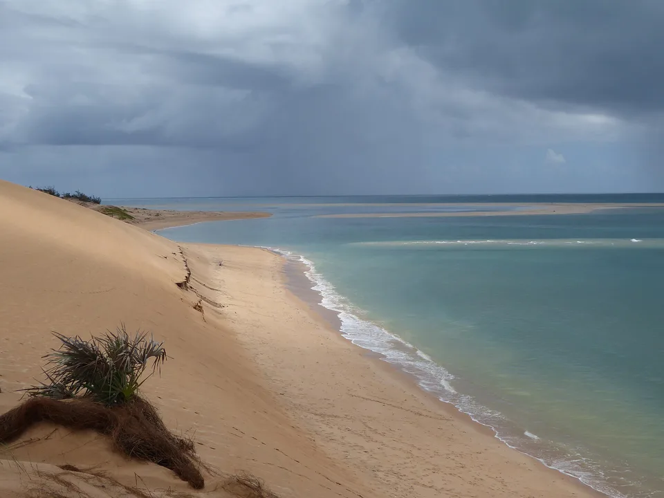
Coral islands, mangroves, tidal flats and Swahili settlements stretch along the far northern coast of Mozambique.

Coral islandsMangrovesSwahili heritage

Location
Cabo Delgado, Mozambique
Best window
May-Oct
Suggested stay
3-5 days
Go for
Island, reef and coastal heritage
The reason to go

Ibo Island

Stone buildings, mangroves and working harbour life create the clearest historical centre of the archipelago.

Plan the least frequent boat, ferry or exposed coastal section first. Use early or late light and keep a weather alternative during May-Oct.

Look a little closer

Worth discovering

The details that make Quirimbas Archipelago different.

Photo journal
01

Ibo Island

Stone buildings, mangroves and working harbour life create the clearest historical centre of the archipelago.

Photo journal
02

Outer coral islands

Reefs and pale sand show the exposed ocean side of the island chain.

Destination view
03

Mangrove channels

Tidal waterways reveal the productive sheltered landscape between islands and mainland.

Photo journal

A closer look at Quirimbas Archipelago

9 photographs
The full story

Quirimbas Archipelago: land, people and change

Coral islands, mangroves, tidal flats and Swahili settlements stretch along the far northern coast of Mozambique. The view is only the surface of a longer story of formation, use and change.

Quirimbas Archipelago is best approached through the relationship between its setting and its lived landscape. The Quirimbas form a long chain of islands and coastal habitats in northern Mozambique. Coral reefs, mangrove channels, sand flats and low wooded islands create a landscape governed by tides and boat access. Some islands are inhabited, while others remain largely undeveloped.

The familiar invitation at Quirimbas Archipelago is “Ibo Island”, yet that image makes more sense when it is connected to the landform, the local economy and the changes that determined access. Stone buildings, mangroves and working harbour life create the clearest historical centre of the archipelago.

Continue to practical planning
Quirimbas Fisherman on dhow safariSee the complete photo journal
Physical setting

Why the terrain has this form

The first layer of Quirimbas Archipelago is geological and ecological rather than scenic. The outer edge faces the Indian Ocean, while inner channels are more sheltered and muddy. Tidal range exposes broad flats and changes the shape of harbours through the day. Mangroves connect island ecology with mainland estuaries.

The map understates the role of the sea. At Quirimbas Archipelago, “Ibo Island” makes clear that water is both a boundary and the route through which settlements, wildlife and outside connections developed. Stone buildings, mangroves and working harbour life create the clearest historical centre of the archipelago.

Cultural landscape

How people learned to live here

The cultural layer of Quirimbas Archipelago is easiest to read in homes, fields, paths and local institutions. Fishing communities, Swahili trading history and the stone architecture of Ibo give the archipelago a strong cultural identity. Contemporary access is affected by regional security and infrastructure, so current official advice and local arrangements are essential before any travel.

At Quirimbas Archipelago, “Outer coral islands” should not be treated as a decorative detail. Reefs and pale sand show the exposed ocean side of the island chain. The feature records how construction, movement or livelihood adapted to local conditions at Quirimbas Archipelago.

Reorganisation

A landscape reorganised

Political change left a physical imprint on Quirimbas Archipelago. At Quirimbas Archipelago, borders, conflict or population movement altered settlement and access, so the quieter landscape visible today should not be mistaken for one that was always empty. At Quirimbas Archipelago, that transition remains visible in the contrast between older working features and visitor infrastructure.

On the ground

What to read in the landscape

At Quirimbas Archipelago, the significance of the feature “Ibo Island” goes beyond its visual impact. Stone buildings, mangroves and working harbour life create the clearest historical centre of the archipelago. Within Quirimbas Archipelago, it is both an attraction and a record of the processes described above.

At Quirimbas Archipelago, the feature “Outer coral islands” is one of the most useful pieces of visible evidence. Reefs and pale sand show the exposed ocean side of the island chain. Within Quirimbas Archipelago, it is both an attraction and a record of the processes described above.

At Quirimbas Archipelago, the significance of the feature “Mangrove channels” goes beyond its visual impact. Tidal waterways reveal the productive sheltered landscape between islands and mainland. At Quirimbas Archipelago, it gives a concrete reference point for reading change rather than merely collecting viewpoints.

Living landscape

What continues to change

Quirimbas Archipelago changes through the year because weather and biological cycles rearrange what can be seen and used. The drier, cooler months generally bring calmer conditions and lower humidity. Cyclone risk and heavy rain affect the warmer season. Tides remain a daily planning factor regardless of month.

For Quirimbas Archipelago, the main seasonal constraint is: the strongest planning window is May-Oct. For Quirimbas Archipelago, outside it, check weather, daylight, road or ferry schedules and seasonal closures before committing to a fixed route.

For Quirimbas Archipelago, one practical detail matters: ferries, tunnels and weather can change the order of the day. For Quirimbas Archipelago, build the route around the least frequent connection, not the closest viewpoint.

Placed within its wider geography, Quirimbas Archipelago is not an isolated exception. For Quirimbas Archipelago, the wider context shows that, the archipelago belongs to a wider East African coastal world extending toward Tanzania and the Mozambique Channel. For Quirimbas Archipelago, its significance lies in the combination of marine habitat, living communities and historic trade routes.

Travel notes

Plan your visit

Time needed
3-5 days
Getting around
Car or local transport, plus ferries or boats and short walks
Effort
Moderate
Plan first
Main transport and accommodation
Time of day
Early morning and late afternoon
Best window
May-Oct
Traveller stories

Stories from people who have been here.

First-hand moments, practical notes and overlooked details from Quirimbas Archipelago.

Loading traveller stories…

Browse all traveller stories ↗

Keep exploring

Where next?

All place stories