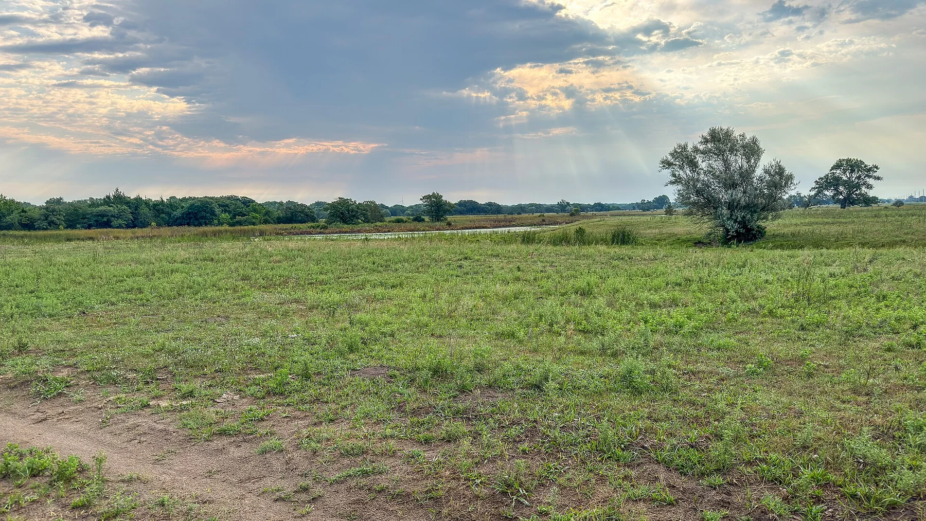
Early light reveals the rolling relief and makes the grassland feel far larger than it appears at midday.
Use sunrise or the final two hours of light, when relief, wildlife and grass colour become much easier to read.
Look a little closer
Worth discovering
The details that make Flint Hills different.
Destination view
01
Konza Prairie
Research land and trails protect representative tallgrass habitat.
Photo journal
02
Scenic Byway
A slow road follows ranchland and limestone ridges.
Destination view
03
Spring burns
Managed fire renews the prairie and changes its colour dramatically.
Photo journal
A closer look at Flint Hills
10 photographs
01Wabaunsee County View02Flint Hills P530039503Flint Hills — view 304Tgpnp05Flint Hills — view 506Marion Reservoir, Kansas (14475174586)07Konza108Flint Hills Scenic Byway - Strong City Kiosk09Cottonwood Limestone, less weathered10Teter Rock
Deep background
The making of Flint Hills
Long grassy ridges, limestone shelves and ranch roads form the largest continuous tallgrass region in North America. Its character becomes clearer when geology, settlement and modern protection are considered together.
4 min readEastern Kansas, United States
Flint Hills is centred on Eastern Kansas, where long grassy ridges, limestone shelves and ranch roads form the largest continuous tallgrass region in North America. The strongest reason to make the journey is to see the prairie at dawn from konza ridge.
The familiar invitation at Flint Hills is “See the prairie at dawn from Konza Ridge”, yet that image makes more sense when it is connected to the landform, the local economy and the changes that determined access. Early light reveals the rolling relief and makes the grassland feel far larger than it appears at midday.
The first layer of Flint Hills is geological and ecological rather than scenic. The terrain is subtle rather than flat: long ridges, coulees, dunes and river breaks become visible with low light and slow travel. Wildlife often provides the main sense of scale.
Relief controls far more than the view. At Flint Hills, “Konza Prairie” reveals how elevation divides vegetation, weather, water and the routes available to people. Research land and trails protect representative tallgrass habitat.
02
Settlement and memory
The human landscape behind the scenery
The Flint Hills are the largest surviving expanse of tallgrass prairie because cherty limestone limited plough agriculture. Kanza and Osage peoples managed and travelled through these grasslands before forced removal and settler occupation.
Railroads turned the region into a major seasonal cattle-grazing area. Ranchers continued spring burning, adapting an older ecological process to livestock production and preserving open prairie where cropland spread elsewhere.
03
Modern history
What altered the old balance
Modern conservation relies on cooperation and conflict among ranchers, land trusts, Indigenous nations and scientists. Fire suppression, invasive plants and wind-energy development now shape debates over a landscape that only appears timeless.
04
On the ground
The evidence still visible on the ground
At Flint Hills, the feature “Konza Prairie” provides a precise clue to how the landscape works. Research land and trails protect representative tallgrass habitat. Its position and condition at Flint Hills connect physical history with the way people use the place now.
Look closely at the feature “Scenic Byway” in Flint Hills; it carries information that a panoramic view can miss. A slow road follows ranchland and limestone ridges. Within Flint Hills, it is both an attraction and a record of the processes described above.
At Flint Hills, the significance of the feature “Spring burns” goes beyond its visual impact. Managed fire renews the prairie and changes its colour dramatically. Within Flint Hills, it is both an attraction and a record of the processes described above.
05
Present day
What continues to change
A single visit to Flint Hills captures only one phase of its annual cycle. For Flint Hills, the most reliable visiting window is Apr-Oct.
For Flint Hills, the stated visiting window is Apr-Oct, but its practical meaning depends on local weather, water and transport rather than the calendar alone.
Placed within its wider geography, Flint Hills is not an isolated exception. Beyond the best-known image of Flint Hills feature, Flint Hills matters because scenic byway and spring burns place the destination inside a broader regional story.
Chronology
Key dates
Fire and bison prairie
Indigenous burning and migratory herds maintained open tallgrass habitat.
Rail-fed cattle economy
Texas cattle and eastern markets made the hills a major grazing region.
Landscape-scale conservation
Preserves and private easements protected grassland while ranching continued.
Travel notes
Plan your visit
Time needed
2-3 days
Getting around
Car, scenic roads and walking trails
Effort
Easy to moderate
Plan first
Accommodation, fuel and wildlife conditions
Time of day
Sunrise and the final hours of light
Best window
Apr-Oct
Traveller stories
Stories from people who have been here.
First-hand moments, practical notes and overlooked details from Flint Hills.