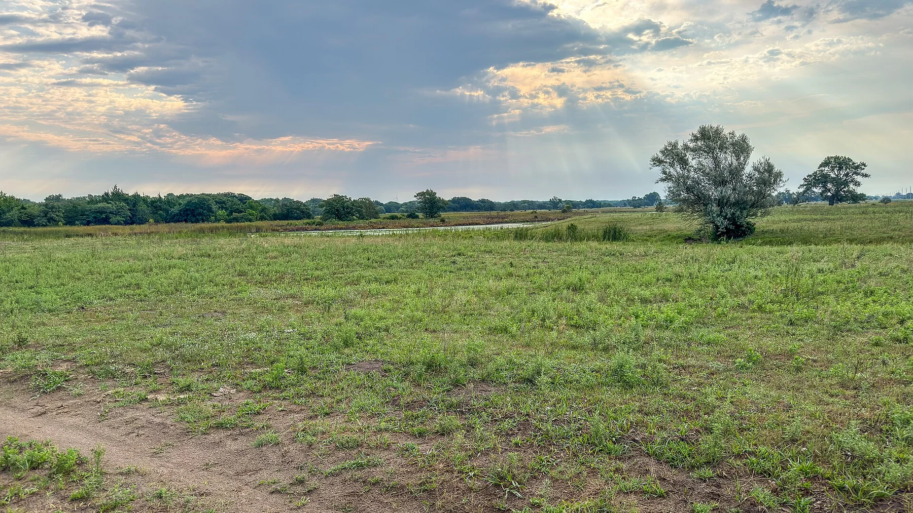
The trail links badland ridges, river bottoms and working ranch country over a distance that reveals the landscape better than a scenic pullout.
Use sunrise or the final two hours of light, when relief, wildlife and grass colour become much easier to read.
Look a little closer
Worth discovering
The details that make Little Missouri National Grassland different.
Photo journal
01
Maah Daah Hey Trail
A long route crosses public grassland and badlands.
Destination view
02
Burning Coal Vein area
Subsurface coal fires altered parts of the terrain.
Destination view
03
Little Missouri breaks
Eroded valleys create a maze of ridges and coulees.
Photo journal
A closer look at Little Missouri National Grassland
8 photographs
01Maah Daah Hey Trail Marker, Little Missouri National Grassland, North Dakota (51916069563)02Little Missouri National Grassland — view 203Maah Daah Hey Trail, Little Missouri National Grassland, North DakotaNorth Dakota (51915961146)04Cottonwood Creek, Maah Daah Hey Trail, McKenzie Ranger District, Little Missouri National Grassland, Region 1 (52339112839)05Badlands of the Little Missouri National Grassland, Dakota Prairie Grasslands, North Dakota (51899896319)06Autumn Trees in the Badlands, Dakota PRairei Grasslands, Little Missouri National Grassland, Northern Region (52424972902)07Grasslands (20230730-FS-CK-002)08Buffalo Gap Trailhead Sign, Little Missouri National Grassland, North Dakota (51916070478)
The full story
What made Little Missouri National Grassland distinctive
Badlands, open range and long-distance trails spread beyond the boundaries of Theodore Roosevelt National Park. The view is only the surface of a longer story of formation, use and change.
4 min readWestern North Dakota, United States
Little Missouri National Grassland is centred on Western North Dakota, where badlands, open range and long-distance trails spread beyond the boundaries of Theodore Roosevelt National Park. The strongest reason to make the journey is to ride or hike a section of the maah daah hey trail.
Many visits to Little Missouri National Grassland begin with the experience described as “Ride or hike a section of the Maah Daah Hey Trail”. The more revealing question is why it exists here, how people used the surrounding ground and what remains visible from earlier phases. The trail links badland ridges, river bottoms and working ranch country over a distance that reveals the landscape better than a scenic pullout.
Cottonwood Creek, Maah Daah Hey Trail, McKenzie Ranger District, Little Missouri National Grassland, Region 1 (52339112839)See the complete photo journal
01
Physical setting
The forces behind the first impression
Understanding Little Missouri National Grassland starts below the visible surface. The terrain is subtle rather than flat: long ridges, coulees, dunes and river breaks become visible with low light and slow travel. Wildlife often provides the main sense of scale.
Altitude turns distance into effort and creates abrupt ecological boundaries. At Little Missouri National Grassland, “Maah Daah Hey Trail” provides a useful reference point for understanding that vertical structure. A long route crosses public grassland and badlands.
02
Human history
Routes, livelihoods and belonging
The Little Missouri badlands were used by Indigenous nations and later absorbed into open-range ranching. Homesteaders attempted farming on dry, erosion-prone soils, but drought and the Depression forced many families from marginal land.
The federal government acquired failed farms under New Deal land programmes in the 1930s. These scattered parcels were reorganised into a national grassland in 1960, creating a public landscape from the aftermath of settlement failure.
03
Turning point
A landscape reorganised
Today grazing leases, oil development, recreation and wildlife habitat overlap across a patchwork of public and private property. The grassland is therefore a product of policy repair, not untouched prairie.
04
On the ground
Three details that explain the whole place
At Little Missouri National Grassland, the feature “Maah Daah Hey Trail” is best understood as part of the surrounding system rather than an isolated stop. A long route crosses public grassland and badlands. Within Little Missouri National Grassland, it is both an attraction and a record of the processes described above.
At Little Missouri National Grassland, the feature “Burning Coal Vein area” is best understood as part of the surrounding system rather than an isolated stop. Subsurface coal fires altered parts of the terrain. Within Little Missouri National Grassland, it is both an attraction and a record of the processes described above.
At Little Missouri National Grassland, the significance of the feature “Little Missouri breaks” goes beyond its visual impact. Eroded valleys create a maze of ridges and coulees. At Little Missouri National Grassland, the detail links local scale with the wider regional pattern.
05
Season and scale
Season, scale and the present day
A single visit to Little Missouri National Grassland captures only one phase of its annual cycle. For Little Missouri National Grassland, the most reliable visiting window is May-Oct.
For Little Missouri National Grassland, the stated visiting window is May-Oct, but its practical meaning depends on local weather, water and transport rather than the calendar alone.
Placed within its wider geography, Little Missouri National Grassland is not an isolated exception. Beyond the best-known image of Little Missouri National Grassland feature, Little Missouri National Grassland matters because burning coal vein area and little missouri breaks place the destination inside a broader regional story.
Chronology
Key dates
Ranching frontier
Cattle operations entered former bison range along the Little Missouri.
Drought and federal land purchase
Failed homesteads were acquired during New Deal relief programmes.
National grassland designated
The recovered parcels became part of a managed public-land system.
Travel notes
Plan your visit
Time needed
2-3 days
Getting around
Car, scenic roads and walking trails
Effort
Easy to moderate
Plan first
Accommodation, fuel and wildlife conditions
Time of day
Sunrise and the final hours of light
Best window
May-Oct
Traveller stories
Stories from people who have been here.
First-hand moments, practical notes and overlooked details from Little Missouri National Grassland.