Ridge between seas

Karpathos

A long Aegean island where high mountains separate beach towns from northern villages with distinctive architecture and strong local traditions.

Aegean mountainsNorthern villagesWind-shaped coast

Location
Dodecanese, Greece
Best window
Apr-Oct
Suggested stay
3-5 days
Go for
Mountain island circuit
The reason to go

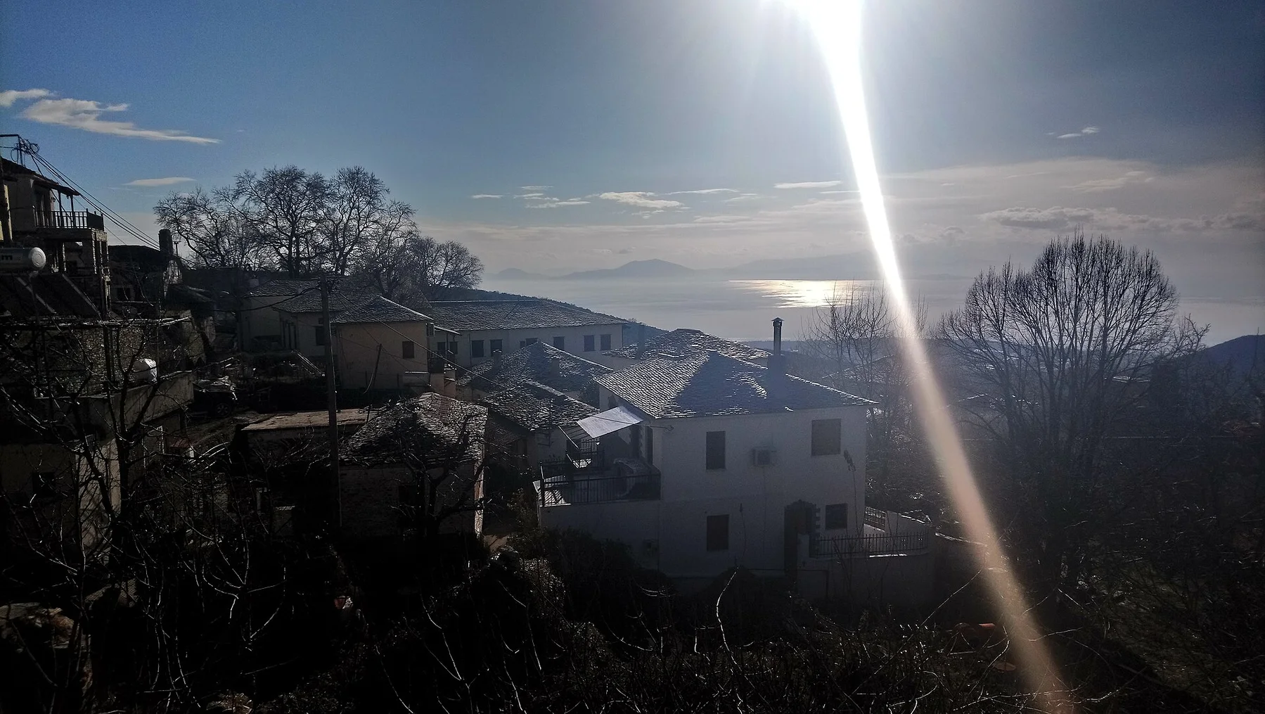
Olympos

A mountain village of narrow lanes and layered houses positioned dramatically above the northern coast.

Plan the least frequent boat, ferry or exposed coastal section first. Use early or late light and keep a weather alternative during Apr-Oct.

Look a little closer

Worth discovering

The details that make Karpathos different.

Photo journal
01

Olympos

A mountain village of narrow lanes and layered houses positioned dramatically above the northern coast.

Destination view
02

Central ridge

Mountain roads reveal both coasts and explain why communities developed with strong local identities.

Destination view
03

Southern bays

A sequence of beaches and wind-exposed waters provides a different landscape from the villages of the north.

Photo journal

A closer look at Karpathos

13 photographs
Deep background

Karpathos beyond the first view

A long Aegean island where high mountains separate beach towns from northern villages with distinctive architecture and strong local traditions. The view is only the surface of a longer story of formation, use and change.

Karpathos lies between Crete and Rhodes, stretched along a mountainous spine that divides its eastern and western coasts. The southern part contains the main port and many beaches, while the north becomes rougher and more isolated. Olympos and nearby villages preserve a distinctive built landscape high above the sea.

The strongest visual shorthand for Karpathos is the experience described as “Olympos”. Behind it lies a more complex relationship between physical processes, settlement and the modern idea of the place as a destination. A mountain village of narrow lanes and layered houses positioned dramatically above the northern coast.

Continue to practical planning
Dodekanese,Karpathos island,nothern partSee the complete photo journal
Landform

The physical foundations of the place

At Karpathos, the physical story begins with the structure of the ground. Steep ridges descend into coves, exposed headlands and small coastal plains. Strong summer winds shape vegetation and make the island popular for wind-based sports in the south. In the north, the terrain narrows roads and preserves long views over both sides of the island.

The map understates the role of the sea. At Karpathos, “Olympos” makes clear that water is both a boundary and the route through which settlements, wildlife and outside connections developed. A mountain village of narrow lanes and layered houses positioned dramatically above the northern coast.

Lives and livelihoods

How people learned to live here

The cultural layer of Karpathos is easiest to read in homes, fields, paths and local institutions. Pigadia is the transport and commercial centre, but the island's cultural identity is especially visible in Olympos, Diafani and mountain settlements. Architecture, music, clothing and local celebrations retain regional distinctions. Emigration and return have also shaped homes and family connections across the island.

At Karpathos, the feature described as “Central ridge” offers a second line of evidence. Mountain roads reveal both coasts and explain why communities developed with strong local identities. Within Karpathos, it shows how local knowledge and practical use became embedded in the landscape.

Modern history

The transition visible today

Formal protection changed how Karpathos was described and managed. At Karpathos, new boundaries, visitor rules and conservation priorities created a public identity that still has to coexist with settlements, customary use and economic pressures. At Karpathos, the current visitor experience is the newest layer rather than the whole history.

Field notes

What to read in the landscape

At Karpathos, the feature “Olympos” provides a precise clue to how the landscape works. A mountain village of narrow lanes and layered houses positioned dramatically above the northern coast. Its position and condition at Karpathos connect physical history with the way people use the place now.

At Karpathos, the feature “Central ridge” provides a precise clue to how the landscape works. Mountain roads reveal both coasts and explain why communities developed with strong local identities. At Karpathos, the detail links local scale with the wider regional pattern.

At Karpathos, the feature “Southern bays” is best understood as part of the surrounding system rather than an isolated stop. A sequence of beaches and wind-exposed waters provides a different landscape from the villages of the north. Its position and condition at Karpathos connect physical history with the way people use the place now.

Present day

The current chapter

At Karpathos, light, water and temperature reveal different structures at different times of year. Late spring is suitable for walking and village exploration before the strongest heat. Summer brings reliable ferry and flight connections, active beaches and frequent wind. September remains warm, while October begins to reduce services and makes travel planning more dependent on weather.

For Karpathos, the main seasonal constraint is: the strongest planning window is Apr-Oct. For Karpathos, outside it, check weather, daylight, road or ferry schedules and seasonal closures before committing to a fixed route.

For Karpathos, one practical detail matters: distances, fuel, food and mobile coverage can be less predictable than the map suggests. For Karpathos, carry offline maps and keep a margin in the schedule.

Placed within its wider geography, Karpathos is not an isolated exception. Karpathos can be explored as several connected landscapes rather than one resort island: southern beaches, the central mountains and the northern village world. For Karpathos, the small island of Saria beyond the northern tip adds a further layer of coastal and archaeological interest.
Travel notes

Plan your visit

Time needed
3-5 days
Getting around
Car to access points, then walking or hiking
Effort
Moderate to demanding
Plan first
Main transport and accommodation
Time of day
Start early for clearer conditions and more time
Best window
Apr-Oct
Traveller stories

Stories from people who have been here.

First-hand moments, practical notes and overlooked details from Karpathos.

Loading traveller stories…

Browse all traveller stories ↗

Keep exploring

Where next?

All place stories