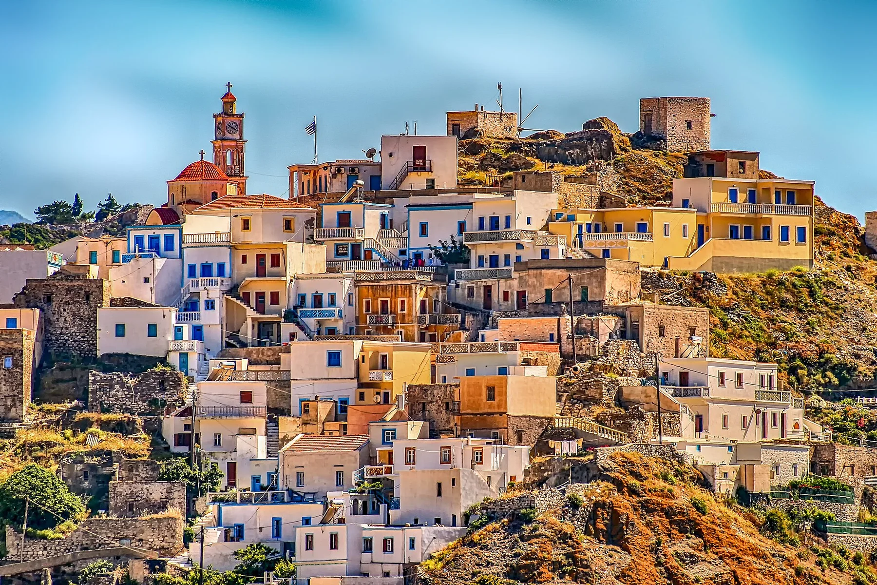
Mountain meeting the Aegean

Pelion Peninsula

Forested mountain villages descend toward small Aegean coves on a peninsula where stone paths, orchards and sea views remain closely connected.

Stone villagesChestnut forestAegean coves

Location
Thessaly, Greece
Best window
Apr-Jun, Sep-Oct
Suggested stay
2-4 days
Go for
Mountain villages and sea
The reason to go

Tsagarada and the eastern slopes

Large plane trees, stone paths and steep forested ground lead toward some of the peninsula most dramatic coves.

Plan the least frequent boat, ferry or exposed coastal section first. Use early or late light and keep a weather alternative during Apr-Jun, Sep-Oct.

Look a little closer

Worth discovering

The details that make Pelion Peninsula different.

Destination view
01

Tsagarada and the eastern slopes

Large plane trees, stone paths and steep forested ground lead toward some of the peninsula most dramatic coves.

Destination view
02

Milies railway landscape

Historic transport, orchards and village architecture show how the mountain was connected before modern roads.

Destination view
03

Damouchari coast

A compact harbour and rocky shoreline provide a clear transition between village life and the open Aegean.

Photo journal

A closer look at Pelion Peninsula

7 photographs
Deep background

A deeper history of Pelion Peninsula

Forested mountain villages descend toward small Aegean coves on a peninsula where stone paths, orchards and sea views remain closely connected. The view is only the surface of a longer story of formation, use and change.

Pelion Peninsula is best approached through the relationship between its setting and its lived landscape. Pelion forms a long, mountainous peninsula between the Pagasetic Gulf and the open Aegean. Its villages occupy shaded slopes and ridges, while roads and old paths descend through orchards and forest toward beaches. The close distance between mountain interior and coast gives the peninsula its distinctive rhythm.

The strongest visual shorthand for Pelion Peninsula is the experience described as “Tsagarada and the eastern slopes”. Behind it lies a more complex relationship between physical processes, settlement and the modern idea of the place as a destination. Large plane trees, stone paths and steep forested ground lead toward some of the peninsula most dramatic coves.

Continue to practical planning
Fakistra beach PelionSee the complete photo journal
Landform

The physical foundations of the place

Understanding Pelion Peninsula starts below the visible surface. The western side generally feels calmer and more sheltered, while the eastern coast is steeper and more exposed to Aegean weather. Chestnut, beech and plane trees cover much of the higher ground, with olive groves and fruit cultivation appearing lower down. Stone bridges and paths reveal older ways of crossing the terrain.

The map understates the role of the sea. At Pelion Peninsula, “Tsagarada and the eastern slopes” makes clear that water is both a boundary and the route through which settlements, wildlife and outside connections developed. Large plane trees, stone paths and steep forested ground lead toward some of the peninsula most dramatic coves.

Lives and livelihoods

Lives shaped by the terrain

The cultural layer of Pelion Peninsula is easiest to read in homes, fields, paths and local institutions. Villages such as Makrinitsa, Tsagarada and Milies retain strong architectural identities built around stone houses, shaded squares and local water. Agriculture, seasonal tourism and connections to nearby Volos shape contemporary life, but settlement remains dispersed across many separate communities.

At Pelion Peninsula, “Milies railway landscape” should not be treated as a decorative detail. Historic transport, orchards and village architecture show how the mountain was connected before modern roads. The feature records how construction, movement or livelihood adapted to local conditions at Pelion Peninsula.

Reorganisation

How access and attention changed the place

Formal protection changed how Pelion Peninsula was described and managed. At Pelion Peninsula, new boundaries, visitor rules and conservation priorities created a public identity that still has to coexist with settlements, customary use and economic pressures. At Pelion Peninsula, the result is not a clean break with the past because earlier routes and habits continue to organise the present landscape.

On the ground

Landmarks that carry the deeper story

At Pelion Peninsula, the significance of the feature “Tsagarada and the eastern slopes” goes beyond its visual impact. Large plane trees, stone paths and steep forested ground lead toward some of the peninsula most dramatic coves. At Pelion Peninsula, it gives a concrete reference point for reading change rather than merely collecting viewpoints.

Start with the feature “Milies railway landscape”, because it condenses a much larger part of the story of Pelion Peninsula. Historic transport, orchards and village architecture show how the mountain was connected before modern roads. For Pelion Peninsula, that relationship is more informative than treating the feature only as a photograph or checklist item.

Look closely at the feature “Damouchari coast” in Pelion Peninsula; it carries information that a panoramic view can miss. A compact harbour and rocky shoreline provide a clear transition between village life and the open Aegean. At Pelion Peninsula, the detail links local scale with the wider regional pattern.

Continuity

Why the landscape still feels dynamic

At Pelion Peninsula, season is part of the landscape history, not merely a planning detail. Late spring combines green forest, flowing water and quieter beaches. Summer is busiest on the coast, while early autumn often offers warm sea temperatures and a more relaxed village atmosphere. Winter brings rain and occasional snow at altitude, changing Pelion into a much more inward-looking mountain landscape.

For Pelion Peninsula, the main seasonal constraint is: the strongest planning window is Apr-Jun, Sep-Oct. For Pelion Peninsula, outside it, check weather, daylight, road or ferry schedules and seasonal closures before committing to a fixed route.

For Pelion Peninsula, one practical detail matters: cloud, wind and trail conditions can change quickly. For Pelion Peninsula, put the highest or most exposed stop first and keep a lower-level alternative.

Placed within its wider geography, Pelion Peninsula is not an isolated exception. For Pelion Peninsula, the wider context shows that, pelion works best as a circuit rather than a single resort. For Pelion Peninsula, crossing from the Pagasetic side to the Aegean side reveals the full contrast between protected gulf, forested ridge and exposed eastern beaches.

Travel notes

Plan your visit

Time needed
2-4 days
Getting around
Car to access points, then walking or hiking
Effort
Moderate
Plan first
Opening days and any limited-entry sites
Time of day
Start early for clearer conditions and more time
Best window
Apr-Jun, Sep-Oct
Traveller stories

Stories from people who have been here.

First-hand moments, practical notes and overlooked details from Pelion Peninsula.

Loading traveller stories…

Browse all traveller stories ↗

Keep exploring

Where next?

All place stories