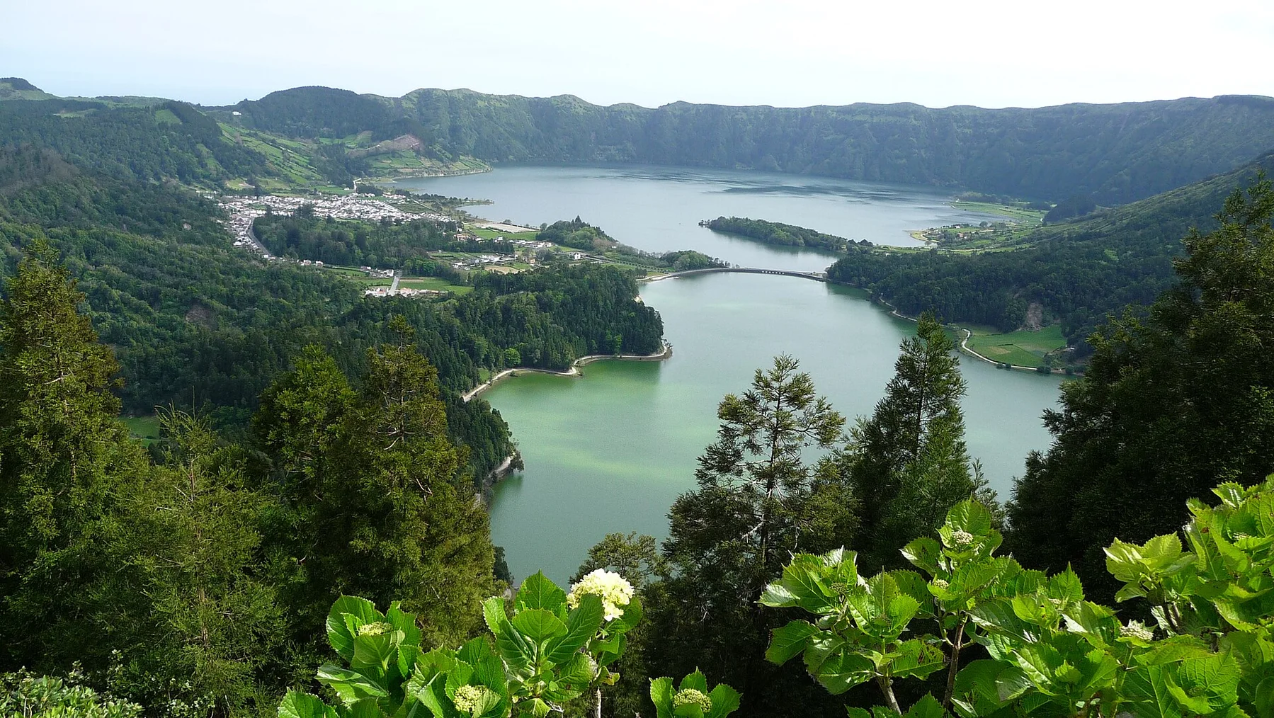
Atlantic cloud forest

Madeira Laurel Forest

Ancient laurel forest, cloud-soaked ridges and levada paths occupy the steep interior of a volcanic Atlantic island.

LaurisilvaLevada pathsVolcanic ridges

Location
Madeira, Portugal
Best window
Mar-Nov
Suggested stay
2-4 days
Go for
Cloud forest and ridge walking
The reason to go

Fanal plateau

Old laurel trees stand in open pasture and mist, creating a more spacious expression of the island forest.

Plan the least frequent boat, ferry or exposed coastal section first. Use early or late light and keep a weather alternative during Mar-Nov.

Look a little closer

Worth discovering

The details that make Madeira Laurel Forest different.

Photo journal
01

Fanal plateau

Old laurel trees stand in open pasture and mist, creating a more spacious expression of the island forest.

Destination view
02

Levada corridors

Water channels lead through tunnels, ravines and shaded vegetation, revealing both ecology and long-term landscape engineering.

Destination view
03

Central ridge views

High routes place the forest below sharp volcanic peaks and make the island scale immediately visible.

Photo journal

A closer look at Madeira Laurel Forest

7 photographs
Deep background

The making of Madeira Laurel Forest

Ancient laurel forest, cloud-soaked ridges and levada paths occupy the steep interior of a volcanic Atlantic island. The view is only the surface of a longer story of formation, use and change.

Madeira Laurel Forest is best approached through the relationship between its setting and its lived landscape. Madeira is often approached through its coast, but the island interior contains a different world of laurel forest, steep valleys and high ridges. Moist Atlantic air condenses against the mountains, sustaining evergreen vegetation that can feel dense and enclosed only minutes from exposed viewpoints.

The strongest visual shorthand for Madeira Laurel Forest is the experience described as “Fanal plateau”. Behind it lies a more complex relationship between physical processes, settlement and the modern idea of the place as a destination. Old laurel trees stand in open pasture and mist, creating a more spacious expression of the island forest.

Continue to practical planning
Encumeada, Madeira 2016 3See the complete photo journal
Natural history

From underlying structure to visible landscape

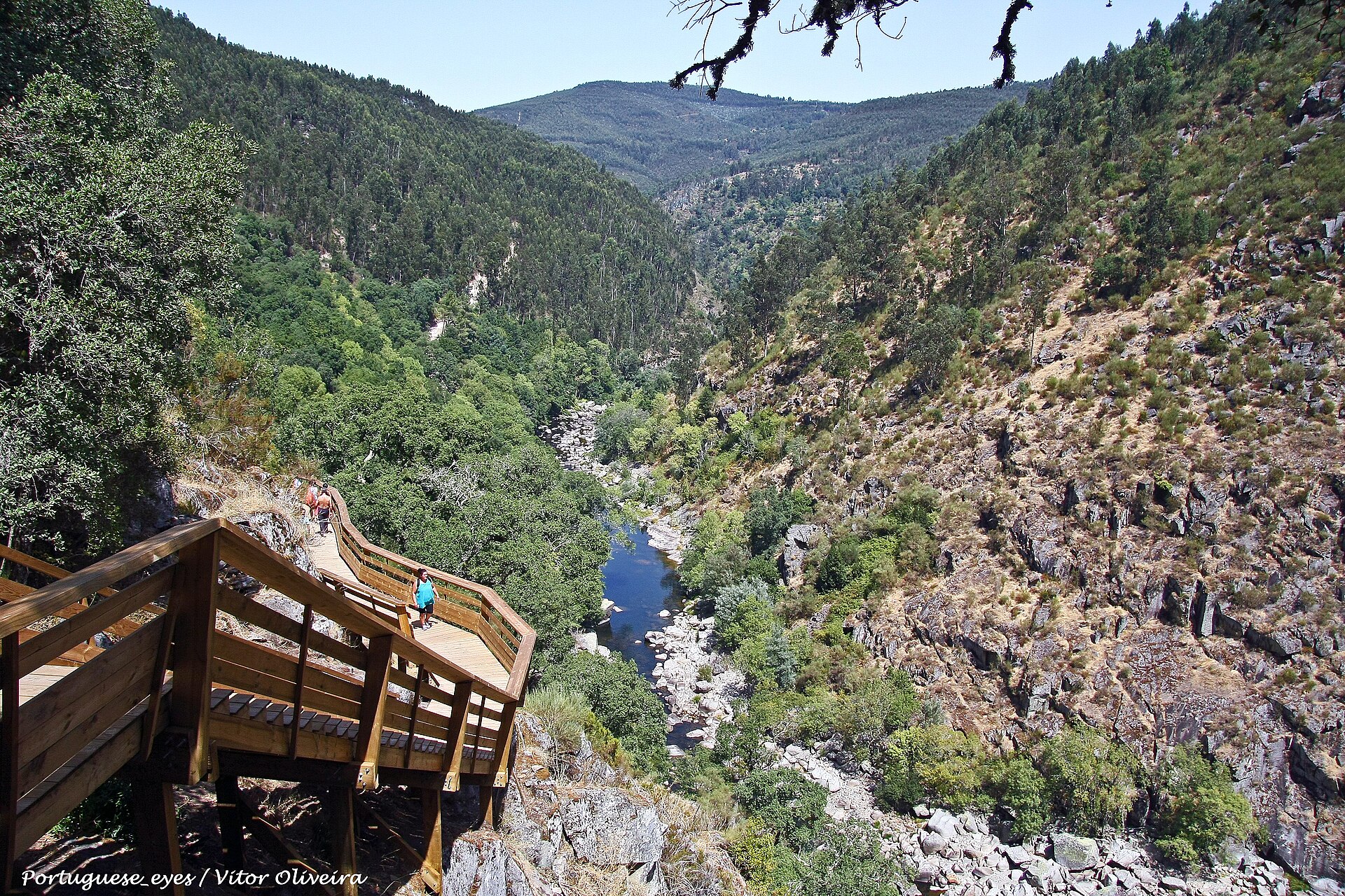
At Madeira Laurel Forest, the physical story begins with the structure of the ground. The terrain is deeply cut by ravines and volcanic slopes. Levadas follow contour lines through forest, tunnels and open cliff sections, creating routes that reveal the engineering of water as well as the island geology. Higher ground shifts toward heath, rock and broad views over cloud layers.

Because land is limited, every ridge, bay and passage acquires practical importance. At Madeira Laurel Forest, “Fanal plateau” is where that compressed geography becomes easiest to read. Old laurel trees stand in open pasture and mist, creating a more spacious expression of the island forest.

Human history

Lives shaped by the terrain

At Madeira Laurel Forest, human history is written into settlement and land use rather than separated from the scenery. The forest exists within a landscape long shaped by settlement, agriculture and water management. Levadas carried water toward cultivated slopes and communities, and many routes still pass small fields, villages and maintenance structures. The contrast between protected forest and inhabited terraces is central to Madeira.

At Madeira Laurel Forest, “Levada corridors” should not be treated as a decorative detail. Water channels lead through tunnels, ravines and shaded vegetation, revealing both ecology and long-term landscape engineering. The feature records how construction, movement or livelihood adapted to local conditions at Madeira Laurel Forest.

Reorganisation

A landscape reorganised

Formal protection changed how Madeira Laurel Forest was described and managed. At Madeira Laurel Forest, new boundaries, visitor rules and conservation priorities created a public identity that still has to coexist with settlements, customary use and economic pressures. At Madeira Laurel Forest, the consequences are clearest where traditional use, protection and tourism occupy the same ground.

On the ground

The small features that reveal the larger pattern

At Madeira Laurel Forest, the significance of the feature “Fanal plateau” goes beyond its visual impact. Old laurel trees stand in open pasture and mist, creating a more spacious expression of the island forest. At Madeira Laurel Forest, the detail links local scale with the wider regional pattern.

Look closely at the feature “Levada corridors” in Madeira Laurel Forest; it carries information that a panoramic view can miss. Water channels lead through tunnels, ravines and shaded vegetation, revealing both ecology and long-term landscape engineering. Within Madeira Laurel Forest, it is both an attraction and a record of the processes described above.

At Madeira Laurel Forest, the feature “Central ridge views” is one of the most useful pieces of visible evidence. High routes place the forest below sharp volcanic peaks and make the island scale immediately visible. Within Madeira Laurel Forest, it is both an attraction and a record of the processes described above.

Present day

A living landscape, not a frozen scene

At Madeira Laurel Forest, light, water and temperature reveal different structures at different times of year. The forest can be visited in most months, but visibility and rainfall vary sharply by altitude. Spring brings fresh growth, summer often provides more stable conditions, and autumn can be warm yet changeable. Cloud is not simply bad weather here; it is part of the ecosystem and often gives the forest its strongest atmosphere.

For Madeira Laurel Forest, the main seasonal constraint is: the strongest planning window is Mar-Nov. For Madeira Laurel Forest, outside it, check weather, daylight, road or ferry schedules and seasonal closures before committing to a fixed route.

For Madeira Laurel Forest, one practical detail matters: cloud, wind and trail conditions can change quickly. For Madeira Laurel Forest, put the highest or most exposed stop first and keep a lower-level alternative.

Placed within its wider geography, Madeira Laurel Forest is not an isolated exception. For Madeira Laurel Forest, the wider context shows that, linking Fanal, Ribeiro Frio, the central peaks and northern valleys shows how the laurel forest changes with exposure and height. For Madeira Laurel Forest, the wider island also connects this interior landscape to sea cliffs, terraced agriculture and compact coastal towns.

Travel notes

Plan your visit

Time needed
2-4 days
Getting around
Car to access points, then walking or hiking
Effort
Moderate
Plan first
Accommodation and seasonal transport
Time of day
Start early for clearer conditions and more time
Best window
Mar-Nov
Traveller stories

Stories from people who have been here.

First-hand moments, practical notes and overlooked details from Madeira Laurel Forest.

Loading traveller stories…

Browse all traveller stories ↗

Keep exploring

Where next?

All place stories