Wetlands

Pantanal Matogrossense

Seasonal floodplains, river channels and forest islands form the protected core of the northern Pantanal.

WetlandsWildlifeWater routesCuiaba River systemSeasonal floodplain

Location
Mato Grosso wetlands, Brazil
Best window
May-Oct
Suggested stay
2-4 days
Go for
Wetland and wildlife journey
The reason to go

Take a dawn boat along a wildlife-rich river channel

Morning water travel offers the strongest combination of birds, capybaras, caiman and, with patience, jaguar habitat.

Use an experienced local guide and begin early, when wildlife activity, water levels and cooler conditions are most favourable.

Look a little closer

Worth discovering

The details that make Pantanal Matogrossense different.

Destination view
01

Cuiaba River system

Boat routes provide access to the wetland interior.

Destination view
02

Seasonal floodplain

Water levels transform roads, grasslands and wildlife movement.

Destination view
03

Forest islands

Higher ground supports trees and dry-season refuge.

Photo journal

A closer look at Pantanal Matogrossense

5 photographs
The full story

What made Pantanal Matogrossense distinctive

Seasonal floodplains, river channels and forest islands form the protected core of the northern Pantanal. Its character becomes clearer when geology, settlement and modern protection are considered together.

Pantanal Matogrossense is centred on Mato Grosso wetlands, where seasonal floodplains, river channels and forest islands form the protected core of the northern Pantanal. The strongest reason to make the journey is to take a dawn boat along a wildlife-rich river channel.

Many visits to Pantanal Matogrossense begin with the experience described as “Take a dawn boat along a wildlife-rich river channel”. The more revealing question is why it exists here, how people used the surrounding ground and what remains visible from earlier phases. Morning water travel offers the strongest combination of birds, capybaras, caiman and, with patience, jaguar habitat.

Continue to practical planning
Martim Pescador VerdeSee the complete photo journal
Landform

The physical foundations of the place

Before roads, settlements or protected-area boundaries, the terrain of Pantanal Matogrossense set the basic terms. Water level determines the route, wildlife concentration and what ground is accessible. Boat or canoe travel often reveals more than a road-based visit.

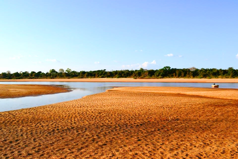
At Pantanal Matogrossense, the landscape is measured by flooding and drainage rather than height. “Cuiaba River system” makes that seasonal geometry visible. Boat routes provide access to the wetland interior.

Lives and livelihoods

The cultural layer of the place

The Pantanal has long been home to Indigenous peoples whose lives followed flood cycles, rivers and fisheries. Colonial cattle ranching expanded from the eighteenth and nineteenth centuries, adapting to seasonal inundation through large properties and mobile herds.

Pantanal Matogrossense National Park was created in 1981 near the meeting of major rivers, protecting a relatively small core of a much larger privately owned wetland.

Reorganisation

The modern turning point

World Heritage status in 2000 recognised a cluster of protected areas, but the system's health depends on headwaters far outside them. Severe fires, navigation projects and upstream sediment now reveal how quickly a floodplain can be altered beyond park boundaries.

Details to read

Three details that explain the whole place

Start with the feature “Cuiaba River system”, because it condenses a much larger part of the story of Pantanal Matogrossense. Boat routes provide access to the wetland interior. At Pantanal Matogrossense, it gives a concrete reference point for reading change rather than merely collecting viewpoints.

At Pantanal Matogrossense, the feature “Seasonal floodplain” is one of the most useful pieces of visible evidence. Water levels transform roads, grasslands and wildlife movement. At Pantanal Matogrossense, it gives a concrete reference point for reading change rather than merely collecting viewpoints.

At Pantanal Matogrossense, the significance of the feature “Forest islands” goes beyond its visual impact. Higher ground supports trees and dry-season refuge. For Pantanal Matogrossense, that relationship is more informative than treating the feature only as a photograph or checklist item.

Present day

What continues to change

Pantanal Matogrossense changes through the year because weather and biological cycles rearrange what can be seen and used. For Pantanal Matogrossense, the most reliable visiting window is May-Oct.

For Pantanal Matogrossense, the stated visiting window is May-Oct, but its practical meaning depends on local weather, water and transport rather than the calendar alone.

Placed within its wider geography, Pantanal Matogrossense is not an isolated exception. Beyond the best-known image of Pantanal Matogrossense feature, Pantanal Matogrossense matters because seasonal floodplain and forest islands place the destination inside a broader regional story.

Chronology

Key dates

  1. Life with the annual flood pulse

    Fishing, travel and settlement adapted to changing water levels.

  2. Extensive cattle ranching

    Large fazendas developed a regional culture suited to seasonal wetlands.

  3. National park and World Heritage

    A protected core gained national and international recognition.

Travel notes

Plan your visit

Time needed
2-4 days
Getting around
Boat or canoe, plus short walks from landing points
Effort
Easy to moderate
Plan first
Water level, boat and local guide
Time of day
Early morning and late afternoon
Best window
May-Oct
Traveller stories

Stories from people who have been here.

First-hand moments, practical notes and overlooked details from Pantanal Matogrossense.

Loading traveller stories…

Browse all traveller stories ↗

Keep exploring

Where next?

All place stories