Three countries, one basin

Prespa Lakes

Two high lakes shared by three countries form a wetland, mountain and village landscape of exceptional ecological and cultural depth.

High lakesWetlandsBorderland villages

Location
Balkan borderlands, Greece / North Macedonia / Albania
Best window
Apr-Oct
Suggested stay
2-4 days
Go for
Transboundary lake journey
The reason to go

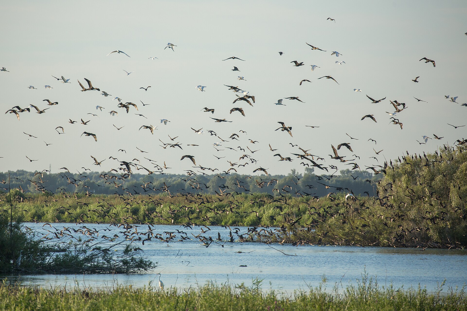
Wetland margins

Reed beds and shallow bays support internationally important bird and fish habitats.

Start early and make this the first exposed stop of the day. Keep a lower route ready if cloud, heat, wind or trail conditions change during Apr-Oct.

Look a little closer

Worth discovering

The details that make Prespa Lakes different.

Destination view
01

Wetland margins

Reed beds and shallow bays support internationally important bird and fish habitats.

Destination view
02

Island heritage

Small islands and lakeside churches preserve traces of medieval religious landscapes.

Destination view
03

Transboundary villages

Communities in three countries reveal different expressions of the same high-lake culture.

Photo journal

A closer look at Prespa Lakes

13 photographs
The full story

Prespa Lakes: land, people and change

Two high lakes shared by three countries form a wetland, mountain and village landscape of exceptional ecological and cultural depth. Its character becomes clearer when geology, settlement and modern protection are considered together.

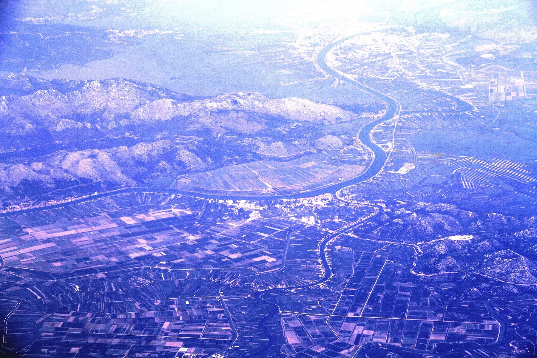
Prespa Lakes is best approached through the relationship between its setting and its lived landscape. The Prespa basin contains Great Prespa and Small Prespa, two high lakes shared by Greece, North Macedonia and Albania. Mountains enclose the water while wetlands, agricultural land and historic villages occupy the lower ground. Because national borders cross the same ecological system, the region offers a rare opportunity to understand one landscape through several cultural and administrative perspectives.

Visitors often encounter Prespa Lakes through the idea of “Wetland margins”, but the destination is more than that single scene. Its landscape carries evidence of work, movement, adaptation and environmental change. Reed beds and shallow bays support internationally important bird and fish habitats.

Continue to practical planning
A boat on the shore of Lake Prespa at sunrise in OteševoSee the complete photo journal
Landform

How the landscape was assembled

Understanding Prespa Lakes starts below the visible surface. Reed beds, shallow bays, island habitats and limestone slopes create a complex transition between water and mountain. Seasonal lake levels expose and cover different margins, supporting fish, pelicans and other wetland species. The basin feels broad and calm, but surrounding ridges rise quickly and reveal how closely the lakes depend on their enclosed watershed.

The visible shoreline or channel at Prespa Lakes is only one stage in a larger cycle. “Wetland margins” demonstrates how flow, season and terrain interact. Reed beds and shallow bays support internationally important bird and fish habitats.

Human history

People, work and memory

At Prespa Lakes, daily life gives the terrain a historical meaning that a viewpoint alone cannot provide. Fishing, orchards, bean cultivation and livestock have shaped communities around the basin. Byzantine churches, island ruins and village architecture show repeated layers of settlement and movement. Border history brought periods of isolation, yet contemporary conservation and local initiatives increasingly treat Prespa as a connected region rather than three unrelated edges.

The role of “Island heritage” is especially revealing at Prespa Lakes. Small islands and lakeside churches preserve traces of medieval religious landscapes. In the history of Prespa Lakes, it connects the wider regional context with a specific place that can still be examined today.

Turning point

The change that redefined the place

Formal protection changed how Prespa Lakes was described and managed. At Prespa Lakes, new boundaries, visitor rules and conservation priorities created a public identity that still has to coexist with settlements, customary use and economic pressures. At Prespa Lakes, the consequences are clearest where traditional use, protection and tourism occupy the same ground.

On the ground

Where the story becomes visible

At Prespa Lakes, the feature “Wetland margins” is one of the most useful pieces of visible evidence. Reed beds and shallow bays support internationally important bird and fish habitats. For Prespa Lakes, that relationship is more informative than treating the feature only as a photograph or checklist item.

At Prespa Lakes, the significance of the feature “Island heritage” goes beyond its visual impact. Small islands and lakeside churches preserve traces of medieval religious landscapes. Its position and condition at Prespa Lakes connect physical history with the way people use the place now.

At Prespa Lakes, the feature “Transboundary villages” provides a precise clue to how the landscape works. Communities in three countries reveal different expressions of the same high-lake culture. Its position and condition at Prespa Lakes connect physical history with the way people use the place now.

Continuity

Why the landscape still feels dynamic

At Prespa Lakes, season is part of the landscape history, not merely a planning detail. Spring is strong for wetlands, flowering slopes and bird activity, while early summer combines long days with accessible mountain routes. Late summer can be dry and luminous, and autumn brings harvest activity and quieter roads. Winter is cold at this elevation, with snow on surrounding mountains and a more austere lake landscape.

For Prespa Lakes, the main seasonal constraint is: the strongest planning window is Apr-Oct. For Prespa Lakes, outside it, check weather, daylight, road or ferry schedules and seasonal closures before committing to a fixed route.

For Prespa Lakes, one practical detail matters: cloud, wind and trail conditions can change quickly. For Prespa Lakes, put the highest or most exposed stop first and keep a lower-level alternative.

Placed within its wider geography, Prespa Lakes is not an isolated exception. For Prespa Lakes, the wider context shows that, prespa lies close to Lake Ohrid but has a different scale and rhythm. For Prespa Lakes, connecting the two basins, then continuing into the nearby mountain parks, creates a broader story about ancient lakes, Balkan biodiversity and communities divided politically but joined by water, trade routes and shared environmental pressures.
Travel notes

Plan your visit

Time needed
2-4 days
Getting around
Car to access points, then walking or hiking
Effort
Moderate
Plan first
Opening days and any limited-entry sites
Time of day
Early morning and late afternoon
Best window
Apr-Oct
Traveller stories

Stories from people who have been here.

First-hand moments, practical notes and overlooked details from Prespa Lakes.

Loading traveller stories…

Browse all traveller stories ↗

Keep exploring

Where next?

All place stories