Geology beside a global strait

Qeshm Island

A large Persian Gulf island of eroded canyons, salt caves, mangrove channels and coastal villages shaped by trade across the Strait of Hormuz.

GeologyMangrovesGulf culture

Location
Strait of Hormuz, Iran
Best window
Nov-Mar
Suggested stay
3-5 days
Go for
Desert coast discovery
The reason to go

A coast where landforms carry the story

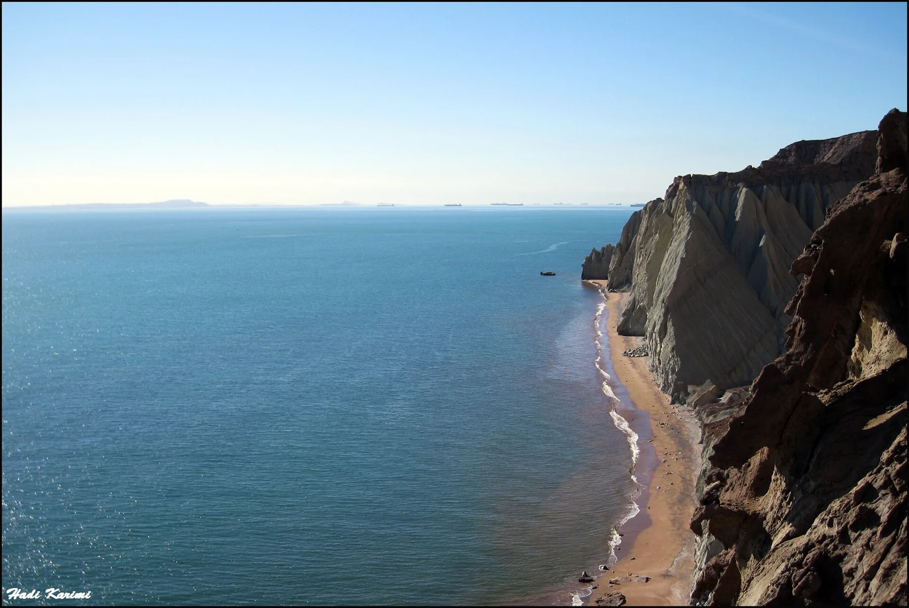
Qeshm compresses salt, wind erosion, tidal forest and maritime culture into one island, creating a journey that shifts repeatedly between desert interior and working coast.

Stay long enough to connect Qeshm Island's headline landscape with one quieter local route rather than treating it as a single viewpoint.
Look a little closer

Worth discovering

The details that make Qeshm Island different.

Destination view
01

Salt inside the island

The Namakdan salt dome contains long caves and crystalline formations created by the movement and dissolution of ancient salt.

Destination view
02

Mangroves in arid water

Hara forests grow in tidal channels despite the surrounding desert climate, supporting birds, fish and boat-based livelihoods.

Destination view
03

Wind-cut canyons

Star Valley and Chahkooh reveal narrow corridors, fluted walls and pillars sculpted from softer sedimentary rock.

Photo journal

A closer look at Qeshm Island

4 photographs
The full story

The making of Qeshm Island

A large Persian Gulf island of eroded canyons, salt caves, mangrove channels and coastal villages shaped by trade across the Strait of Hormuz. Its character becomes clearer when geology, settlement and modern protection are considered together.

Qeshm Island is best approached through the relationship between its setting and its lived landscape. Qeshm compresses salt, wind erosion, tidal forest and maritime culture into one island, creating a journey that shifts repeatedly between desert interior and working coast.

Many visits to Qeshm Island begin with the experience described as “Desert coast discovery”. The more revealing question is why it exists here, how people used the surrounding ground and what remains visible from earlier phases. At Qeshm Island, allow enough time to connect Qeshm Island's headline landscape with one quieter local route instead of reducing Qeshm Island to a single viewpoint.

Continue to practical planning
Qeshm - Iran1See the complete photo journal
Origins

What the ground explains

Before roads, settlements or protected-area boundaries, the terrain of Qeshm Island set the basic terms. Salt domes, sandstone and marl formations, tidal flats, mangroves and a long irregular coast make Qeshm one of the Gulf's most geologically varied islands.

Because land is limited, every ridge, bay and passage acquires practical importance. At Qeshm Island, “Salt inside the island” is where that compressed geography becomes easiest to read. The Namakdan salt dome contains long caves and crystalline formations created by the movement and dissolution of ancient salt.

Human history

Settlement, movement and local knowledge

Qeshm has long guarded the narrow entrance to the Persian Gulf, placing its ports within trade between Iran, Arabia, India and East Africa. Fishing, boatbuilding, date cultivation and salt extraction developed beside routes controlled at different times by Persian dynasties, Arab powers and maritime empires.

Portuguese forces built a stone fort on Qeshm in the early sixteenth century as part of their attempt to dominate Hormuz and Gulf shipping. Safavid forces expelled the Portuguese from the region in 1622. Villages, cisterns, dhow traditions and the ruined fort preserve this strategic history alongside much older salt caves and eroded valleys.

Turning point

The change that redefined the place

Recognition of Qeshm as a UNESCO Global Geopark reframed the island's salt domes, canyons and mangroves as a connected geological landscape. Tourism and free-zone development now place pressure on the same coast that supported small ports and boatbuilding communities.

On the ground

Three details that explain the whole place

At Qeshm Island, the feature “Salt inside the island” is best understood as part of the surrounding system rather than an isolated stop. The Namakdan salt dome contains long caves and crystalline formations created by the movement and dissolution of ancient salt. Its position and condition at Qeshm Island connect physical history with the way people use the place now.

Start with the feature “Mangroves in arid water”, because it condenses a much larger part of the story of Qeshm Island. Hara forests grow in tidal channels despite the surrounding desert climate, supporting birds, fish and boat-based livelihoods. Its position and condition at Qeshm Island connect physical history with the way people use the place now.

At Qeshm Island, the feature “Wind-cut canyons” is best understood as part of the surrounding system rather than an isolated stop. Star Valley and Chahkooh reveal narrow corridors, fluted walls and pillars sculpted from softer sedimentary rock. Within Qeshm Island, the feature explains why this destination differs from nearby landscapes.

Present day

What continues to change

At Qeshm Island, season is part of the landscape history, not merely a planning detail. Winter brings the most comfortable temperatures. Summer heat and humidity can make inland exploration difficult, while tides matter for mangrove and coastal trips.

For Qeshm Island, the most useful time of day is: early morning in the canyons.

For Qeshm Island, plan this first: island transport and tide-dependent trips.

Placed within its wider geography, Qeshm Island is not an isolated exception. For Qeshm Island, the wider context shows that, hormuz Island, Bandar Abbas and the ports of the Strait add volcanic colour, fortifications and wider maritime context.

Chronology

Key dates

  1. Gulf trade island

    Qeshm's settlements served maritime routes between the Iranian plateau, Arabia and the Indian Ocean.

  2. Portuguese fort and expulsion

    A colonial stronghold near Qeshm town formed part of the contest for Hormuz and Gulf commerce.

  3. Geopark recognition

    International geological status linked natural sites with village knowledge and conservation.

In context

Get to know the place

The landscape

Salt domes, sandstone and marl formations, tidal flats, mangroves and a long irregular coast make Qeshm one of the Gulf's most geologically varied islands.

People and place

Bandari villages reflect fishing, boat building, date cultivation and centuries of exchange with Oman, East Africa and the wider Persian Gulf.

Seasonal character

Winter brings the most comfortable temperatures. Summer heat and humidity can make inland exploration difficult, while tides matter for mangrove and coastal trips.

Beyond the main view

Hormuz Island, Bandar Abbas and the ports of the Strait add volcanic colour, fortifications and wider maritime context.

Travel notes

Plan your visit

Time needed
3-5 days
Getting around
Car, taxi and local boat
Effort
Easy to moderate
Plan first
Island transport and tide-dependent trips
Time of day
Early morning in the canyons
Best window
Nov-Mar
Keep exploring

Where next?

All place stories