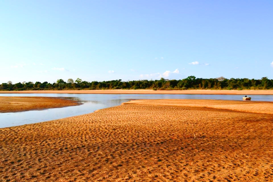
Camp beside a dry-season river beach with local guidance
The shifting sandbanks and enormous river horizon make the island feel coastal despite being deep inside the continent.
Plan the least frequent boat or flight first, then use the remaining time for the signature route rather than trying to collect every viewpoint.
Look a little closer
Worth discovering
The details that make Bananal Island different.
Destination view
01
Araguaia beaches
Seasonal sandbars emerge as river levels fall.
Destination view
02
Indigenous territories
Responsible visits require local permission and context.
Photo journal
03
Javaes and Araguaia channels
Two major river arms define the island.
Photo journal
A closer look at Bananal Island
2 photographs
01Rio Javaés02Bananal Island — view 2
Deep background
Bananal Island: the story behind the landscape
The world's largest river island contains wetlands, cerrado and Indigenous territories between two channels of the Araguaia. Its character becomes clearer when geology, settlement and modern protection are considered together.
4 min readAraguaia River, Brazil
Bananal Island is centred on Araguaia River, where the world's largest river island contains wetlands, cerrado and Indigenous territories between two channels of the Araguaia. The strongest reason to make the journey is to camp beside a dry-season river beach with local guidance.
Visitors often encounter Bananal Island through the idea of “Camp beside a dry-season river beach with local guidance”, but the destination is more than that single scene. Its landscape carries evidence of work, movement, adaptation and environmental change. The shifting sandbanks and enormous river horizon make the island feel coastal despite being deep inside the continent.
On an island, coast, altitude and exposure work together. At Bananal Island, the feature described as “Araguaia beaches” shows how a short distance can separate sheltered ground from a very different ocean-facing environment. Seasonal sandbars emerge as river levels fall.
Bananal Island is not a uniform area. Changes in elevation, exposure, water and substrate produce distinct environments over short distances, which is why a route through the place often reveals more than a fixed viewpoint.
02
Cultural landscape
The human landscape behind the scenery
Bananal is one of the world's largest river islands and the homeland of Karaja and Javae peoples. Villages, fisheries and ceremonial traditions developed around the annual division and reunion of the Araguaia and Javaes waters.
Missionaries, ranchers and state agencies entered the island during the twentieth century. Araguaia National Park was initially declared across a much larger area in 1959, creating conflict with Indigenous territories and later boundary reductions.
03
Reorganisation
The modern turning point
The island is now divided among Indigenous lands, protected areas and ranching zones. Flood ecology and Indigenous governance are inseparable, and conservation plans that ignore village rights repeat the conflicts of early park creation.
04
Details to read
What to read in the landscape
Look closely at the feature “Araguaia beaches” in Bananal Island; it carries information that a panoramic view can miss. Seasonal sandbars emerge as river levels fall. Within Bananal Island, it is both an attraction and a record of the processes described above.
At Bananal Island, the feature “Indigenous territories” is best understood as part of the surrounding system rather than an isolated stop. Responsible visits require local permission and context. At Bananal Island, it gives a concrete reference point for reading change rather than merely collecting viewpoints.
Start with the feature “Javaes and Araguaia channels”, because it condenses a much larger part of the story of Bananal Island. Two major river arms define the island. At Bananal Island, it gives a concrete reference point for reading change rather than merely collecting viewpoints.
05
Living landscape
The place within its wider region
At Bananal Island, season is part of the landscape history, not merely a planning detail. For Bananal Island, the most reliable visiting window is May-Sep.
For Bananal Island, the stated visiting window is May-Sep, but its practical meaning depends on local weather, water and transport rather than the calendar alone.
Placed within its wider geography, Bananal Island is not an isolated exception. Beyond the best-known image of Bananal Island feature, Bananal Island matters because indigenous territories and javaes and araguaia channels place the destination inside a broader regional story.
Chronology
Key dates
Karaja and Javae river-island homeland
Culture and subsistence developed around seasonal channels and fisheries.
Araguaia National Park declared
A large federal park overlapped inhabited and claimed Indigenous lands.
Boundaries and rights reworked
Park reductions and Indigenous demarcation reshaped governance of the island.
Travel notes
Plan your visit
Time needed
3-5 days
Getting around
Local transport, walking and boat or ferry connections
Effort
Easy to moderate
Plan first
Main flight or ferry, accommodation and weather backup
Time of day
Morning movement; late light for coast
Best window
May-Sep
Traveller stories
Stories from people who have been here.
First-hand moments, practical notes and overlooked details from Bananal Island.